ArcGIS metadata is mysterious. Here's how I am puzzling through it.
Part 1: Setup and Importing
Simple shapefile: PolygonForMetadata in LL83 and UTM16
ArcGIS Metadata created for LL83 and UTM16
Template for basic metadata creation: 133UAtemplate.xml
Basic, FGDC-compliant metadata: PolygonForMetadata.xml
USGS FGDC MP report for PolygonForMetadata.xml
Imported PolygonForMetadata.xml onto PolygonForMetadata_Project.shp via Metadata Importer (ArcToolbox > Conversion > Metadata > Metadata Importer): PolygonForMetadata_Project.shp.xml
USGS FGDC MP report for PolygonForMetadata_Project.shp.xml after Metadata Importer.
Blog from 20111011.
Double checking what happens when Auto Updates are or are not checked while importing:
Auto Update disabled in ArcGIS 10.1 Beta:
"Touched" above file with Auto Updates enabled in ArcGIS 10.1 Beta:
- XML File
- MP report: 11 errors: 11 missing (same errors as first imported metadata, different line numbers)
Auto Updates disabled in ArcGIS 10 with Import Metadata via Description tab:
Auto Updates enabled in ArcGIS 10 with Import Metadata via Description tab:
- XML File
- MP report: 23 errors: 2 misplaced, 21 missing (same errors as Auto Updates disabled in ArcGIS 10, different line numbers)
Blog from 20111012.
Part 2: Editing
Adding Attribute information (Attribute Definition; Attribute Definition Source; Valid Attribute "range") in Resource Section > Fields. Here's the XML File ArcGIS created and Here's the MP Report (2 errors: 2 missing).
The last two errors are hard to find. So, I created screen captures of all the editing screens. Along with screen captures of each of the editing sections, a "template" XML file was created with all of the information at the bottom of the screen. It helped to find the repetitive sections as well as document the dropdowns.
There were some fairly large changes to the metadata with ArcGIS 10.1 Beta Service Pack 2. So I tried a few new things:
- Updating required fields so that no errors showed in the editor interface
- Starting from scratch, Updating and then importing metadata and then fixing the errors in the editor interface:
The required sections when importing updated metadata are as follows:
- Overview
- Topics & Keywords
- topic cateogry is required Response: checked Imagery & Base Maps check box.
- Citation
- at least one date is required Response: input today's date as date created.
- Resource
- Quality
- either a conformance result or a quantitative result is required
- either a conformance result or a quantitative result is required
- either a conformance result or a quantitative result is required
Part 3: Finding Required Fields
A new, blank template was created. Each section was reviewed to see which ones are required. Required fields are indicated in red.
- Overview
- Item Desriptions
- title is required
- abstract is required
- purpose is required
- Use Limitations has a red input text box backgroud but is not listed as required at the top of the page
- Topics & Keywords
- Overview Citation
- Overview Citation Contacts
- Contacts Manager
- Metadata
- Metadata Details
- Metadata Contacts
- at least one metadata contact is required for the responsible party
- name, organization, or position is required for the responsible party
- role is required for the responsible party (Dropdown)
- Metadata Maintenance
- Metadata Constraints
- Resources
- Resource Details
- Resource Extents
- Resource Point of Contacts
- Resource Maintenance
- Resource Constraints
- No apparent error. When General Constraints is added, however, it throws a Use Limitation error. This is linked to Overview:Item Descriptions:Use Limitations. Once one is filled out, the same text is displayed in both and both errors goes away.
- Spatial Data Representation
- Resource Content
- Resource Quality
- Resource Lineage
- Resource Distribution
- Resource Fields
- Resource References
- Geoprocessing History
Upon filling out the required fields and attempting to validate FGDC metadata, it fails with the following warnings:
Here are the sections.
- Overview
- Item Descriptions
- Title
- Thumbnail
- Tags
- Summary (Purpose)
- Description (Abstract)
- Credits
- Use Limitation
- Appropriate Scale Range
- Topics & Keywords
- Topic Categories
- Farming
- Biota
- Boundaries
- Atmospheric Sciences
- Econonmy
- Elevation
- Environment
- Geoscientific
- Health
- Imagery & Base Maps
- Military & Intelligence
- Inland Waters
- Location
- Oceans
- Planning & Cadastral
- Society
- Structure
- Transportation
- Utilities & Communication
- Theme Keywords are repeatable
- Place Keywords are repeatable
- Temporal Keywords are repeatable
- Discipline Keywords are repeatable
- Stratum Keywords are repeatable
- Other Keywords are repeatable
- Overview Citation
- Titles
- Title
- Alternative Title
- Collective Title
- Presentation Form Dropdown
- Empty Default
- Digital Document
- Hardcopy Document
- Digital Image
- Hardcopy Image
- Digital Map
- Hardcopy Map
- Digital Model
- Hardcopy Model
- Digital Profile
- Hardcopy Profile
- Digital Table
- Hardcopy Table
- Digital Video
- Hardcopy Video
- Digital Audio
- Hardcopy Audio
- Digital Multimedia
- Hardcopy Multimedia
- Digital Diagram
- Hardcopy Diagram
- FGDC Geospatial Data Presentation Form Dropdown is repeatable.
- Empty Default
- Atlas
- Audio
- Diagram
- Document
- Globe
- Map
- Model
- Multimedia Presentation
- Profile
- Raster Digital Data
- Remote Sensing Image
- Section Spreadsheet
- Tabular Digital Data
- Vector Digital Data
- Video
- View
- Identifiers
- Dates
- Created
- Published
- Revised
- Edition
- Series
- Other Details
- Overview Citation Contacts
- Contacts Manager
- Lists all contacts used within the metadata and provides the option to save contacts.
- Metadata
- Metadata Details
- File Identifier (create button)
- Parent Identifier
- Dataset URI
- Date stamp
- Language Dropdown
- See Language screen captures
- Character Set Dropdown
- See Character Set screen captures
- Hierarchy Level Dropdown is repeatable
- Empty Default
- Attribute
- Attribute Type
- Collection Hardware
- Collection Session
- Dataset
- Series
- Non-geographic Dataset
- Dimesnon Group
- Feature
- Feature Type
- Property Type
- Field Session
- Software
- Service
- Model
- Tile
- Initiative
- Steromate
- Sensor
- Platform Series
- Sensor Series
- Transfer Aggregate
- Other Aggregate
- Hierarchy Level Name is repeatable
- Metadata Contacts
- Metadata Maintenance
- Update Frequency Dropdown
- Empty Default
- Continual
- Daily
- Weekly
- Fortnightly
- Monthly
- Quarterly
- Biannually
- As Needed
- Irregular
- Not Planned
- Unknown
- Custom Frequency
- Next Update
- Update Scope Dropdown is repeatable.
- Empty Default
- Attribute
- Attribute Type
- Collection Hardware
- Collection Session
- Dataset
- Series
- Non-geographic Dataset
- Dimesnon Group
- Feature
- Feature Type
- Property Type
- Field Session
- Software
- Service
- Model
- Tile
- Initiative
- Steromate
- Sensor
- Platform Series
- Sensor Series
- Transfer Aggregate
- Other Aggregate
- Scope Description is repeatable.
- Attributes
- Attribute Instances
- Features
- Feature Instances
- Dataset
- Other Instances
- Maintenance Contact is repeatable.
- Maintenance Note is repeatable.
- Metadata Constraints
- General Constraint is repeatable.
- Use Limitation is repeatable.
- Legal Constraint is repeatable.
- Use Limitation is repeatable.
- Access Constraint Dropdown
- Empty Default
- Copyright
- Patent
- Patent Pending
- Trademark
- License
- Intellectual Property Rights
- Restricted
- Other Restrictions
- Use Constraint Dropdown
- Empty Default
- Copyright
- Patent
- Patent Pending
- Trademark
- License
- Intellectual Property Rights
- Restricted
- Other Restrictions
- Other Constraints is repeatable.
- Security Constraint is repeatable.
- Use Limitation is repeatable.
- Classification Dropdown
- Empty Default
- Unclassified
- Restricted
- Confidential
- Secret
- Top Secret
- Classification System
- User Note
- Handling Description
- Resources
- Resource Details
- Status Dropdown is repeatable.
- Empty Default
- Complete
- Historical Archive
- Obsolete
- On Going
- Planned
- Required
- Under Development
- Credit is repeatable.
- Languages are repeatable
- Language Dropdown is repeatable.
- See Language screen captures
- Character Set Dropdown
- See Character Set screen captures
- Spatial Representation Type Dropdown is repeatable.
- Empty Default
- Vector
- Grid
- Text Table
- Tin
- Stereo Model
- Video
- Scale Resolution is repeatable.
- Distance Resolution is repeatable
- Browse Graphic is repeatable
- File name
- Description
- File type
- Processing environment
- Usage is repeatable.
- Specific Usage
- Usage date
- Limitations
- Contact is repeatable
- Supplemental Information
- Distribution Format is repeatable
- Format Name
- Format Version
- Amendment Number
- Specification
- Decompression Technique
- Information Content
- Resource Extents
- Description
- Bounding Box is repeatable.
- West
- East
- North
- South
- Extent contains the resource? (check box)
- Geographic Description is repeatable.
- Description contains the resource? (check box)
- Identifier
- Authority Citation
- Temporal Period Extent is repeatable.
- Begin Date/Time
- End Date/Time
- Temporal Instant Extent is repeatable.
- Vertical Extent is repeatable.
- Minimum Value
- Maximum Value
- Resource Points of Contact
- Contact is repeatable and loadable.
- Resource Maintenance
- Update Frequency Dropdown
- Empty Default
- Continual
- Daily
- Weekly
- Fortnightly
- Monthly
- Quarterly
- Biannually
- Annually
- As Needed
- Irregular
- Not Planned
- Unknown
- Custom Frequency
- Next Update
- Update Scope Dropdown is repeatable.
- Empty Default
- Attribute
- Attribute Type
- Collection Hardware
- Collection Session
- Dataset
- Series
- Non-geographic Dataset
- Dimesnon Group
- Feature
- Feature Type
- Property Type
- Field Session
- Software
- Service
- Model
- Tile
- Initiative
- Steromate
- Sensor
- Platform Series
- Sensor Series
- Transfer Aggregate
- Other Aggregate
- Scope Description is repeatable.
- Attributes
- Attribute Instances
- Features
- Feature Instances
- Dataset
- Other Instances
- Maintenance Contact is repeatable.
- Maintenance Note is repeatable.
- Resource Constraints
- General Constraints is repeatable.
- Use Limitation is repeatable.
- Legal Constraints is repeatable.
- Use Limitation is repeatable.
- Access Constraint Dropdown is repeatable.
- Empty Default
- Copyright
- Patent
- Patent Pending
- Trademark
- License
- Intellectual Property Rights
- Restricted
- Other Restrictions
- Use Constraints Dropdown is repeatable.
- Empty Default
- Copyright
- Patent
- Patent Pending
- Trademark
- License
- Intellectual Property Rights
- Restricted
- Other Restrictions
- Other constraints is repeatable.
- Security Constraints is repeatable.
- Use Limitation is repeatable.
- Classification Dropdown
- Empty Default
- unclassified
- Restricted
- Confidential
- Secret
- Top Secret
- Classification System
- User Note
- Handling Description
- Spatial Data Representation
- Grid Spatial Representation is repeatable.
- Number of Dimensions
- Dimension is repeatable.
- Name Dropdown
- Empty Default
- Row
- Column
- Vertical
- Track
- Cross Track
- Line
- Sample
- Time
- Size
- Resolution (Also contains unit Dropdown...see Unit screen captures)
- Cell Geometery Dropdown
- Transform Parameter Availability (check box)
- Georectified Representation is repeatable.
- Number of Dimensions
- Dimensions is repeatable.
- Cell Geometry Dropdown
- Transformation Parameter Availability (check box)
- Check Point Availability (check box)
- Check Point Description
- Corner Point
- Position
- Description
- Reference
- Identifier
- Identifier Codespace
- Center Point
- Position
- Description
- Reference
- Identifier
- Identifier Codespace
- Point in Pixel Dropdown
- Empty Default
- Center
- Lower Left
- Lower Right
- Upper Right
- Upper Left
- Transformation Dimension Description
- Transformation Dimension Mapping
- Georeferencable Representation is repeatable.
- Number of Dimensions
- Dimension is repeatable
- Name Dropdown
- Empty Default
- Row
- Column
- Vertical
- Track
- Cross Track
- LIne
- Sample
- Time
- Size
- Resolution
- Cell Geometry Dropdown
- Transformation Parameter Availability (check box)
- Control Point Availability (check box)
- Orientation Parameter Availability (check box)
- Orientation Parameter Description
- Georeferenced Parameter
- Parameter Citation is repeatable.
- Vector Representation is repeatable.
- Topology level Dropdown
- Empty Default
- Geometry Only
- 1D Topology
- Planar Graph
- Full Planar Graph
- Surface Graph
- Full Surface Graph
- 3D topology
- Full 3D Topology
- Abstract
- Geometric Objects is repeatable.
- Geometric Objects
- Geometric Objects Dropdown
- Empty Default
- Complex
- Composite
- Curve
- Point
- Solid
- Surface
- Indirect Spatial Representation is repeatable.
- Resource Content
- Coverage Description is repeatable.
- Attribute Description
- Content Type Dropdown
- Empty Default
- Image
- Thematic Classification
- Physical Measurement
- Range Dimension is repeatable.
- Sequence Identifier / Type
- Descriptor
- Band is repeatbale.
- Sequence Identifier / Type
- Descriptor
- Min Value
- Max Value
- Units Dropdown
- Peak Response
- Bits per Value
- Tone Gradation
- Scale Factor
- Offset
- Image Description is repeatable.
- Attribute Description
- Content Type Dropdown
- Empty Default
- Image
- Thematic Classification
- Physical Measurement
- Range Dimension is repeatable.
- Sequence Identifier / Type
- Descriptor
- Band is repeatbale.
- Sequence Identifier / Type
- Descriptor
- Min Value
- Max Value
- Units Dropdown
- Peak Response
- Bits per Value
- Tone Gradation
- Scale Factor
- Offset
- Illumination Elevation Angle
- Illumination Azimuth Angle
- Imaging Condition Dropdown
- Empty Default
- Blurred Image
- Cloud
- Degrading Obliquity
- Fog
- Heavy Smoke or Dust
- Night
- Rain
- Semi-Darkness
- Shadow
- Snow
- Terrain Masking
- Quality Code
- Cloud Cover Percentage
- Processing Level Code
- Compression Quantity
- Triangulation Indicator (check box)
- Radiometric Calibration Information Availability (check box)
- Camera Calibration Information Availability (check box)
- Film Distortion Information Availability (check box)
- Lens Distortion Information Availability (check box)
- Feature Catalog is repeatable.
- Compliance Code (check box)
- Include With Dataset (check box)
- Language Dropdown
is repeatable.
- See Language screen captures
- Feature Type is repeatable.
- Feature Catalog Citation is repeatable.
- Resource Quality
- Scope Level Dropdown
- Empty Default
- Attribute
- Attribute Type
- Collection Hardware
- Collection Session
- Dataset
- Series
- Non-Geographic Dataset
- Dimension Group
- Feature
- Feature Type
- Property Type
- Field Session
- Software
- Service
- Model
- Tile
- Initiative
- Stereomate
- Sensor
- PlatformSeries
- SensorSeries
- ProductionSeries
- TransferAggregate
- OtherAggregate
- Level Description is repeatable.
- Attributes
- Attribute Instances
- Features
- Feature Instances
- Dataset
- Other Instances
- Extent is repeatable.
- Description
- Bounding Box is repeatable.
- West
- East
- North
- South
- Extent contains the resource? (check box)
- Geographic Description is repeatable.
- Description contains the resource? (check box)
- Identifier
- Authority Citation
- Temporal Period Extent is repeatable.
- Begin Date/Time
- End Date/Time
- Temporal Instant Extent is repeatable.
- Vertical Extent is repeatable.
- Minimum Value
- Maximum Value
- Report is repeatable.
- Report Type Dropdown
- Empty Default
- Quantitative Attribute Accuracy
- Conceptual Consistency
- Completeness Omission
- Absolute External Positional Accuracy
- Dimension Dropdown
- Empty Default
- horizontal
- vertical
- Measure Date is repeatable.
- Measure
- Name is repeatable.
- Identifier
- Identifier
- Authority Citation
- Description
- Evaluation Method
- Type Dropdown
- Empty Default
- Direct Internal
- Direct External
- Indirect
- Description
- Procedure Citation
- Conformance Result
- Pass (check box)
- Explanation
- Specification (citation)
- Quantitative Result
- Value Type
- Value is repeatable.
- Value Unit Dropdown
- Error Statistic
- Resource Lineage
- Statement
- Data Source is repeatable.
- Source Description
- Medium Name Dropdown
- Empty Default
- CD ROM
- DVD
- DVD ROM
- 3.5 inch Floppy
- 5.25 inch Floppy
- 7 Track Tape
- 9 Track Tape
- 3480 Cartrigde
- 3490 Cartridge
- 3580 Cartridge
- 4mm Cartridge Tape
- 8mm Cartridge Tape
- 1.25 inch Cartridge Tape
- Digital Linear Tape
- On-line
- Satellite
- Telephone Link
- Hardcopy
- Diazo Polyester 08
- Card Microfilm
- Microfilm 240
- Microfilm 35
- Microfilm 70
- Microfilm General
- Microfiche
- Negative Photo
- Paper
- Diazo
- Photo
- Traced Paper
- Hard Drive
- USB Flash Drive
- Scale Denominator
- Reference System
- Code
- Code Space
- Version
- Authority Citation
- Source Citation is repeatable.
- Source Extent is repeatable.
- Description
- Bounding Box is repeatable.
- West
- East
- North
- South
- Extent contains the resource? (check box)
- Geographic Description is repeatable.
- Description contains the resource? (check box)
- Identifier
- Authority Citation
- Temporal Period Extent is repeatable.
- Begin Date/Time
- End Date/Time
- Temporal Instant Extent is repeatable.
- Vertical Extent is repeatable.
- Minimum Value
- Maximum Value
- Process Step is repeatable.
- Process Description
- Rationale
- Date
- Processor (contact) is repeatable.
- Data Source is repeatable.
- Source Description
- Medium Name Dropdown
- Empty Default
- CD ROM
- DVD
- DVD ROM
- 3.5 inch Floppy
- 5.25 inch Floppy
- 7 Track Tape
- 9 Track Tape
- 3480 Cartrigde
- 3490 Cartridge
- 3580 Cartridge
- 4mm Cartridge Tape
- 8mm Cartridge Tape
- 1.25 inch Cartridge Tape
- Digital Linear Tape
- On-line
- Satellite
- Telephone Link
- Hardcopy
- Diazo Polyester 08
- Card Microfilm
- Microfilm 240
- Microfilm 35
- Microfilm 70
- Microfilm General
- Microfiche
- Negative Photo
- Paper
- Diazo
- Photo
- Traced Paper
- Hard Drive
- USB Flash Drive
- Scale Denominator
- Reference System
- Code
- Code Space
- Version
- Authority Citation
- Source Citation is repeatable.
- Source Extent is repeatable.
- Description
- Bounding Box is repeatable.
- West
- East
- North
- South
- Extent contains the resource? (check box)
- Geographic Description is repeatable.
- Description contains the resource? (check box)
- Identifier
- Authority Citation
- Temporal Period Extent is repeatable.
- Begin Date/Time
- End Date/Time
- Temporal Instant Extent is repeatable.
- Vertical Extent is repeatable.
- Minimum Value
- Maximum Value
- Resource Distribution
- Distribution Format is repeatable.
- Format Name
- Format Version
- Amendment Number
- Specification
- Decompression Technique
- Information Content
- Distributor is repeatable.
- Load a distributor (contact)
- Ordering Process (Available Time Period) is repeatable.
- Fees and Currency Dropdown
- See Currency screen captures
- Available Date
- Available Period
- Begin Date/Time
- End Date/Time
- Ordering Instructions
- Turnaround
- Distribution Format is repeatable.
- Format Name
- Format Version
- Amendment Number
- Specification
- Decompresssion Technique
- Information Content
- Digital Transfer Options is repeatable.
- Units of Distribution
- Transfer Size
- Online Resource is repeatable.
- Linkage
- Protocol
- Profile
- Name
- Description
- Function Dropdown
- Empty Default
- Download
- Information
- Offline Access
- Order
- Search
- Offline Medium
- Medium Name Dropdown
- Empty Default
- CD ROM
- DVD
- DVD ROM
- 3.5 inch Floppy
- 5.25 inch Floppy
- 7 Track Tape
- 9 Track Tape
- 3480 Cartrigde
- 3490 Cartridge
- 3580 Cartridge
- 4mm Cartridge Tape
- 8mm Cartridge Tape
- 1.25 inch Cartridge Tape
- Digital Linear Tape
- On-line
- Satellite
- Telephone Link
- Hardcopy
- Diazo Polyester 08
- Card Microfilm
- Microfilm 240
- Microfilm 35
- Microfilm 70
- Microfilm General
- Microfiche
- Negative Photo
- Paper
- Diazo
- Photo
- Traced Paper
- Hard Drive
- USB Flash Drive
- Density is repeatable.
- Density Units
- Volumes
- Medium Note
- Format Code Dropdown is repeatable
- Empty Default
- CPIO
- TAR
- High Sierra
- ISO 9660
- ISO 9600 Rock Ridge
- ISO 9600 Apple HFS
- UDF
- Digital Transfer Options are repeatable.
- Units of Distribution
- Transfer Size
- Online Resource is repeatable.
- Linkage
- Protocol
- Profile
- Name
- Description
- Function Dropdown
- Empty Default
- Download
- Information
- Offline Access
- Order
- Search
- Offline Medium
- Medium Name Dropdown
- Empty Default
- CD ROM
- DVD
- DVD ROM
- 3.5 inch Floppy
- 5.25 inch Floppy
- 7 Track Tape
- 9 Track Tape
- 3480 Cartrigde
- 3490 Cartridge
- 3580 Cartridge
- 4mm Cartridge Tape
- 8mm Cartridge Tape
- 1.25 inch Cartridge Tape
- Digital Linear Tape
- On-line
- Satellite
- Telephone Link
- Hardcopy
- Diazo Polyester 08
- Card Microfilm
- Microfilm 240
- Microfilm 35
- Microfilm 70
- Microfilm General
- Microfiche
- Negative Photo
- Paper
- Diazo
- Photo
- Traced Paper
- Hard Drive
- USB Flash Drive
- Density is repeatable.
- Density Units
- Volumes
- Medium Note
- Format Code Dropdown is repeatable
- Empty Default
- CPIO
- TAR
- High Sierra
- ISO 9660
- ISO 9600 Rock Ridge
- ISO 9600 Apple HFS
- UDF
- Resource Fields
- Entity and Attribute Details are repeatable.
- Label
- Entity Type
- Object
- Count
- Definition
- Definition Source
- Attribute
- Label
- Alias
- Definition
- Definition Source
- Type
- Width
- Precision
- Scale
- Indexed
- Value Accuracy
- Value Explanation
- Value Measure Frequency Dropdown
- Empty
- Continual
- Daily
- Weekly
- Fortnightly
- Monthly
- Quarterly
- Biannually
- Annually
- As Needed
- Irregular
- Not Planned
- Unknown
- Beginning Date of Values
- Ending Date of Values
- Enumerated Domain is repeatable.
- Value
- Definition
- Definition Source
- Range Domain
- Minimum
- Maximum
- Mean
- Standard Deviation
- Units
- Measurement Resolution
- Codeset Domain
- Unrepresentable Domain
- Overview is repeatable.
- Summary
- Citation is repeatable
- Resource References
- Aggregate Information is repeatable.
- Dataset Citation
- Identifier
- Association Type Dropdown
- Empty Default
- Cross Reference
- Larger Work Citation
- Part of Seamless Database
- Source
- Stereo Mate
- Initiative Type Dropdown
- Empty Default
- Campaign
- Collection
- Exercise
- Experiment
- Investigation
- Mission
- Sensor
- Operation
- Platform
- Process
- Program
- Project
- Study
- Task
- Trial
- Portrayal Citation is repeatable.
- Application Schema is repeatable.
- Citation
- Schema Language
- Constraint Lanuage
- ASCII
- Graphics File (check box)
- Software Development File (check box)
- Software Development File Format
- Geoprocessing History (uneditable except for the Export check box)
- Process
- Export (check box)
- Tool Source
- Date
- Time
- Tool Execution
There are many repetition of the following sections. Here they are in great detail:
Citation
Outline
- Titles
- Title
- Alternate Title
- Collective Title
- Presentation Form Dropdown is repeatable (with FGDC Geospatial Data Presentation Form).
- Empty Default
- Digital Document
- Hardcopy Document
- Digital Image
- Hardcopy Image
- Digital Map
- Hardcopy Map
- Digital Model
- Hardcopy Model
- Digital Profile
- Hardcopy Profile
- Digital Table
- Hardcopy Table
- Digital Video
- Hardcopy Video
- FGDC Geospatial Data Presentation Form Dropdown is repeatable (with Presentation Form).
- Empty Default
- Atlas
- Audio
- Diagram
- Document
- Globe
- Map
- Model
- Multimedia Presentation
- Profile
- Raster Digital Data
- Remote Sensing Image
- Section
- Spreadsheet
- Tabular Digital Data
- Vector Digital Data
- Video
- View
- Identifiers
- Dates
- Created
- Published
- Revised
- Edition
- Series
- Other Details
Attributed details
- Titles
- Title The name by which the cited resource is known. Data type: CharacterString. From: ISO 19115:2003.
- Alternate Title The short name by which the cited resource is known. For example, "DCW" is a common alternative title for the "Digital Chart of the World" resource. Data type: CharacterString. From: ISO 19115:2003.
- Collective Title The title of a collection or series of which this resource is a part. However, a larger work such as a collection or series can be more completely and accurately documented as an aggregate resource. Data type: CharacterString. From: ISO 19115:2003.
- Presentation Form (Describes the manner in which the resource is represented. Data type: CI_PresentationFormCode. From: ISO 19115:2003.) Dropdown is repeatable(with FGDC Geospatial Data Presentation Form).
- Empty Default
- Digital Document
- Hardcopy Document
- Digital Image
- Hardcopy Image
- Digital Map
- Hardcopy Map
- Digital Model
- Hardcopy Model
- Digital Profile
- Hardcopy Profile
- Digital Table
- Hardcopy Table
- Digital Video
- Hardcopy Video
- FGDC Geospatial Data Presentation Form Dropdown is repeatable (with Presentation Form).
- Empty Default
- Atlas
- Audio
- Diagram
- Document
- Globe
- Map
- Model
- Multimedia Presentation
- Profile
- Raster Digital ata
- Remote Sensing Image
- Section
- Spreadsheet
- Tabular Digital Data
- Vector Digital Data
- Video
- View
- Identifiers
- Identifier An alphanumeric value that identifies an authoritative reference, or an instance in a namespace. Data type: CharacterString. From: ISO 19115:2003.
- ISBN An international standard book number associated with the resource. Data type: CharacterString. From: ISO 19115:2003.
- ISSN An international standard serial number associated with the resource. Data type: CharacterString. From: ISO 19115:2003.
- Dates
- Created The date when the cited resource was created. Data type: Date. From: ISO 19115:2003.
- Published The date when the cited resource was published. Data type: Date. From: ISO 19115:2003.
- Revised The date when the cited resouce was revised. Data type: Date. From: ISO 19115:2003.
- Edition
- Edition The version of the cited resource. Data type: CharacterString. From: ISO 19115:2003.
- Date The date of this edition of the cited resource. Data type: Date. From: ISO 19115:2003.
- Series
- Name The name of the collection or series of which the resource is a part. Data type: CharacterString. From: ISO 19115:2003.
- Issue Identifies the issue in the series assicated with the resource. Data type: CharacterString. From: ISO 19115:2003.
- Page Identifies the pages of the publication on which the article was published. Data type: CharacterString. From: ISO 19115:2003.
- Other Details Provides additional information required to complete the citation. Data type: CharacterString. From: ISO 19115:2003.
Contact
Outline
- Contact
- Name
- Organization
- Position
- Role Dropdown
- Empty Default
- Resource Provider
- Custodian
- Owner
- User
- Distributor
- Originator
- Point of Contact
- Principal Investigator
- Processor
- Publisher
- Author
- Contact Information
- Email
- Online Resource is repeatable
- Linkage
- Protocol
- Profile
- Name
- Description
- Function Dropdown
- Empty Default
- Download
- Information
- Offline Access
- Order
- Search
- Address Type Dropdown
- Empty Default
- Postal
- Physical
- Both
- Address is repeatable
- City
- State
- Postal Code
- Country Dropdown
- Phone is repeatable
- TDD/TTY (check box - repeated with Phone)
- Fax is repeatable
- Instructions
- Hours
Attributed details
- Contact
- Name The name of the person associated with the resource. The name of an individual, organization, or position must be provided. Data type: CharacterString. From: ISO 19115:2003.
- Organization The name of an organization associated with the resource. The name of an individual, organization, or position must be provided. Data type: CharacterString. From: ISO 19115:2003.
- Position The name of a role or position associated with the resource. The name of an individual, organization, or position must be provided. Data type: CharacterString. From: ISO 19115:2003.
- Role (Identifies the association between the responsible party and the resource. Data type: CI_RoleCode. From: ISO 19115:2003.) Dropdown
- Empty Default
- Resource Provider
- Custodian
- Owner
- User
- Distributor
- Originator
- Point of Contact
- Principal Investigator
- Processor
- Publisher
- Author
- Contact Information
- Email The address of the electronic mailbox where a responsible party may be reached. Data type: CharacterString. From: ISO 19115:2003.
- Online Resource is repeatable
- Linkage The location or address where an online resource can be accessed using a Uniform Resource Locator or similar addressing scheme. For example, information about ESRI can be found at the URL http://www.esri.com. Data type: URL. From: ISO 19115:2003.
- Protocol The connection protocol to be used when accessing the online resource. Data type: CharacterString. From: ISO 19115:2003.
- Profile The name of an application profile that can be used with the online resource. Data type: CharacterString. From: ISO 19115:2003.
- Name The name of the online resource. Data type: CharacterString. From: ISO 19115:2003.
- Description Describes what the online resource is or does. Data type: CharacterString. From: ISO 19115:2003.
- Function (Identifies the function performed by the online resource. Data type: CI_OnLineFunctionCode. From: ISO 19115:2003.) Dropdown
- Empty
- Download
- Information
- Offline Access
- Order
- Search
- Address Type Dropdown
- Empty Default
- Postal
- Physical
- Both
- Address (The address of the location. Data type: CharacterString. From: ISO 19115:2003.) is repeatable
- City The city of the location. Data type: CharacterString. From: ISO 19115:2003.
- State The state or province of the location. Data type: CharacterString. From: ISO 19115:2003.
- Postal Code The ZIP or postal code of the location. Data type: CharacterString. From: ISO 19115:2003.
- Country The country of the location. Data type: CharacterString. From: ISO 19115:2003.
- Phone (Provides a telephone number by which individuals can speak to the responsible party. Data type: CharacterString. From: ISO 19115:2003.) is repeatable
- TDD/TTY (check box - repeated with Phone)
- Fax (Provides a telephone number of a fax machine for the responsible party. Data type: CharacterString. From: ISO 19115:2003.) is repeatable
- Instructions Provides additional instructions describing how or when to contact the responsible party. Data type: CharacterString. From: ISO 19115:2003.
- Hours Provides a timeperiod, including the time zone, when a responsible party may be contacted. Data type: CharacterString. From: ISO 19115:2003.
Here are details for each of the sections, where available:
- Overview
- Item Descriptions
- Title The name by which the cited resource is known. Data type: Character String. From: ISO 19115:2003.
- Thumbnail A small graphic that illustrates the resource's content, or graphically identifies the resource in another manner. The graphic is encoded as base 64 text and embedded within the item's metadata. Thumbnails can be created when previewing the resource in the Item Description dialog box or in ArcCatalog. For items that can't be previewed, an external file can be included in the item's metadata and used as its thumbnail. In contrast, a resource's graphic overview is an external file that is referenced by the item's metadata. External files can be longer and more detailed. If an extrenal file is moved the location of that file stored in the resources metadata will be invalid. Data type: CharacterString. From: ArcGIS metadata.
- Tags A set of terms that can be used by ArcGIS to search for the resource. Terms should be provided as a comma-separated list. Data type: CharacterString. From: ArcGIS metadata.
- Summary (Purpose) A summary of the intentions with which the resource was developed. In metadata standards this information is known as the purpose. ArcGIS Online referes to this information as the resource's summary. Data type: CharacterString. From: ISO19115.
- Description (Abstract) A brief narrative summary of the resource's content. In metadata standards this information is known as the abstract. ArcGIS Online refers to this information as the resource's description. For geoprocessing tools this information is referred to as the tool's summary. Data type: CharacterString. From: ISO 19115.
- Credits A recognition of those who created or contributed to the resource. Data type: CharacterString. From: ISO 19115.
- Use Limitation A recognition of those who created or contributed to the resource. Data type: CharacterString. From: ISO 19115.
- Appropriate Scale Range
- Topics & Keywords
- Topic Categories Check Boxes
- Farming
- Biota
- Boundaries
- Atmospheric Sciences
- Econonmy
- Elevation
- Environment
- Geoscientific
- Health
- Imagery & Base Maps
- Military & Intelligence
- Inland Waters
- Location
- Oceans
- Planning & Cadastral
- Society
- Structure
- Transportation
- Utilities & Communication
- Theme Keywords are repeatable. Keywords that associate the resource with a particular subject or topic. Data type: MD_Keywords. From: ISO 19115:2003.
- Place Keywords are repeatable. Keywords that associate the resource with a location. Data type: MD_Keywords. From: ISO 19115:2003.
- Temporal Keywords are repeatable. Keywords that associate the resource with a timeperiod. Data type: MD_Keywords. From: ISO 19115:2003.
- Discipline Keywords are repeatable. Keywords that associate the resource with a branch of instruction or specialized learning. Data type: MD_Keywords. From: ISO 19115:2003.
- Stratum Keywords are repeatable.
Keywords that associate the resource with a layer or leve, for example, in the soil, sea, or atmosphere. Data type: MD_Keywords. From: ISO 19115:2003.
- Other Keywords are repeatable.
Keywords that don't fit into other categories that describe characteristics of the resource. Data type: MD_Keywords. From: ISO 19115:2003.
- Overview Citation
- Overview Citation Contacts
- Contacts Manager (A list of all contacts used within the metadata)
- Metadata
- Metadata Details
- File Identifier A unique identifier for the metadata. An identifer generated by ArcGIS is typically a Globally Unique Identifier (GUID). Data type: CharacterString. From: ISO 19115:2003.
- Parent Identifier Unique identifier of the "parent" metadata to which tis metadata is a subset, or "child". For example: if the metadata describes a resource that is part of a series, the parent metadata would describe the series as a whole. This information is required if there is an upper hierarchy level resource of which this resource is a part. Data type: CharacterString. From: ISO 19115:2003/Cor. 1:2006.
- Dataset URI The Uniform Resource Identifier (URI) of the resource described by the metadata. Data type: CharacterString. From: ISO 19115:2003.
- Date stamp The date when the metadata was created or updated. Data type: Date. From: ISO 19115:2003.
- Language (The primary language of information provided in the metadata. This informatio is required because the UTF-8 encoding used by ArcGIS does not restrict the metadata to a specific language. Data type: CharacterString based on ISO639 language codes. From: ISO 19115:2003.) Dropdown
- See Language screen captures
- Character Set (The character encoding used for the metadata. ArcGIS metadata is encoded as UTF-8. Data type: MD_CharacterSetCode. From: ISO 19115:2003.) Dropdown
- See Character Set screen captures
- Hierarchy Level (The hierarchical scope to which the metadata applies. For example, the hierarchy of resources might consist of a service that provides access to a map that accesses several datasets. This information is required if the resource hierarchy is a level other than "dataset". Data type: MD_ScopeCode. From: ISO 19115:2003.) Dropdown
- Empty Default
- Attribute
- Attribute Type
- Collection Hardware
- Collection Session
- Dataset
- Series
- Non-geographic Dataset
- Dimesnon Group
- Feature
- Feature Type
- Property Type
- Field Session
- Software
- Service
- Model
- Tile
- Initiative
- Steromate
- Sensor
- Platform Series
- Sensor Series
- Transfer Aggregate
- Other Aggregate
- Hierarhcy Level Name The name of the hierarchy level for which the metadata is provided. This information is required if the resource's hierarchy level is a level other than "dataset". Data type: CharacterString. From: ISO19115:2003.
- Metadata Contacts
- Metadata Maintenance
- Update Frequency (The frequency with which hte resource or metadata is updated. Data type: MD_MaintenanceFrequencyCode. From: ISO 19115:2003.) Dropdown
- Empty Default
- Continual
- Daily
- Weekly
- Fortnightly
- Monthly
- Quarterly
- Biannually
- As Needed
- Irregular
- Not Planned
- Unknown
- Custom Frequency Describes a custom maintenance period as the duration of time between updates. Durations are formatted as PnYnMnDTnHnMnS, where the length of time isnY years, nM months, nD days, nH hours, nM minutes, nS seconds. The period designator, "P", must be provided. The date/time separator, "T" must be present when units of time are given and must be absent when units of time are omitted. Units in the duration that are zero can be omitted. At least one number and its designator must be provided. Seconds may have a decimal fraction. For example, a period of 45 days would be P45D. Data type: TM_PeriodDuration. From: ISO 19115:2003.
- Next Update The scheduled revision date. Data type: Date. From: ISO 19115:2003.
- Update Scope (The scope of data for which this maintenance information applies. Data type: MD_ScopeCode. From: ISO 19115:2003.) Dropdown is repeatable.
- Empty Default
- Attribute
- Attribute Type
- Collection Hardware
- Collection Session
- Dataset
- Series
- Non-geographic Dataset
- Dimesnon Group
- Feature
- Feature Type
- Property Type
- Field Session
- Software
- Service
- Model
- Tile
- Initiative
- Steromate
- Sensor
- Platform Series
- Sensor Series
- Transfer Aggregate
- Other Aggregate
- Scope Description is repeatable.
- Attributes Identifies the instances of attribute types to which the information applies. Data type: GF_AttributeType. From: ISO 19115:2003/Cor. 1:2006.
- Attribute Instances Identifies the attribute instances to which the information applies. Data type: GF_AttributeType. From: ISO 19115:2003.
- Features Identifies instances of feature types to which the information applies. Data type: GF_AttributeType. From: ISO 19115:2003/Cor. 1:2006.
- Feature Instances Identifies the feature instances to which the information applies. Data type: GF_AttributeType. From: ISO 19115:2003.
- Dataset Identifies the dataset to which the information applies. Data type: CharacterString. From: ISO 19115:2003.
- Other Instances Identifies another class of information to which the information applies. Data type: CharacterString. From: ISO 19115:2003.
- Maintenance Contact is repeatable.
- Maintenance Note is repeatable. Describes the specific requirements for maintaining the resource. Data type: CharacterString. From: ISO 19115:2003.
- Metadata Constraints
- General Constraint is repeatable.
- Use Limitation is repeatable. Describes limitations affecting the fitness of use of the resource; for example, "Not to be used for navigation." Datatype: CharacterString. From: ISO19115:2003.
- Legal Constraint is repeatable.
- Use Limitation is repeatable. Describes limitations affecting the fitness of use of the resource; for example, "Not to be used for navigation." Datatype: CharacterString. From: ISO19115:2003.
- Access Constraint (Restrictions or limitations on obtaining the resource or metadata; for example, to assure the protection of privacy or intellectural property. Data type: MD_RestrictionCode. From: ISO 19115:2003.) Dropdown
- Empty Default
- Copyright
- Patent
- Patent Pending
- Trademark
- License
- Intellectual Property Rights
- Restricted
- Other Restrictions
- Use Constraint (Restrictions, limitations, or warnings on using the resource or metadata; for example, to assure the protection of privacy or intellectual property. Data type: MD_RestrictionCode. From: ISO 19115:2003.) Dropdown
- Empty Default
- Copyright
- Patent
- Patent Pending
- Trademark
- License
- Intellectual Property Rights
- Restricted
- Other Restrictions
- Other Constraints is repeatable. Other restrictions and legal prerequisites for accessing and using the resource or metadata. Data type: CharacterString. From: ISO 19115:2003.
- Security Constraint is repeatable.
- Use Limitation (Describes limitations affecting the fitness of use of the resource; for example, "Not to be used for navigation." Datatype: CharacterString. From: ISO19115:2003.) is repeatable.
- Classification (Identifies any handling restrictions on the resource or metadata. Data type: MD_ClassificationCode. From: ISO 19115:2003.) Dropdown
- Empty Default
- Unclassified
- Restricted
- Confidential
- Secret
- Top Secret
- Classification system: The name of the classification system. Data type: CharacterString. From: ISO 19115:2003.
- User Note: Explains any legal or other restrictions and prerequisites for obtaining and using the resource or metadata. Data type: CharacterString. From: ISO 19115:2003.
- Handling Description: Provides additional information about the restrictions on handling the resource or metadata. Data type: CharacterString. From: ISO 19115:2003.
- Resources
- Resource Details
- Status (The status of the resource. Data type: MD_ProgressCode. From: ISO 19115.) Dropdown is repeatable.
- Empty Default
- Complete
- Historical Archive
- Obsolete
- On Going
- Planned
- Required
- Under Development
- Credit is repeatable. The status of the resource. Data type: MD_ProgressCode. From: ISO 19115:2003.
- Languages are repeatable
- Language (The language of information within the data. Data type: CharacterString based on ISO 630 language code. From: ISO 19115:2003.) Dropdown is repeatabe.
- See Language screen captures
- Character Set (The character encoding standard used for the data. This information is required if the resource does not use Unicode data. Data type: MD_CharacterSetCode. From: ISO 19115:2003.) Dropdown.
- See Character Set screen captures
- Spatial Representation Type (Identifies the method used to spatially represent geographic information. Data type: MD_SpatialRepresentationTypeCode. From: ISO 19115:2003.) Dropdown is repeatable.
- Empty Default
- Vector
- Grid
- Text Table
- Tin
- Stereo Model
- Video
- Scale Resolution is repeatable. The level of detail provided by the resource, expressed as the scale of a comparable hardcopy map or chart. Data type: MD_RepresentativeFraction. From: ISO 19115:2003.
- Distance Resolution is repeatable. The level of detail provided by the resource, expressed as the ground sample distance. Data type: Distance. From: ISO 19115:2003.
- Browse Graphic is repeatable.
- File name The file name of the graphic that provies an illustration of the resource. If an external file is moved, the location of that file stored in the resource's metadata will be invald. If the resources metadata will be published to a metadata catalog or geoportal the file's location should be provided as a URL or a similar type of online address. Data type: CharacterString. From: ISO 19115:2003.
- Description A description of the illustration. Data type: CharacterString. From: ISO 19115:2003.
- File type The format in which the illustration is encoded; for example, CGM, EPS, GIF, JPEG, TIFF, and so on. Data type: CharacterString. From: ISO 19115:2003.
- Processing Environment Describes the data's processing environment, including the software and operating system used, and the file name and size. Data type: CharacterString. From: ISO 19115:2003.
- Usage is repeatable.
- Specific Usage A brief description of how hte resource was used. Data type: CharacterString. From: ISO 19115:2003.
- Usage date The date and time when the resource was used. Data type: DateTime. From: ISO 19115:2003.
- Limitations Describes applications determined by the user for which the resource is not suitable. Data type: CharacterString. From: ISO 19115:2003.
- Contact is repeatable
- Supplemental Information Provides additional descriptive information about the resource. Data type: CharacterString. From: ISO 19115:2003.
- Distribution Format is repeatable.
- Format Name The name of the data transfer format. Data type: CharacterString. From: ISO 19115:2003.
- Format Version The version of the transfer format, if appropriate; for example, a data or number. Data type: CharacterString. From: ISO 19115:2003.
- Amendment Number A amendment number for this version of the format. Data type: CharacterString. From: ISO 19115:2003.
- Specification The name of a subset, profile, or product specification of the format, if appropriate. Data type: CharacterString. From: ISO 19115:2003.
- Decompression Technique The algorithms or processes that must be applied to read or expand the distributed resource, if it was compressed. Data type: CharacterString. From: ISO 19115:2003.
- Information Content
- Resource Extents
- Description
- Bounding Box is repeatable.
- West The Western-most coordinate of the extent, expressed in decimal degrees longitude where positive values are East. Data type: Decimal, where the value, x, is -180.0 <= x <= 180.0. From: ISO 19115:2003/Cor. 1:2006.
- East The Eastern-most coordinate of the extent, expressed in decimal degrees longitude where positive values are East. Data type: Decimal, where the value, x, is -180.0 <= x <= 180. From: ISO 19115:2003/Cor. 1:2006.
- South The Southern-most coordinate of the extent, expressed in decimal degrees latitude where positive values are North. Data type: Decimal, where the value, x, is -90.0 <= x <= 90.0. From: ISO 19115:2003/Cor. 1:2006.
- North The Northern-most coordinate of the extent, expressed in decimal degrees latitude where positive values are North. Data type: Decimal, where the value, x, is -90.0 <= x <= 90.0. From: ISO 19115:2003/Cor. 1:2006.
- Extent contains the resource? (check box)
- Geographic Description is repeatable.
- Description contains the resource? (check box)
- Identifier An alphanumeric value that identifies an authoratative reference, or an instance in a namespace. Data type: CharacterString. From: ISO 19115:2003.
- Authority Citation
- Temporal Period Extent is repeatable.
- Begin Date/Time
- End Date/Time
- Temporal Instant Extent is repeatable.
- Vertical Extent is repeatable.
- Minimum Value
- Maximum Value
- Resource Points of Contact
- Contact is repeatable and loadable.
- Resource Maintenance parallels Metadata Maintenance
- Update Frequency (The frequency with which hte resource or metadata is updated. Data type: MD_MaintenanceFrequencyCode. From: ISO 19115:2003.) Dropdown
- Empty Default
- Continual
- Daily
- Weekly
- Fortnightly
- Monthly
- Quarterly
- Biannually
- Annually
- As Needed
- Irregular
- Not Planned
- Unknown
- Custom Frequency Describes a custom maintenance period as the duration of time between updates. Durations are formatted as PnYnMnDTnHnMnS, where the length of time isnY years, nM months, nD days, nH hours, nM minutes, nS seconds. The period designator, "P", must be provided. The date/time separator, "T" must be present when units of time are given and must be absent when units of time are omitted. Units in the duration that are zero can be omitted. At least one number and its designator must be provided. Seconds may have a decimal fraction. For example, a period of 45 days would be P45D. Data type: TM_PeriodDuration. From: ISO 19115:2003.
- Next Update The scheduled revision date. Data type: Date. From: ISO 19115:2003.
- Update Scope (The scope of data for which this maintenance information applies. Data type: MD_ScopeCode. From: ISO 19115:2003.) Dropdown is repeatable.
- Empty Default
- Attribute
- Attribute Type
- Collection Hardware
- Collection Session
- Dataset
- Series
- Non-geographic Dataset
- Dimesnon Group
- Feature
- Feature Type
- Property Type
- Field Session
- Software
- Service
- Model
- Tile
- Initiative
- Steromate
- Sensor
- Platform Series
- Sensor Series
- Transfer Aggregate
- Other Aggregate
- Scope Description is repeatable.
- Attribute Identifies the instances of attribute types to which the information applies. Data type: GF_AttributeType. From: ISO 19115:2003/Cor. 1:2006.
- Attribute Instances Identifies the attribute instances to which the information applies. Data type: GF_AttributeType. From: ISO 19115:2003.
- Features Identifies instances of feature types to which the information applies. Data type: GF_AttributeType. From: ISO 19115:2003/Cor. 1:2006.
- Feature Instances Identifies the feature instances to which the information applies. Data type: GF_AttributeType. From: ISO 19115:2003.
- Dataset Identifies the dataset to which the information applies. Data type: CharacterString. From: ISO 19115:2003.
- Other Instances Identifies another class of information to which the information applies. Data type: CharacterString. From: ISO 19115:2003.
- Maintenance Contact is repeatable.
- Maintenance Note is repeatable. Describes the specific requirements for maintaining the resource. Data type: CharacterString. From: ISO 19115:2003.
- Resource Constraints parallels Metadata Constraints
- General Constraints is repeatable.
- Use Limitation is repeatable. Describes limitations affecting the fitness of use of the resource; for example, "Not to be used for navigation." Data type: CharacterString. From: ISO 19115:2003.
- Legal Constraints is repeatable.
- Use Limitation is repeatable. Describes limitations affecting the fitness of use of the resource; for example, "Not to be used for navigation." Data type: CharacterString. From: ISO 19115:2003.
- Access Constraint Dropdown is repeatable.
- Empty Default
- Copyright
- Patent
- Patent Pending
- Trademark
- License
- Intellectual Property Rights
- Restricted
- Other Restrictions
- Use Constraints Dropdown is repeatable.
- Empty Default
- Copyright
- Patent
- Patent Pending
- Trademark
- License
- Intellectual Property Rights
- Restricted
- Other Restrictions
- Other constraints is repeatable. Other restrictions and legal prerequisites for accessing and using the resource or metadata. Data type: CharacterString. From: ISO 19115:2003.
- Security Constraints is repeatable.
- Use Limitation is repeatable. Describes limitations affecting the fitness of use of the resource; for example, "Not to be used for navigation." Data type: CharacterString. From: ISO 19115:2003.
- Classification Dropdown Identifies any handling restrictions on the resource or metadata. Data type: MD_ClassificationCode. From: ISO 19115:2003.
- Empty Default
- unclassified
- Restricted
- Confidential
- Secret
- Top Secret
- Classification System The name of the classification system. Data type: CharacterString. From: ISO 19115:2003.
- User Note Explains any legal restrictions and prerequisites for obtaining and using the resource or metadata. Data type: CharacterString. From: ISO 19115:2003.
- Handling Description Provides additional information about the restrictions on handing the resource or metadata. Data type: CharacterString. From: ISO 19115:2003.
- Spatial Data Representation
- Grid Spatial Representation is repeatable.
- Number of Dimensions The number of independent spatial and temporal axes represented in the data. Data type: Integer. From: ISO 19115:2003.
- Dimension is repeatable.
- Name (Identifies which axis of the data is described. Data type: MD_DimensionNameTypeCode. From: ISO 19115:2003.) Dropdown
- Empty Default
- Row
- Column
- Vertical
- Track
- Cross Track
- Line
- Sample
- Time
- Size The number of elements along the axis. Data type: Integer. From: ISO 19115:2003.
- Resolution Describes the degree of detail provided in this axis. For example, each cell may describe a 10 meter setion of the Earth's surface. Data type: Measure. From: ISO 19115:2003. (Also contains Units Dropdown...see Unit screen captures)
- Cell Geometry (Indicates if raster cells are manages as points or areas. Data type: MD_CellGeometryCode. From: ISO 19115:2003.) Dropdown
- Transformation Parameter Availability Indicates whether parameters for transforming between image coordinates and geographic or map coordinates are available. Data type: Boolean. From: ISO 19115:2003. (check box)
- Georectified Representation is repeatable.
- Number of Dimensions
The number of independent spatial and temporal axes represented in the data. Data type: Integer. From: ISO 19115:2003.
- Dimensions is repeatable.
- Name (Identifies which axis of the data is described. Data type: MD_DimensionNameTypeCode. From: ISO 19115:2003.) Dropdown
- Empty Default
- Row
- Column
- Vertical
- Track
- Cross Track
- LIne
- Sample
- Time
- Size The number of elements along the axis. Data type: Integer. From: ISO 19115:2003.
- Resolution Describes the degree of detail provided in this axis. For example, each cell may describe a 10 meter setion of the Earth's surface. Data type: Measure. From: ISO 19115:2003. (Also contains units Dropdown...see Unit screen captures)
- Geometry (Indicates if raster cells are manages as points or areas. Data type: MD_CellGeometryCode. From: ISO 19115:2003.) Dropdown
- Transformation Parameter Availability Indicates whether parameters for transforming between image coordinates and geographic or map coordinates are available. Data type: Boolean. From: ISO 19115:2003. (check box)
- Check Point Availability Indicates if geographic position points are available to test the accuracy of the georeferenced raster data. Data type: Boolean. From: ISO 19115:2003. (check box)
- Check Point Description
- Corner Point
- Position
- Description
- Reference
- Identifier
- Identifier Codespace
- Center Point
- Position
- Description
- Reference
- Identifier
- Identifier Codespace
- Point in Pixel (The location within a raster cell that corresponds to the Earth location for that cell. Data type: MD_PixelOrientationCode. From: ISO 19115:2003.) Dropdown
- Empty Default
- Center
- Lower Left
- Lower Right
- Upper Right
- Upper Left
- Transformation Dimension Description Describes the transformation that was performed to georectify the raster. Data type: CharacterString. From: ISO 19115:2003.
- Transformation Dimension Mapping Describes the geographic position points used to test the accuracy of the georeferenced raster data. A description must be provided if check points are available. Data type: CharacterString. From: ISO 19115:2003.
- Georeferencable Representation is repeatable.
- Number of Dimensions The number of independent spatial and temporal axes represented in the data. Data type: Integer. From: ISO 19115:2003.
- Dimension is repeatable
- Name (Identifies which axis of the data is described. Data type: MD_DimensionNameTypeCode. From: ISO 19115:2003.) Dropdown
- Empty Default
- Row
- Column
- Vertical
- Track
- Cross Track
- LIne
- Sample
- Time
- Size The number of elements along the axis. Data type: Integer. From: ISO 19115:2003.
- Resolution Describes the degree of detail provided in this axis. For example, each cell may describe a 10 meter setion of the Earth's surface. Data type: Measure. From: ISO 19115:2003. (Also contains units Dropdown...see Unit screen captures)
- Cell Geometry (Indicates if raster cells are managed as points or areas. Data type: MD_CellGeometryCode. From: ISO 19115:2003.) Dropdown
- Transformation Parameter Availability Indicates whether parameters for transforming between image coordinates and geographic or map cooridnates are available. Data type: Booean. From: ISO 19115:2003. (check box)
- Control Point Availability Indicates whether control points are available. Data type: Boolean. From: ISO 19115:2003. (check box)
- Orientation Parameter Availability Indicates whether orientation parameters are available. Data type: Boolean. From: ISO 19115:2003. (check box)
- Orientation Parameter Description Describes the parameters that in turn describe a sensor's orientation. Data type: CharacterString. From: ISO 19115:2003.
- Georeferenced Parameter Describes the parameters that support georeferencing for the raster data. Data type: Record. From: ISO 19115:2003.
- Parameter Citation is repeatable.
- Vector Representation is repeatable.
- Topology level (Identifies the degree of complexity of the spatial relationships between the objects in the dataset. Data type: MD_TopologyLevelCode. From: ISO19115:2003.) Dropdown
- Empty Default
- Geometry Only
- 1D Topology
- Planar Graph
- Full Planar Graph
- Surface Graph
- Full Surface Graph
- 3D topology
- Full 3D Topology
- Abstract
- Geometric Objects is repeatable.
- Geometric Objects The total number of the given type of objects in the dataset. Data type: Integer greater than zero. From: ISO 19115:2003.
- Geometric Objects (Identifies a type of object that occurs in the dataset. These may be zero-, one-, two-, or three-dimensional objects. Data type: MD_GeometricObjectTypeCode. From: ISO 19115:2003.) Dropdown
- Empty Default
- Complex
- Composite
- Curve
- Point
- Solid
- Surface
- Indirect Spatial Representation is repeatable.
- Resource Content
- Coverage Description is repeatable.
- Attribute Description Identifies the information conveyed by the raster data. Data type: RecordType. From: ISO 19115:2003.
- Content Type The general category of information provided by the raster data. Data type: MD_CoverageContentTypeCode. From: ISO 19115:2003.) Dropdown
- Empty Default
- Image
- Thematic Classification
- Physical Measurement
- Range Dimension is repeatable
- Sequence Identifier / Type A number that uniquely identifies instances of bands of wavelengths on which a sensor operates. Data type: MemberName. From: ISO 19115:2003.
- Descriptor Describes the range of values possible for this set of cells. Data type: CharacterString. From: ISO 19115:2003.
- Band is repeatbale.
- Sequence Identifier / Type A number that uniquely identifies instances of bands of wavelengths on which a sensor operates. Data type: MemberName. From: ISO 19115:2003.
- Descriptor Describes the range of values possible for this set of cells. Data type: CharacterString. From: ISO 19115:2003.
- Min Value The shortest wavelength the sensor is capable of collecting in this band. Data type: Real. From: ISO 19115:2003.
- Max Value The longest wavelength the sensor is capable of collecting in this band. Data type: Real. From: ISO 19115:2003.
- Units Dropdown
- Peak Response The wavelength at which the response is the highest. Data type: Real. From: ISO 19115:2003.
- Bits per Value The maximum number of significant bits in the uncompressed representation of the cell value. Data type: Integer. From: ISO 19115:2003.
- Tone Gradation The number of discrete numerical values. Data type: Integer. From: ISO 19115:2003.
- Scale Factor The physical value corresponding to a cell value of zero. Data type: Real. From: ISO 19115:2003.
- Offset The physical value corresponding to a cell value of zero. Data type: Real. From: ISO 19115:2003.
- Image Description is repeatable.
- Attribute Description Identifies the information conveyed by the raster data. Data type: RecordType. From: ISO 19115:2003.
- Content Type The general category of information provided by the raster data. Data type: MD_CoverageContentTypeCode. From: ISO 19115:2003.) Dropdown
- Empty Default
- Image
- Thematic Classification
- Physical Measurement
- Range Dimension is repeatable
- Sequence Identifier / Type A number that uniquely identifies instances of bands of wavelengths on which a sensor operates. Data type: MemberName. From: ISO 19115:2003.
- Descriptor Describes the range of values possible for this set of cells. Data type: CharacterString. From: ISO 19115:2003.
- Band is repeatbale.
- Sequence Identifier / Type A number that uniquely identifies instances of bands of wavelengths on which a sensor operates. Data type: MemberName. From: ISO 19115:2003.
- Descriptor Describes the range of values possible for this set of cells. Data type: CharacterString. From: ISO 19115:2003.
- Min Value The shortest wavelength the sensor is capable of collecting in this band. Data type: Real. From: ISO 19115:2003.
- Max Value The longest wavelength the sensor is capable of collecting in this band. Data type: Real. From: ISO 19115:2003.
- Units Dropdown
- Peak Response The wavelength at which the response is the highest. Data type: Real. From: ISO 19115:2003.
- Bits per Value The maximum number of significant bits in the uncompressed representation of the cell value. Data type: Integer. From: ISO 19115:2003.
- Tone Gradation The number of discrete numerical values. Data type: Integer. From: ISO 19115:2003.
- Scale Factor The physical value corresponding to a cell value of zero. Data type: Real. From: ISO 19115:2003.
- Offset The physical value corresponding to a cell value of zero. Data type: Real. From: ISO 19115:2003.
- Illumination Elevation Angle The illumination elevation, measured in degrees clockwise from the target plane at intersection of the optical line of sight with the Earth's surface. For images from a scanning device, refer to the centre pixel of the image. Data type: Real numbers between -90.0 and 90.0. From: ISO 19115:2003.
- Illumination Azimuth Angle The illumination azimuth measured in degrees clockwise from true North at the time the image is taken. For images from a scanning device, refer to the centre pixel of the image. Data type: Real numbers between 0.0 and 360.0. From: ISO 19115:2003.
- Imaging Condition (Identifies a condition that affects the image quality. Data type: MD_ImagingConditionCode. From: ISO 19115:2003.) Dropdown
- Empty Default
- Blurred Image
- Cloud
- Degrading Obliquity
- Fog
- Heavy Smoke or Dust
- Night
- Rain
- Semi-Darkness
- Shadow
- Snow
- Terrain Masking
- Quality Code
- Identifier
An alphanumeric value that identifies an authoratative reference, or an instance in a namespace. Data type: CharacterString. From: ISO 19115:2003.
- Cloud Cover Percentage Describes the area of the image that is obscured by clouds, expressed as a percentage of the image's horizontal extent. Data type: Real numbers between 0.0 and 100.0. From: ISO 19115:2003.
- Processing Level Code
- Identifier An alphanumeric value that identifies an authoratative reference, or an instance in a namespace. Data type: CharacterString. From: ISO 19115:2003.
- Compression Quantity The total number of lossy compression cycles that have been performed on the image. Data type: Integer. From: ISO 19115:2003.
- Triangulation Indicator Indicates whether triangulation has been performed on the image. Data type: Boolean. From: ISO 19115:2003. (check box)
- Radiometric Calibration Information Availability Indicates whether informaiton is available for generating a radiometrically calibrated image. Data type: Boolean. From: ISO 19115:2003. (check box)
- Camera Calibration Information Availability Indicates whether information is available for camera calibration corrections. Data type: Boolean. From: ISO 19115:2003. (check box)
- Film Distortion Information Availability Indicates whether Calibration Reseau infromation is available. Data type: Boolean. From: ISO 19115:2003. (check box)
- Lens Distortion Information Availability Indicates whether lens abberation correction information is available. Data type: Boolean. From: ISO 19115:2003. (check box)
- Feature Catalog is repeatable.
- Compliance Code Indicates whether the cited feature catalog complies with ISO 19110. Data type: Boolean. From: ISO 19115:2003. (check box)
- Include With Dataset Indicates whether the feature catalog is included with the resource. Data type: Boolean. From: ISO 19115:2003. (check box)
- Language Dropdown
is repeatable.
- See Language screen captures
- Feature Type is repeatable. Identifies the feature types described by the feature catalog that occur in the resource. Data type: CharacterString. From: ISO 19115:2003.
- Feature Catalog Citation is repeatable.
- Resource Quality
- Scope Level (Describes the specific data to which the data quality information applies. For example, the features in a dataset may be derived from different sources with different dates, scales, and levels of accuracy. Data type: DQ_Scope From: ISO 19115:2003.) Dropdown
- Empty Default
- Attribute
- Attribute Type
- Collection Hardware
- Collection Session
- Dataset
- Series
- Non-Geographic Dataset
- Dimension Group
- Feature
- Feature Type
- Property Type
- Field Session
- Software
- Service
- Model
- Tile
- Initiative
- Stereomate
- Sensor
- PlatformSeries
- SensorSeries
- ProductionSeries
- TransferAggregate
- OtherAggregate
- Level Description is repeatable.
- Attributes Identifies the instances of attribute types to which the information applies. Data type: GF_AttributeType. From: ISO 19115:2003/Cor. 1:2006.
- Attribute Instances Identifies the attriute instances to which the information applies. Data type: GF_AttributeType. From: ISO 19115:2003.
- Features Identifiees instances of feature types to which the information applies. Data type: GF_AttributeType. From: ISO 19115:2003/Cor. 1:2006.
- Feature Instances Identifies the feature instances to which the information applies. Data type: GF_AttributeType. From: ISO 19115:2003.
- Dataset Identifies the dataset to which the information applies. Data type: CharacterString. From: ISO 19115:2003.
- Other Instances Identifies another class of information to which the information applies. Data type: CharacterString. From: ISO 19115:2003.
- Extent is repeatable.
- Description
- Bounding Box is repeatable.
- West The Western-most coordinate of the extent, expressed in decimal degrees longitude where positive values are East. Data type: Decimal, where the value, x, is -180.0 <= x <= 180.0. From: ISO 19115:2003/Cor. 1:2006.
- East The Eastern-most coordinate of the extent, expressed in decimal degrees longitude where positive values are East. Data type: Decimal, where the value, x, is -180.0 <= x <= 180. From: ISO 19115:2003/Cor. 1:2006.
- South The Southern-most coordinate of the extent, expressed in decimal degrees latitude where positive values are North. Data type: Decimal, where the value, x, is -90.0 <= x <= 90.0. From: ISO 19115:2003/Cor. 1:2006.
- North The Northern-most coordinate of the extent, expressed in decimal degrees latitude where positive values are North. Data type: Decimal, where the value, x, is -90.0 <= x <= 90.0. From: ISO 19115:2003/Cor. 1:2006.
- Extent contains the resource? (check box)
- Geographic Description is repeatable.
- Description contains the resource? (check box)
- Identifier An alphanumeric value that identifies an authoratative reference, or an instance in a namespace. Data type: CharacterString. From: ISO 19115:2003.
- Authority Citation
- Temporal Period Extent is repeatable.
- Begin Date/Time
- End Date/Time
- Temporal Instant Extent is repeatable.
- Vertical Extent is repeatable.
- Minimum Value
- Maximum Value
- Report is repeatable.
- Report Type (Identifies the aspect of quality information addressed by the report. Data type: DQ_Element. From: ISO 19115:2003.) Dropdown
- Empty Default
- Quantitative Attribute Accuracy
- Conceptual Consistency
- Completeness Omission
- Absolute External Positional Accuracy
- Dimension Dropdown
- Empty Default
- horizontal
- vertical
- Measure Date (Identifies the date and time when the data quality was measured. Data type: DateTime. From: ISO 19115:2003.) is repeatable.
- Measure
- Name (The name of the test applied to the data to measure its quality. Data type: CharacterString. From: ISO 19115:2003.) is repeatable.
- Identifier
- Identifier An alphanumeric value that identifies an authoritative reference, or an instance in a namespace. Data type: CharacterString. From: ISO 19115:2003.
- Authority Citation
- Description A description of the data quality measure. Data type: CharacterString. From: ISO 19115:2003.
- Evaluation Method
- Type (Identifies the type of method used to evaluate the quality of the data. Data type: DQ_EvaulationMethodTypeCode. From: ISO 19115:2003.) Dropdown
- Empty Default
- Direct Internal
- Direct External
- Indirect
- Description A description of the evaluation method. Data type: CharacterString. From: ISO 19115:2003.
- Procedure Citation
- Conformance Result
- Pass (check box)
- Explanation An explanation of the meaning of conformance for this result. Data type: CharacterString. From: ISO 19115:2003.
- Specification (citation)
- Quantitative Result
- Value Type The type of value used to report a data quality result; for example, a covariance matrix. Data type: RecordType. From: ISO 19115:2003.
- Value (The quantitative values determined by the evaluation procedure used. Data type: Record. From: ISO 19115:2003.) is repeatable.
- Value Unit (The units of measure for the data quality result values. Data type: UnitOfMeasure. From: ISO 19115:2003.) Dropdown...see Unit screen captures
- Error Statistic The statistical method used to determine the value. Data type: CharacterString. From: ISO 19115:2003.
- Resource Lineage
- Statement Provides a general description of the resource's lineage. A lineage statement must be provided if process steps or sources aren't provided and the resource described has "dataset" or "series" hierarchy level. Data type: CharacterString. From: ISO 19115:2003.
- Data Source is repeatable.
- Source Description A detailed description of the source. A description or extent must be provided to describe the source. Data type: CharacterString. From: ISO 19115:2003.
- Medium Name (The mane of the medium on which the resource can be received. Data type: MD_MediumNameCode. From: ISO 19115:2003.) Dropdown
- Empty Default
- CD ROM
- DVD
- DVD ROM
- 3.5 inch Floppy
- 5.25 inch Floppy
- 7 Track Tape
- 9 Track Tape
- 3480 Cartrigde
- 3490 Cartridge
- 3580 Cartridge
- 4mm Cartridge Tape
- 8mm Cartridge Tape
- 1.25 inch Cartridge Tape
- Digital Linear Tape
- On-line
- Satellite
- Telephone Link
- Hardcopy
- Diazo Polyester 08
- Card Microfilm
- Microfilm 240
- Microfilm 35
- Microfilm 70
- Microfilm General
- Microfiche
- Negative Photo
- Paper
- Diazo
- Photo
- Traced Paper
- Hard Drive
- USB Flash Drive
- Scale Denominator The scale of the spatial information provided by the source. Data type: MD_RepresentativeFraction. From: ISO 19115:2003.
- Reference System
- Code An alphanumeric value that identifies an authoratative reference, or an instance in a namespace. Data type: CharacterString. From: ISO 19115:2003.
- Code Space The name or identifier of the authority responsible for the refrence or namespace. For example, if the code identifies an EPSG-defined spatial reference the codespace would be 'EPSG.' Data type: CharacterString. From: ISO 19115:2003.
- Version The version of the detailed reference associated with the code. For example, if the code identifies an EPSG-defined spatial reference the codespace would be the version number of the EPSG database to which the coded value refers. Data type: CharacterString. From: ISO 19115:2003.
- Authority Citation
- Source Citation is repeatable.
- Extent is repeatable.
- Description
- Bounding Box is repeatable.
- West The Western-most coordinate of the extent, expressed in decimal degrees longitude where positive values are East. Data type: Decimal, where the value, x, is -180.0 <= x <= 180.0. From: ISO 19115:2003/Cor. 1:2006.
- East The Eastern-most coordinate of the extent, expressed in decimal degrees longitude where positive values are East. Data type: Decimal, where the value, x, is -180.0 <= x <= 180. From: ISO 19115:2003/Cor. 1:2006.
- South The Southern-most coordinate of the extent, expressed in decimal degrees latitude where positive values are North. Data type: Decimal, where the value, x, is -90.0 <= x <= 90.0. From: ISO 19115:2003/Cor. 1:2006.
- North The Northern-most coordinate of the extent, expressed in decimal degrees latitude where positive values are North. Data type: Decimal, where the value, x, is -90.0 <= x <= 90.0. From: ISO 19115:2003/Cor. 1:2006.
- Extent contains the resource? (check box)
- Geographic Description is repeatable.
- Description contains the resource? (check box)
- Identifier An alphanumeric value that identifies an authoratative reference, or an instance in a namespace. Data type: CharacterString. From: ISO 19115:2003.
- Authority Citation
- Temporal Period Extent is repeatable.
- Begin Date/Time
- End Date/Time
- Temporal Instant Extent is repeatable.
- Vertical Extent is repeatable.
- Minimum Value
- Maximum Value
- Process Step is repeatable.
- Process Description Describes the event, transformation, or process that occurred while maintaining the resource, including any parameters or tolerances that were used. Data type: CharacterString. From: ISO 19115:2003.
- Rationale Describes why the process step occurred. Data type: CharacterString. From: ISO 19115:2003.
- Date Identifies the date and time when the process step occurred. Data type: CharacterString. From: ISO 19115:2003.
- Processor (contact) is repeatable.
- Data Source is repeatable.
- Source Description A detailed description of the source. A description or extent must be provided to describe the source. Data type: CharacterString. From: ISO 19115:2003.
- Medium Name (The mane of the medium on which the resource can be received. Data type: MD_MediumNameCode. From: ISO 19115:2003.) Dropdown
- Empty Default
- CD ROM
- DVD
- DVD ROM
- 3.5 inch Floppy
- 5.25 inch Floppy
- 7 Track Tape
- 9 Track Tape
- 3480 Cartrigde
- 3490 Cartridge
- 3580 Cartridge
- 4mm Cartridge Tape
- 8mm Cartridge Tape
- 1.25 inch Cartridge Tape
- Digital Linear Tape
- On-line
- Satellite
- Telephone Link
- Hardcopy
- Diazo Polyester 08
- Card Microfilm
- Microfilm 240
- Microfilm 35
- Microfilm 70
- Microfilm General
- Microfiche
- Negative Photo
- Paper
- Diazo
- Photo
- Traced Paper
- Hard Drive
- USB Flash Drive
- Scale Denominator The scale of the spatial information provided by the source. Data type: MD_RepresentativeFraction. From: ISO 19115:2003.
- Reference System
- Code An alphanumeric value that identifies an authoratative reference, or an instance in a namespace. Data type: CharacterString. From: ISO 19115:2003.
- Code Space The name or identifier of the authority responsible for the refrence or namespace. For example, if the code identifies an EPSG-defined spatial reference the codespace would be 'EPSG.' Data type: CharacterString. From: ISO 19115:2003.
- Version The version of the detailed reference associated with the code. For example, if the code identifies an EPSG-defined spatial reference the codespace would be the version number of the EPSG database to which the coded value refers. Data type: CharacterString. From: ISO 19115:2003.
- Authority Citation
- Source Citation is repeatable.
- Extent is repeatable.
- Description
- Bounding Box is repeatable.
- West The Western-most coordinate of the extent, expressed in decimal degrees longitude where positive values are East. Data type: Decimal, where the value, x, is -180.0 <= x <= 180.0. From: ISO 19115:2003/Cor. 1:2006.
- East The Eastern-most coordinate of the extent, expressed in decimal degrees longitude where positive values are East. Data type: Decimal, where the value, x, is -180.0 <= x <= 180. From: ISO 19115:2003/Cor. 1:2006.
- South The Southern-most coordinate of the extent, expressed in decimal degrees latitude where positive values are North. Data type: Decimal, where the value, x, is -90.0 <= x <= 90.0. From: ISO 19115:2003/Cor. 1:2006.
- North The Northern-most coordinate of the extent, expressed in decimal degrees latitude where positive values are North. Data type: Decimal, where the value, x, is -90.0 <= x <= 90.0. From: ISO 19115:2003/Cor. 1:2006.
- Extent contains the resource? (check box)
- Geographic Description is repeatable.
- Description contains the resource? (check box)
- Identifier An alphanumeric value that identifies an authoratative reference, or an instance in a namespace. Data type: CharacterString. From: ISO 19115:2003.
- Authority Citation
- Temporal Period Extent is repeatable.
- Begin Date/Time
- End Date/Time
- Temporal Instant Extent is repeatable.
- Vertical Extent is repeatable.
- Minimum Value
- Maximum Value
- Resource Distribution
- Distribution Format is repeatable.
- Format Name The name of the data transfer format. Data type: CharacterString. From: ISO 19115:2003.
- Format Version The version of the transfer format, if appropriate; for example, a date or number. Data type: CharacterString. From: ISO 19115:2003.
- Amendment Number An amendment number for this version of the format. Data type: CharacterString. From: ISO 19115:2003.
- Specification The name of a subset, profile, or product specification of the format, if appropriate. Data type: CharacterString. From: ISO 19115:2003.
- Decompression Technique The algorithms or processes that must be applied to read or expand the distributed resource, if it was compressed. DataType: CharacterString. From: ISO 19115:2003.
- Information Content
- Distributor is repeatable.
- Load a distributor (contact)
- Ordering Process (Available Time Period) is repeatable.
- Fees (Describes any fees and terms for obtaining the resource. Fees should include monetary units as specified in ISO 4217. Data type: CharacterString. From: ISO 19115:2003.) and Currency Dropdown
- See Currency screen captures
- Available Date The date and time when the resource will be available. Data type: DateTime. From: ISO 19115:2003.
- Available Period
- Begin Date/Time
- End Date/Time
- Ordering Instructions Describes instructions, terms, and services provided by the distributor. Data type: CharacterString. From: ISO 19115:2003.
- Turnaround Describes the typical period of time in which an order can be fulfilled. Data type: CharacterString. From: ISO 19115:2003.
- Distribution Format is repeatable.
- Format Name The name of the data transfer format. Data type: CharacterString. From: ISO 19115:2003.
- Format Version The version of the transfer format, if appropriate; for example, a date or number. Data type: CharacterString. From: ISO 19115:2003.
- Amendment Number An amendment number for this version of the format. Data type: CharacterString. From: ISO 19115:2003.
- Specification The name of a subset, profile, or product specification of the format, if appropriate. Data type: CharacterString. From: ISO 19115:2003.
- Decompression Technique The algorithms or processes that must be applied to read or expand the distributed resource, if it was compressed. DataType: CharacterString. From: ISO 19115:2003.
- Information Content
- Digital Transfer Options is repeatable.
- Units of Distribution The units in which the resource is available; for example, the units may be tiles, layers, or geographic areas. Data type: CharacterString. From: ISO 19115:2003.
- Transfer Size The estimated size of a unit in the specified transfer format, expressed in megabytes. Data type: Real numbers greater than 0.0. From: ISO 19115:2003.
- Online Resource is repeatable.
- Linkage The location or address where an online resource can be accessed using a Uniform Resource Locator or similar addressing scheme. For example, information about Esri can be found at the URL http://www.esri.com. Data type: URL. From: ISO 19115:2003.
- Protocol The protocol to be used when accessing the online resource. Data type: CharacterString. From: ISO 19115:2003.
- Profile The name of an application profile that can be used with the online resource. Data type: CharacterString. From: ISO 19115:2003.
- Name The name of the online resource. Data type: CharacterString. From: ISO 19115:2003.
- Description Describes what the online resource is or does. Data type: CharacterString. From: ISO 19115:2003.
- Function (Identifies the function performed by the online resource. Data type: CI_OnLineFunctionCode. From: ISO 19115:2003.) Dropdown
- Empty Default
- Download
- Information
- Offline Access
- Order
- Search
- Offline Medium
- Medium Name (The name of the medium on which the resource can be received. Data type: MD_MediumNameCode. From: ISO 19115:2003.) Dropdown
- Empty Default
- CD ROM
- DVD
- DVD ROM
- 3.5 inch Floppy
- 5.25 inch Floppy
- 7 Track Tape
- 9 Track Tape
- 3480 Cartrigde
- 3490 Cartridge
- 3580 Cartridge
- 4mm Cartridge Tape
- 8mm Cartridge Tape
- 1.25 inch Cartridge Tape
- Digital Linear Tape
- On-line
- Satellite
- Telephone Link
- Hardcopy
- Diazo Polyester 08
- Card Microfilm
- Microfilm 240
- Microfilm 35
- Microfilm 70
- Microfilm General
- Microfiche
- Negative Photo
- Paper
- Diazo
- Photo
- Traced Paper
- Hard Drive
- USB Flash Drive
- Density (The density at which the data is recorded. Data type: Real numbers greater than 0.0. From: ISO 19115:2003.) is repeatable.
- Density Units The units of measure for recording density. Units must are required if a density has been provided. Data type: CharacterString. From: ISO 19115:2003.
- Volumes The number of items in the media identified. Data type: Integer numbers greater than 0. From: ISO 19115:2003/Cor. 1:2006.
- Medium Note Describes any limitations or requirements for using the medium. Data type: CharacterString. From: ISO 19115:2003.
- Format Code (The method used to write data to the medium. Data type: MD_MediumFormatCode. From: ISO 19115:2003.) Dropdown is repeatable
- Empty Default
- CPIO
- TAR
- High Sierra
- ISO 9660
- ISO 9600 Rock Ridge
- ISO 9600 Apple HFS
- UDF
- Digital Transfer Options are repeatable.
- Units of Distribution The units in which the resource is available; for example, the units may be tiles, layers, or geographic areas. Data type: CharacterString. From: ISO 19115:2003.
- Transfer Size The estimated size of a unit in the specified transfer format, expressed in megabytes. Data type: Real numbers greater than 0.0. From: ISO 19115:2003.
- Online Resource is repeatable.
- Linkage The location or address where an online resource can be accessed using a Uniform Resource Locator or similar addressing scheme. For example, information about Esri can be found at the URL http://www.esri.com. Data type: URL. From: ISO 19115:2003.
- Protocol The protocol to be used when accessing the online resource. Data type: CharacterString. From: ISO 19115:2003.
- Profile The name of an application profile that can be used with the online resource. Data type: CharacterString. From: ISO 19115:2003.
- Name The name of the online resource. Data type: CharacterString. From: ISO 19115:2003.
- Description Describes what the online resource is or does. Data type: CharacterString. From: ISO 19115:2003.
- Function (Identifies the function performed by the online resource. Data type: CI_OnLineFunctionCode. From: ISO 19115:2003.) Dropdown
- Empty Default
- Download
- Information
- Offline Access
- Order
- Search
- Offline Medium
- Medium Name (The name of the medium on which the resource can be received. Data type: MD_MediumNameCode. From: ISO 19115:2003.) Dropdown
- Empty Default
- CD ROM
- DVD
- DVD ROM
- 3.5 inch Floppy
- 5.25 inch Floppy
- 7 Track Tape
- 9 Track Tape
- 3480 Cartrigde
- 3490 Cartridge
- 3580 Cartridge
- 4mm Cartridge Tape
- 8mm Cartridge Tape
- 1.25 inch Cartridge Tape
- Digital Linear Tape
- On-line
- Satellite
- Telephone Link
- Hardcopy
- Diazo Polyester 08
- Card Microfilm
- Microfilm 240
- Microfilm 35
- Microfilm 70
- Microfilm General
- Microfiche
- Negative Photo
- Paper
- Diazo
- Photo
- Traced Paper
- Hard Drive
- USB Flash Drive
- Density (The density at which the data is recorded. Data type: Real numbers greater than 0.0. From: ISO 19115:2003.) is repeatable.
- Density Units The units of measure for recording density. Units must are required if a density has been provided. Data type: CharacterString. From: ISO 19115:2003.
- Volumes The number of items in the media identified. Data type: Integer numbers greater than 0. From: ISO 19115:2003/Cor. 1:2006.
- Medium Note Describes any limitations or requirements for using the medium. Data type: CharacterString. From: ISO 19115:2003.
- Format Code (The method used to write data to the medium. Data type: MD_MediumFormatCode. From: ISO 19115:2003.) Dropdown is repeatable
- Empty Default
- CPIO
- TAR
- High Sierra
- ISO 9660
- ISO 9600 Rock Ridge
- ISO 9600 Apple HFS
- UDF
- Resource Fields
- Entity and Attribute Details are repeatable.
- Label
- Entity Type
- Object
- Count
- Definition
- Definition Source
- Attribute
- Label
- Alias
- Definition
- Definition Source
- Type
- Width
- Precision
- Scale
- Indexed
- Value Accuracy
- Value Explanation
- Value Measure Frequency Dropdown
- Empty
- Continual
- Daily
- Weekly
- Fortnightly
- Monthly
- Quarterly
- Biannually
- Annually
- As Needed
- Irregular
- Not Planned
- Unknown
- Beginning Date of Values
- Ending Date of Values
- Enumerated Domain is repeatable.
- Value
- Definition
- Definition Source
- Range Domain
- Minimum
- Maximum
- Mean
- Standard Deviation
- Units
- Measurement Resolution
- Codeset Domain
- Unrepresentable Domain
- Overview is repeatable.
- Summary
- Citation is repeatable
- Resource References
- Aggregate Information is repeatable.
- Dataset Citation
- Identifier
- Association Type Dropdown
- Empty Default
- Cross Reference
- Larger Work Citation
- Part of Seamless Database
- Source
- Stereo Mate
- Initiative Type Dropdown
- Empty Default
- Campaign
- Collection
- Exercise
- Experiment
- Investigation
- Mission
- Sensor
- Operation
- Platform
- Process
- Program
- Project
- Study
- Task
- Trial
- Portrayal Citation is repeatable.
- Application Schema is repeatable.
- Citation
- Schema Language
- Constraint Lanuage
- ASCII
- Graphics File (check box)
- Software Development File (check box)
- Software Development File Format
- Geoprocessing History (uneditable except for the Export check box)
- Process
- Export (check box)
- Tool Source
- Date
- Time
- Tool Execution
Screen captures
Part 1 generated four sections of screen shots:
Part 2 generated lots of screenshots:
Tool Info (Input and Results).
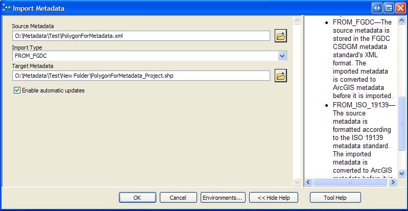
Import Metadata setup.
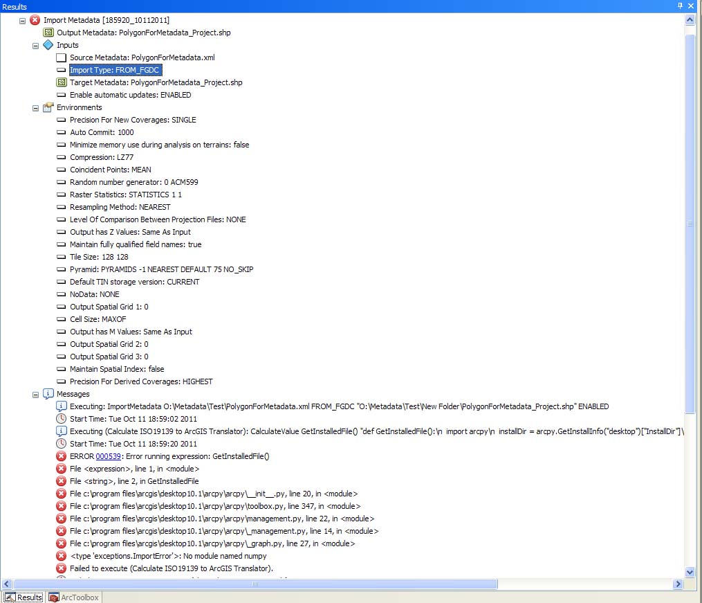
Import Metadata Fail Results, part 1.
Import Metadata Fail Results, part 2.
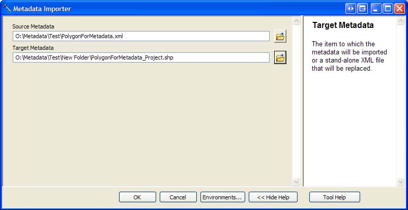
Metadata Importer setup.
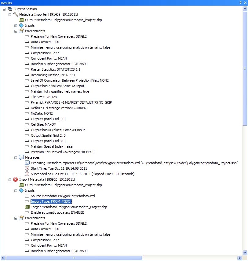
Metadata Importer Results
ArcGIS 10.1 Display of Metadata on the Shapefile.
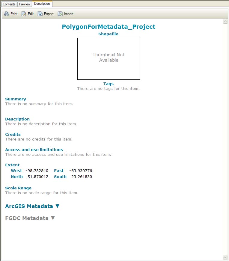
Initial view of the shapefile metadata.
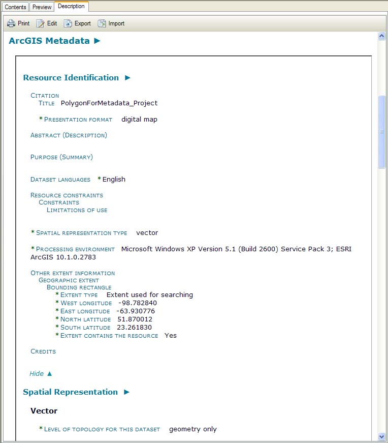
Shapefile ArcGIS metadata, part 1.
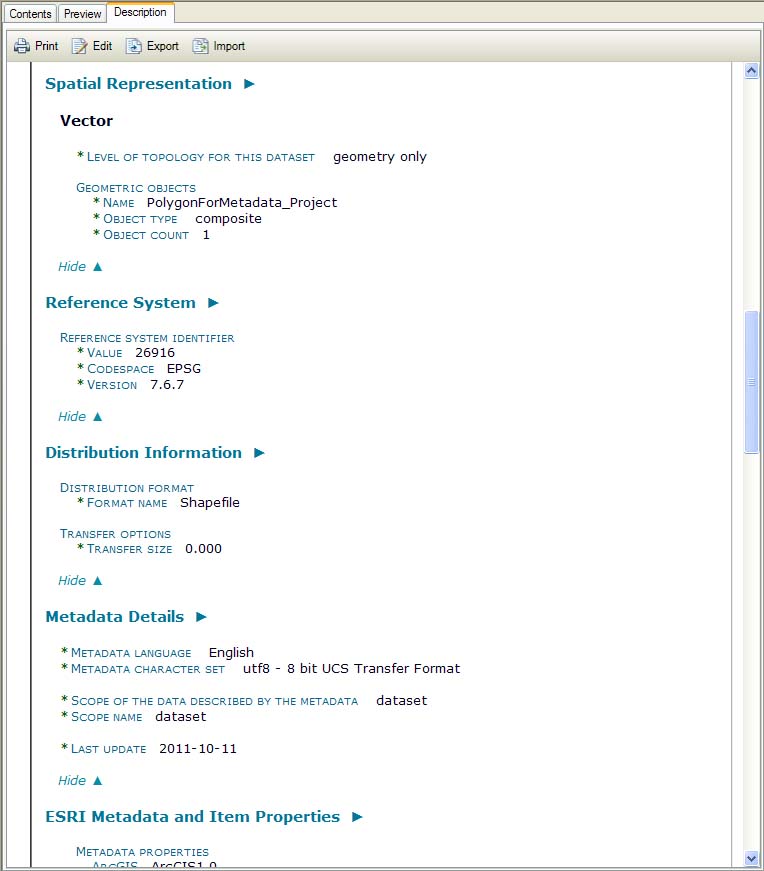
Shapefile ArcGIS metadata, part 2.
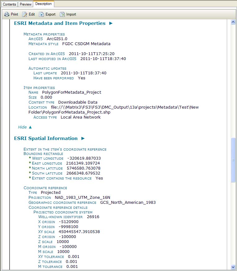
Shapefile ArcGIS metadata, part 3.
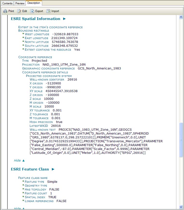
Shapefile ArcGIS metadata, part 3 and a half.
Shapefile ArcGIS metadata, part 4.
Shapefile ArcGIS metadata, part 4 and a half.
Shapefile ArcGIS metadata, part 5.
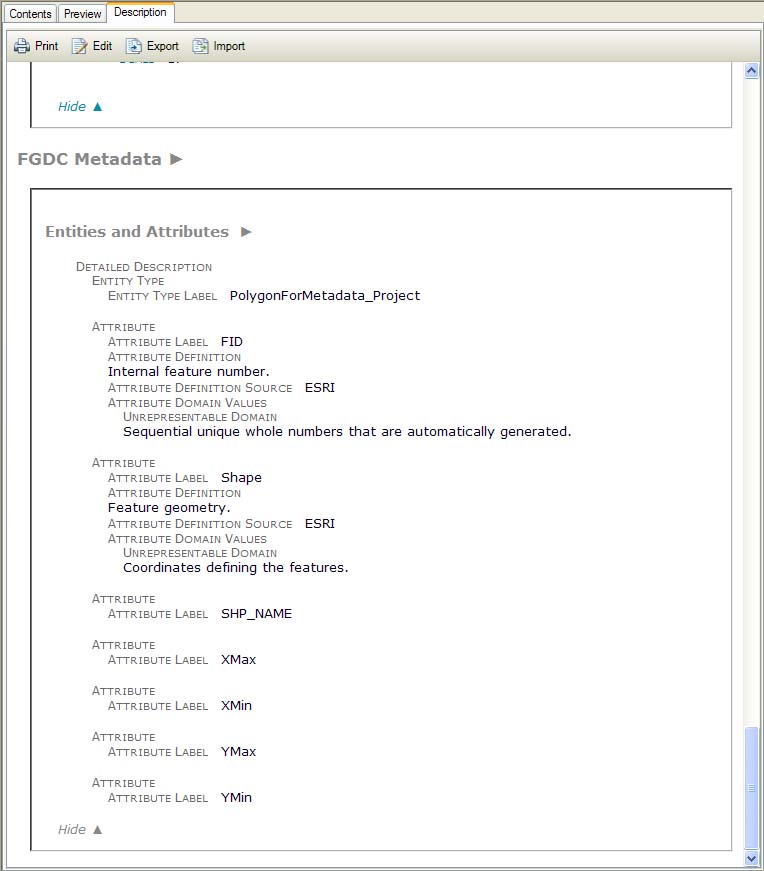
Shapefile FGDC metadata.
ArcGIS 10.1 Display of Metadata from the Simple FGDC-Compliant XML template.
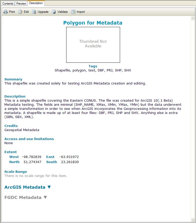
Initial view of the simple template metadata.
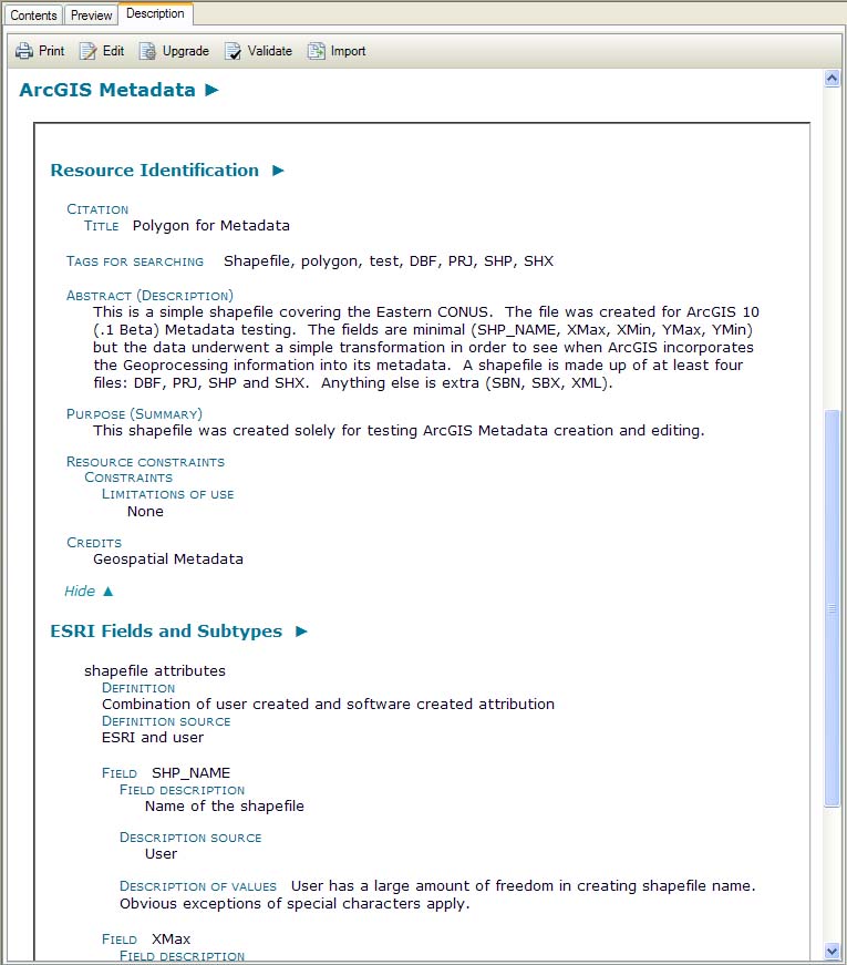
Template ArcGIS metadata, part 1.
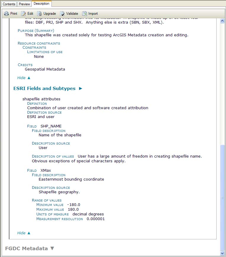
Template ArcGIS metadata, part 2.
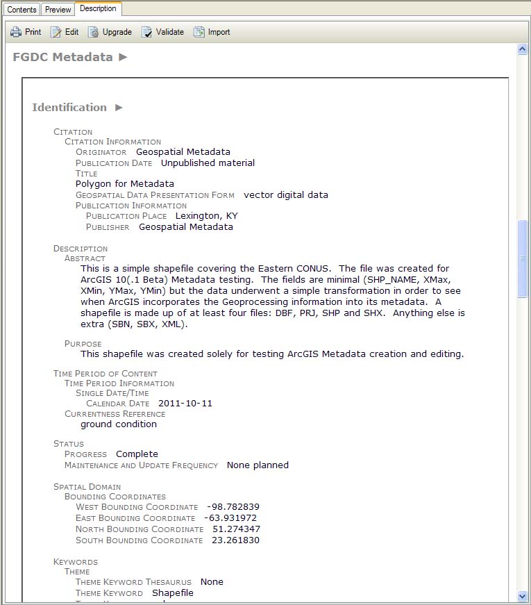
Template FGDC metadata, part 1.
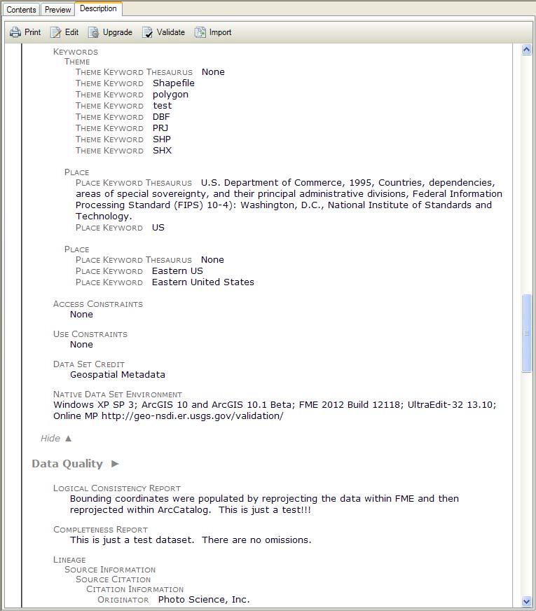
Template FGDC metadata, part 2.
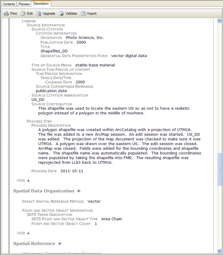
Template FGDC metadata, part 3.
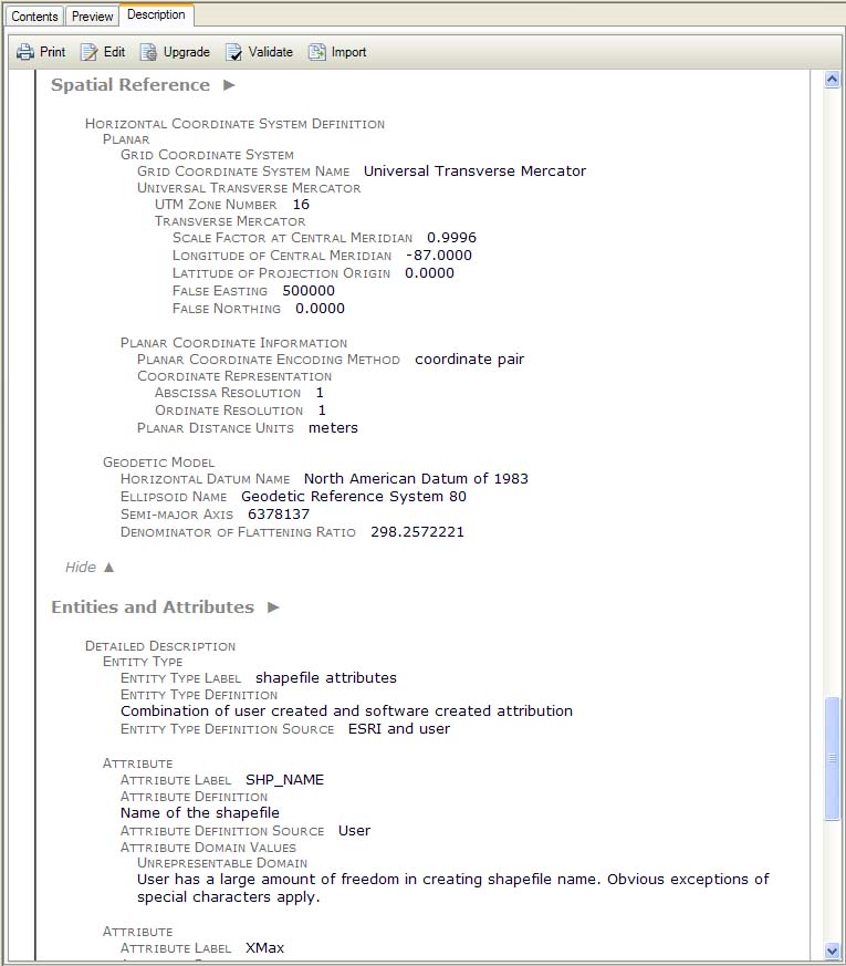
Template FGDC metadata, part 4.
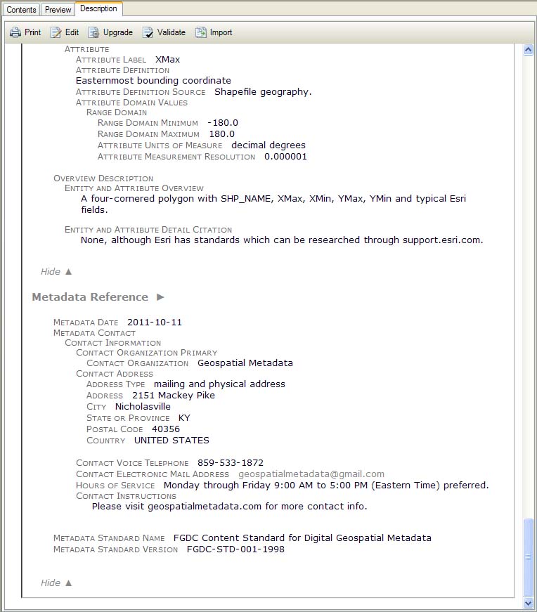
Template FGDC metadata, part 5.
ArcGIS 10.1 Display of Metadata on Shapefile onto which the simple FGDC-Compliant XML template was successfully imported.
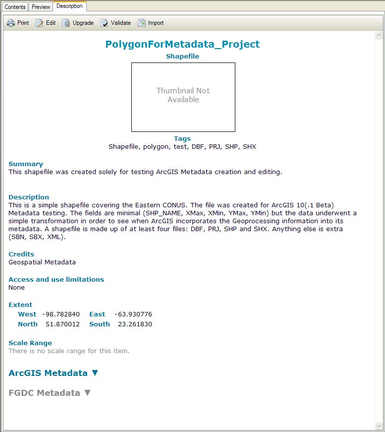
Initial view of the imported metadata.
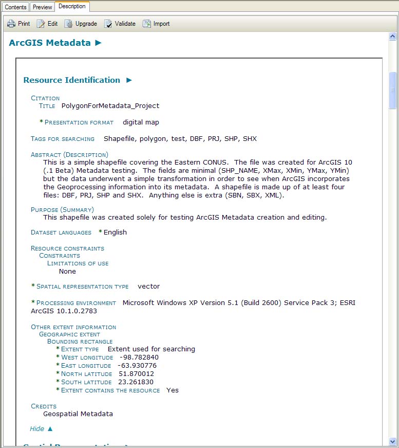
Imported ArcGIS metadata, part 1.
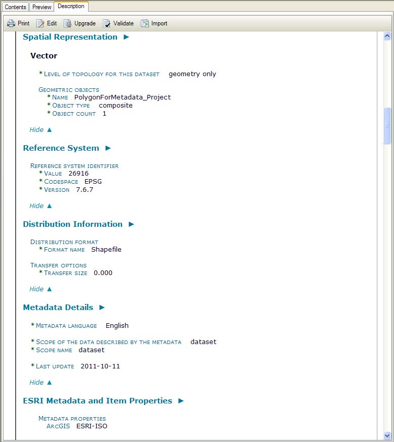
Imported ArcGIS metadata, part 2.
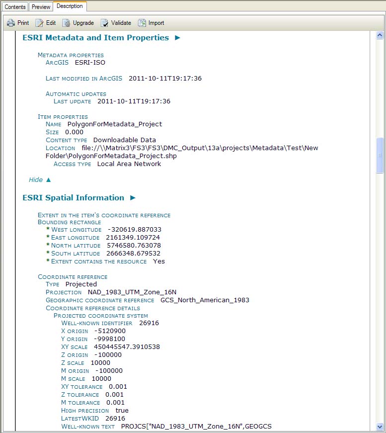
Imported ArcGIS metadata, part 3.
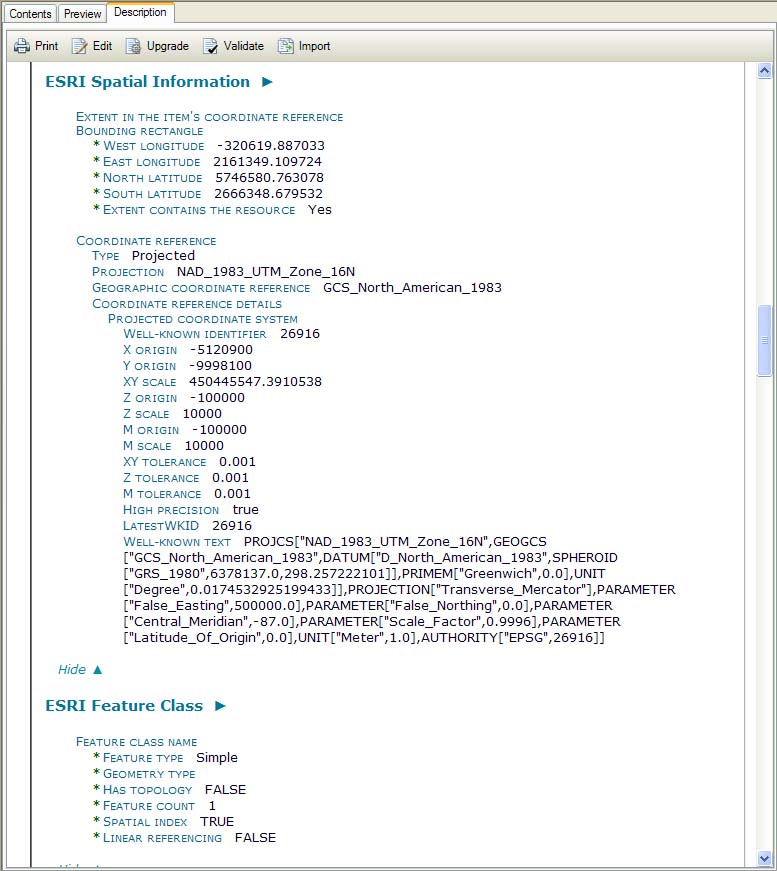
Imported ArcGIS metadata, part 3 and a half.

Imported ArcGIS metadata, part 4.
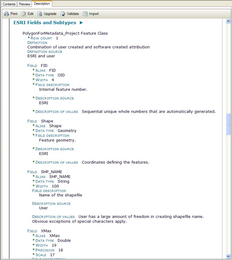
Imported ArcGIS metadata, part 5.
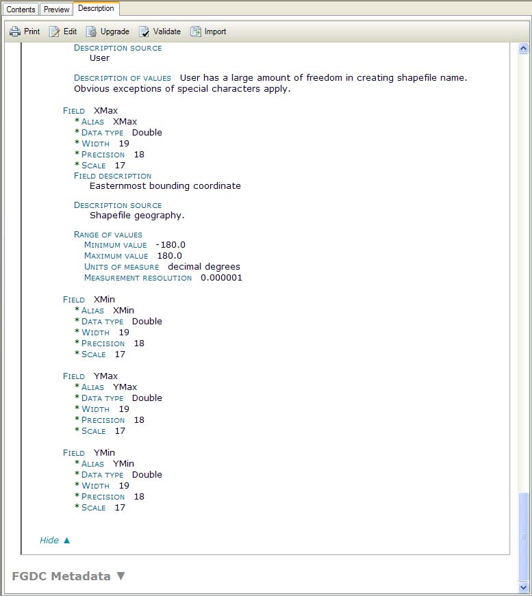
Imported ArcGIS metadata, part 6.
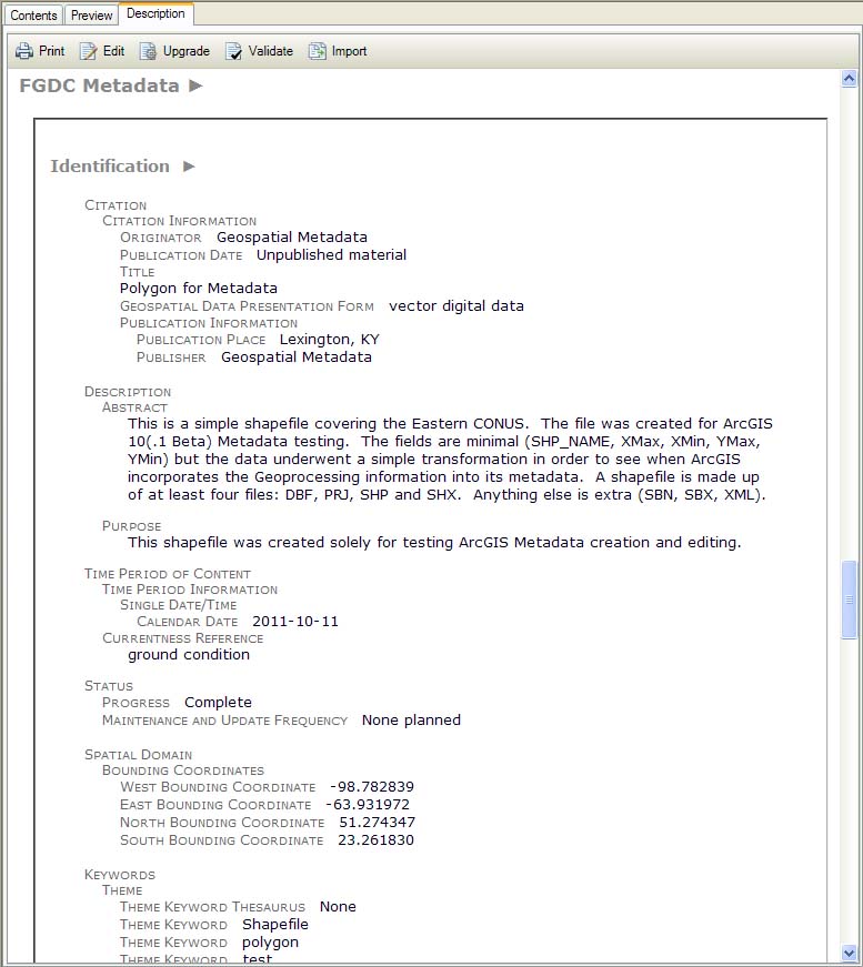
Imported FGDC metadata, part 1.
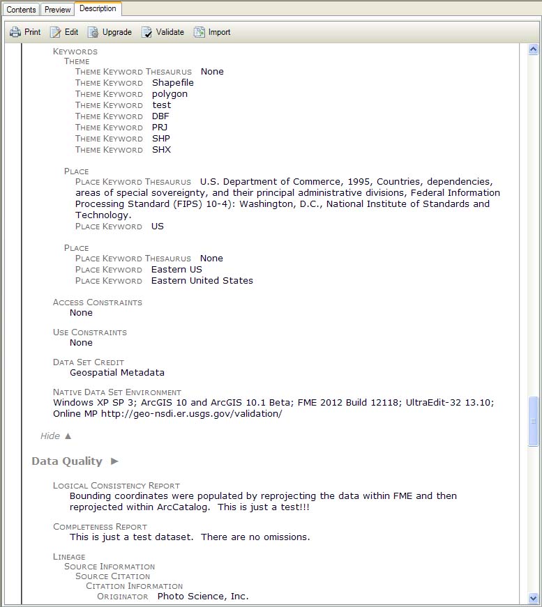
Imported FGDC metadata, part 2.
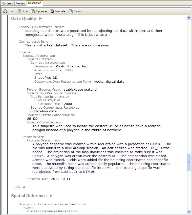
Imported FGDC metadata, part 3.
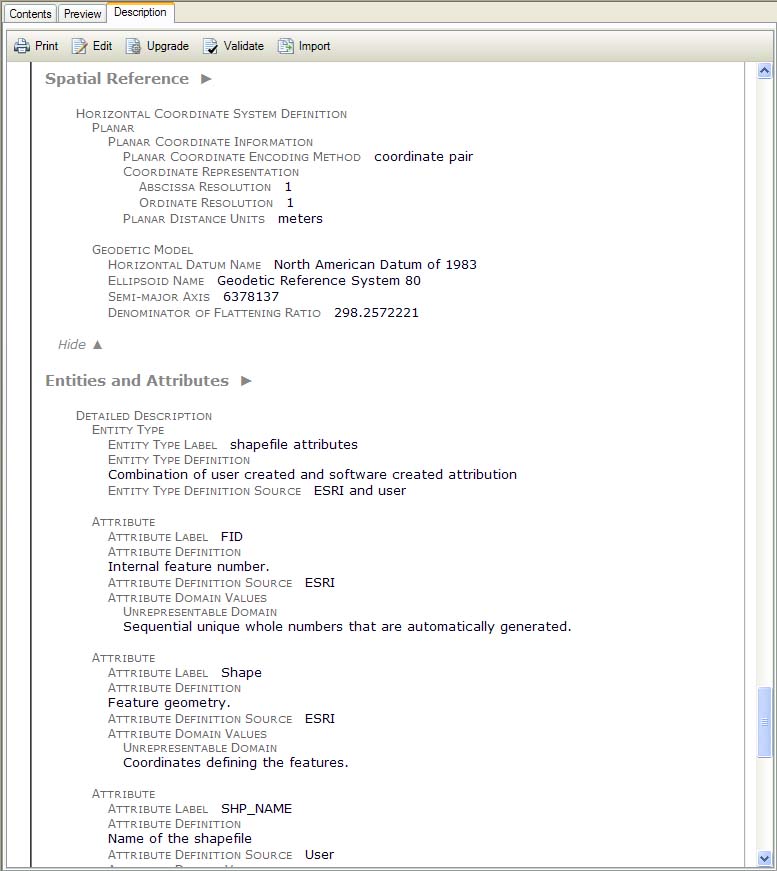
Imported FGDC metadata, part 4.
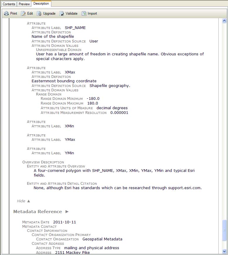
Imported FGDC metadata, part 5.
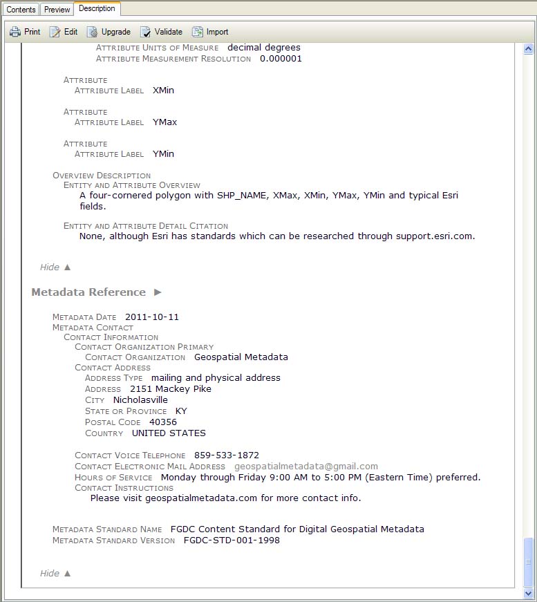
Imported FGDC metadata, part 6.
Editor Basic Views.
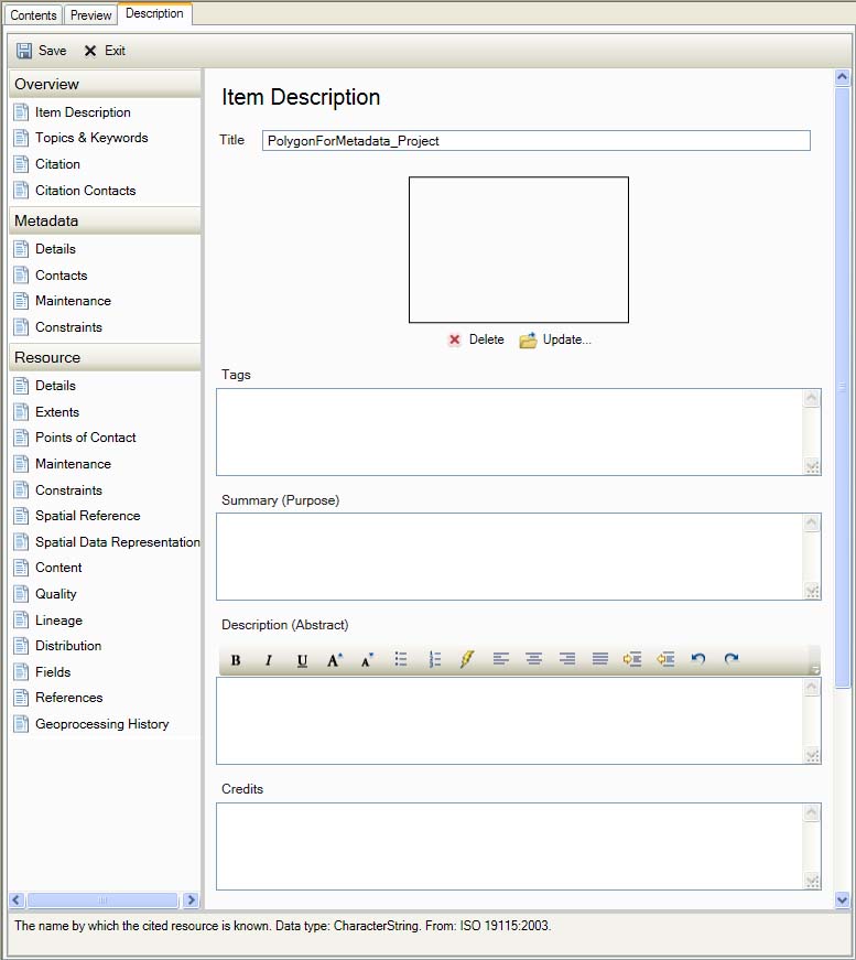
ArcGIS Metadata Editor on unimported shapefile.
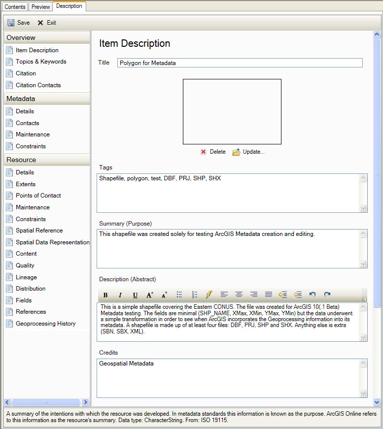
ArcGIS Metadata Editor on simple FGDC-Compliant XML metadata template.
Overview
Item Description
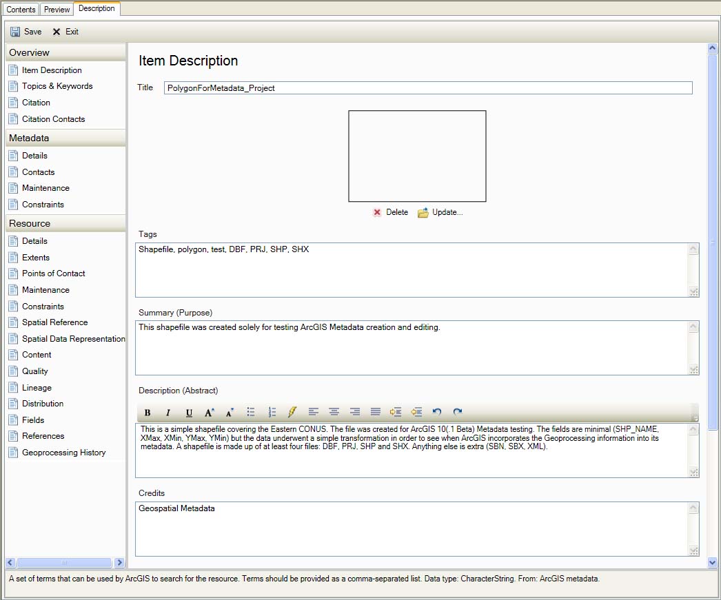
Item Description
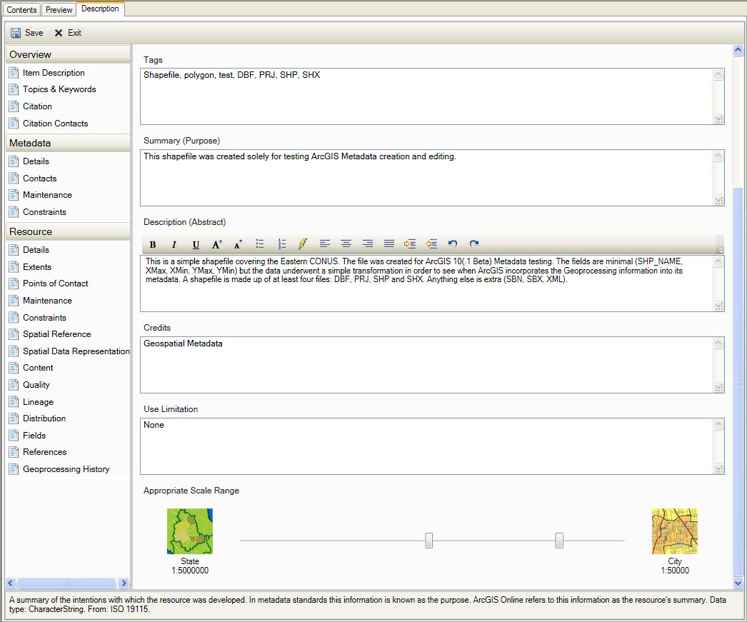
Item Description
Topics & Keywords
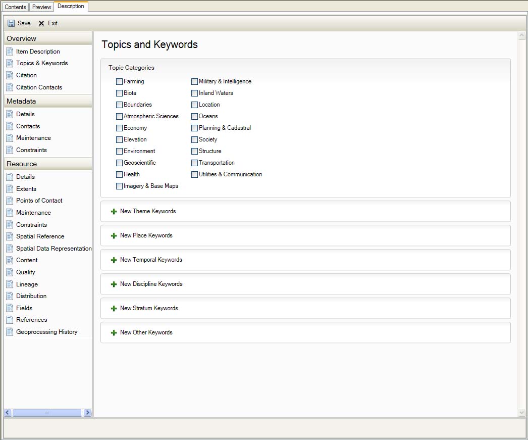
Topics & Keywords
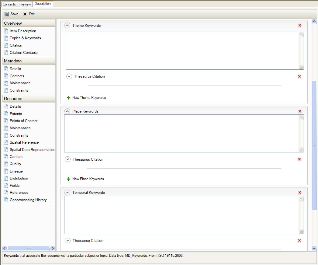
Topics & Keywords
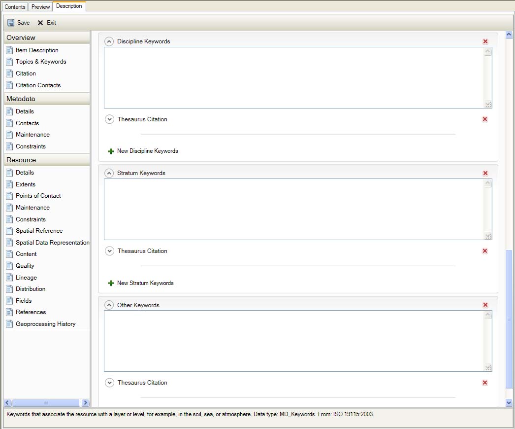
Topics & Keywords
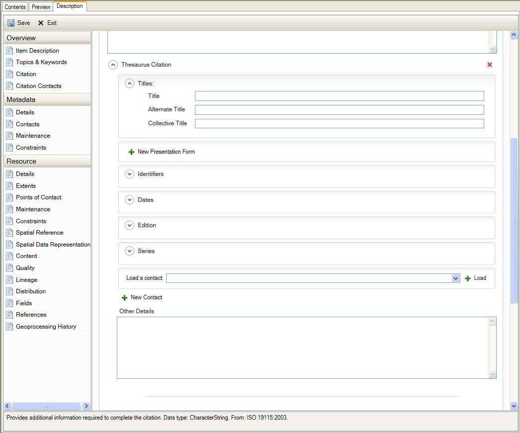
Topics & Keywords - Thesaurus
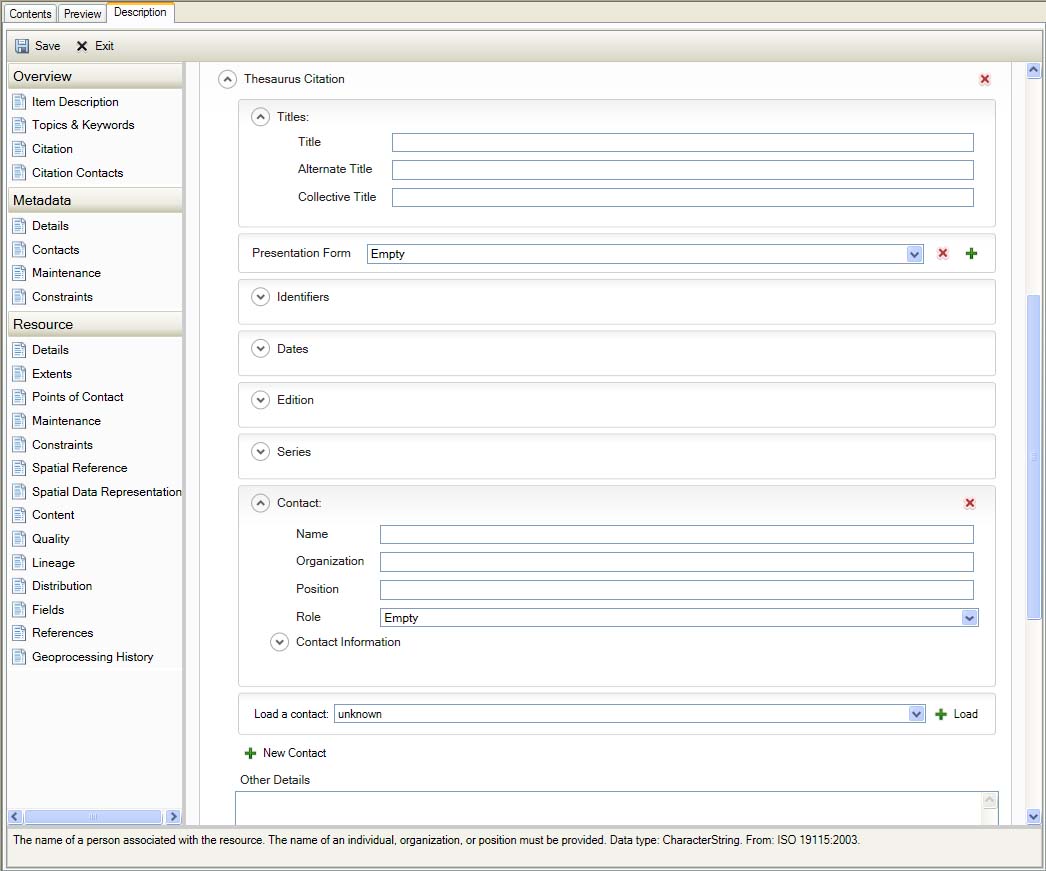
Topics & Keywords - Thesaurus
Citation
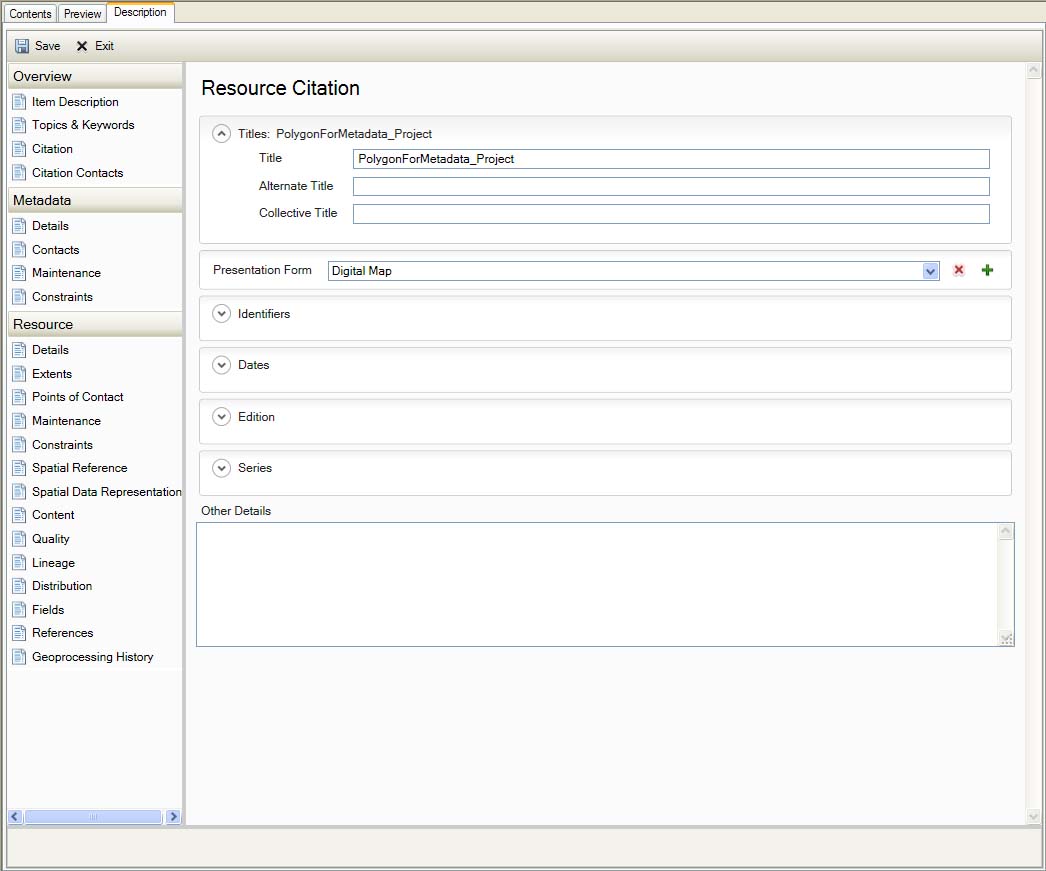
Item Description Citation
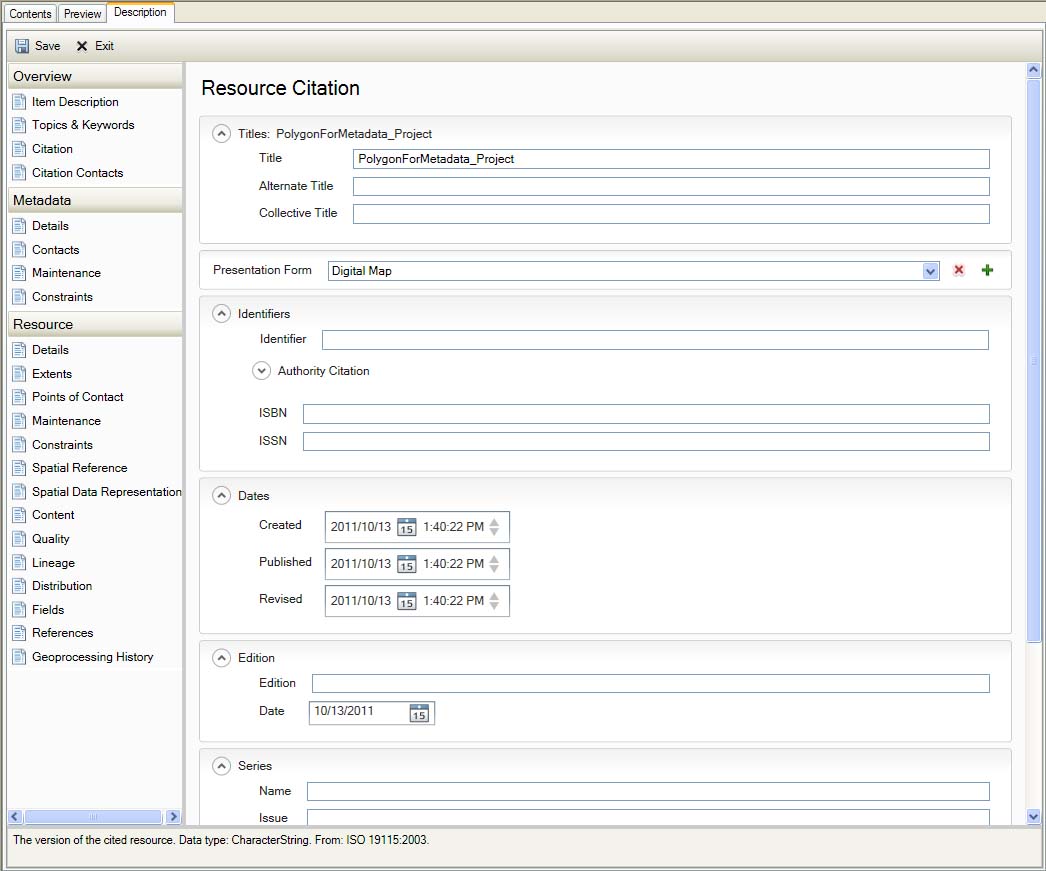
Item Description Citation
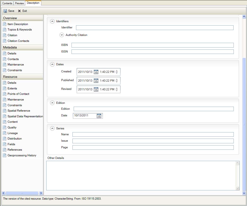
Item Description Citation
Citation Contacts
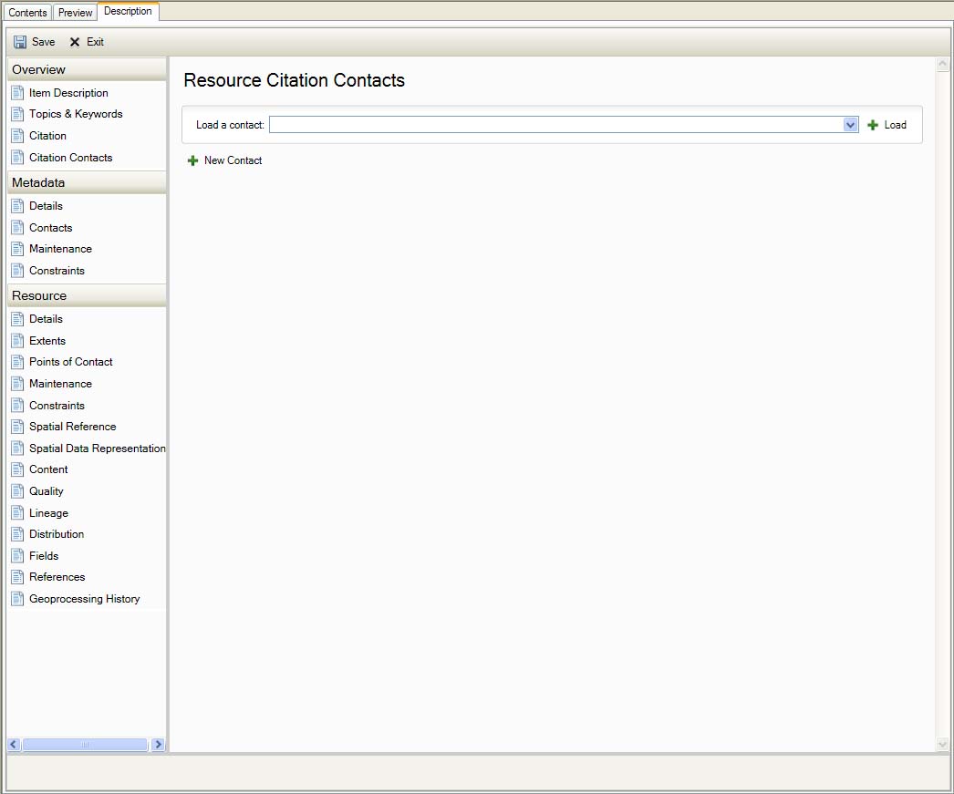
Item Description Citation Contacts
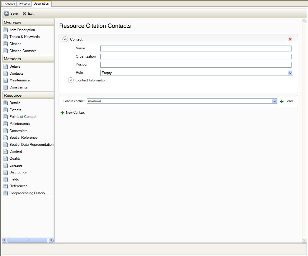
Item Description Citation Contacts
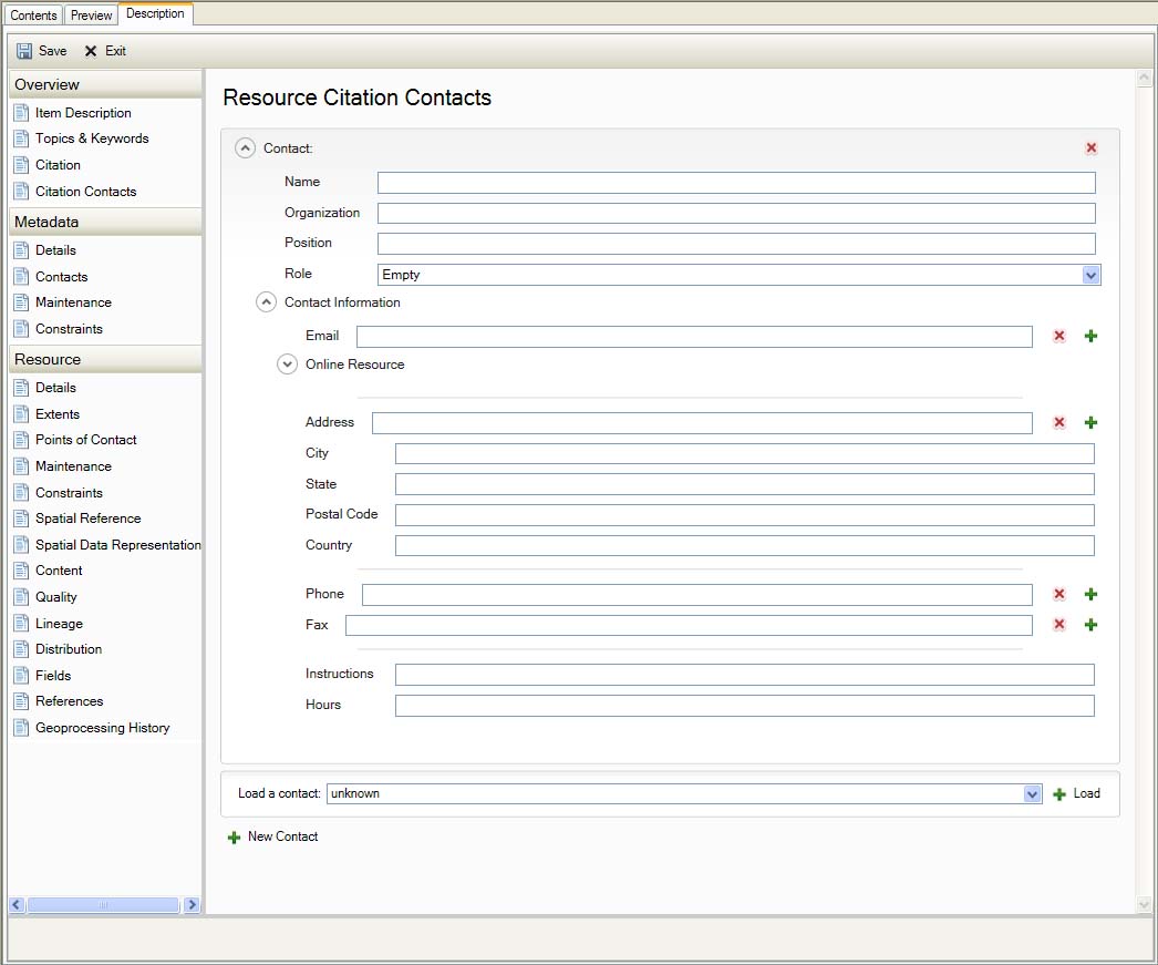
Item Description Citation Contacts
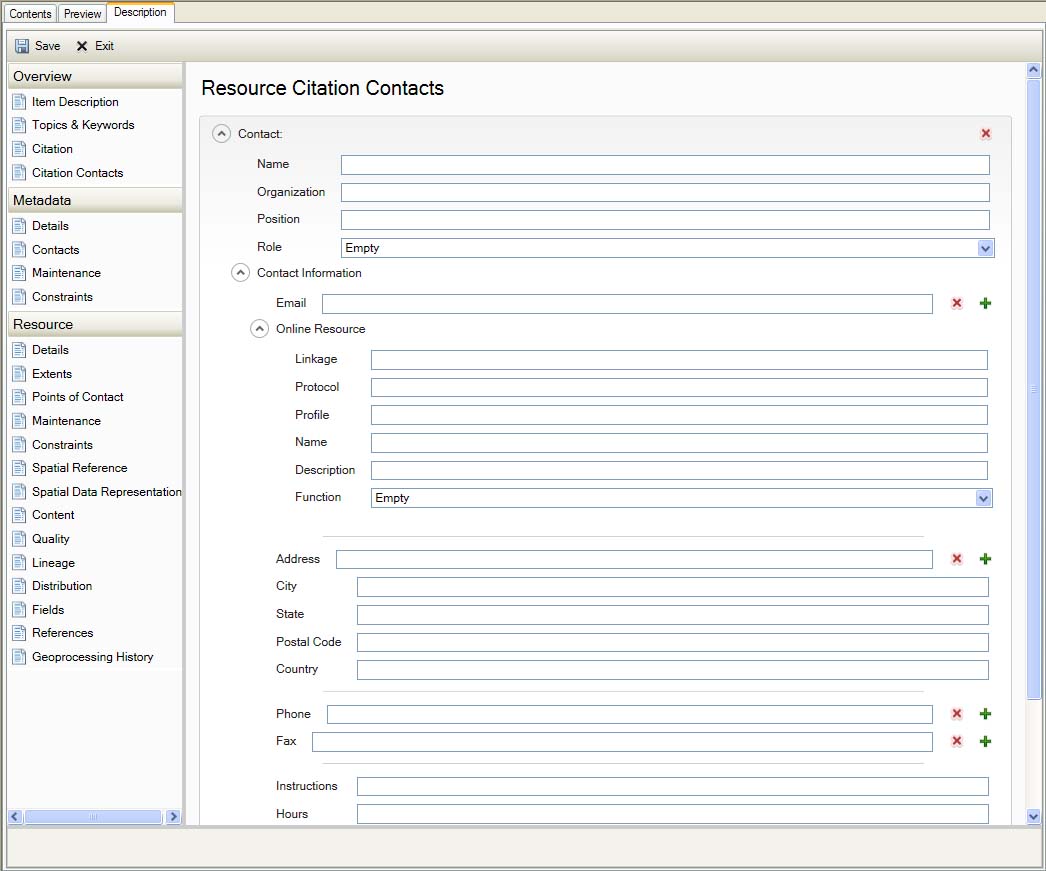
Item Description Citation Contacts
Metadata
Details
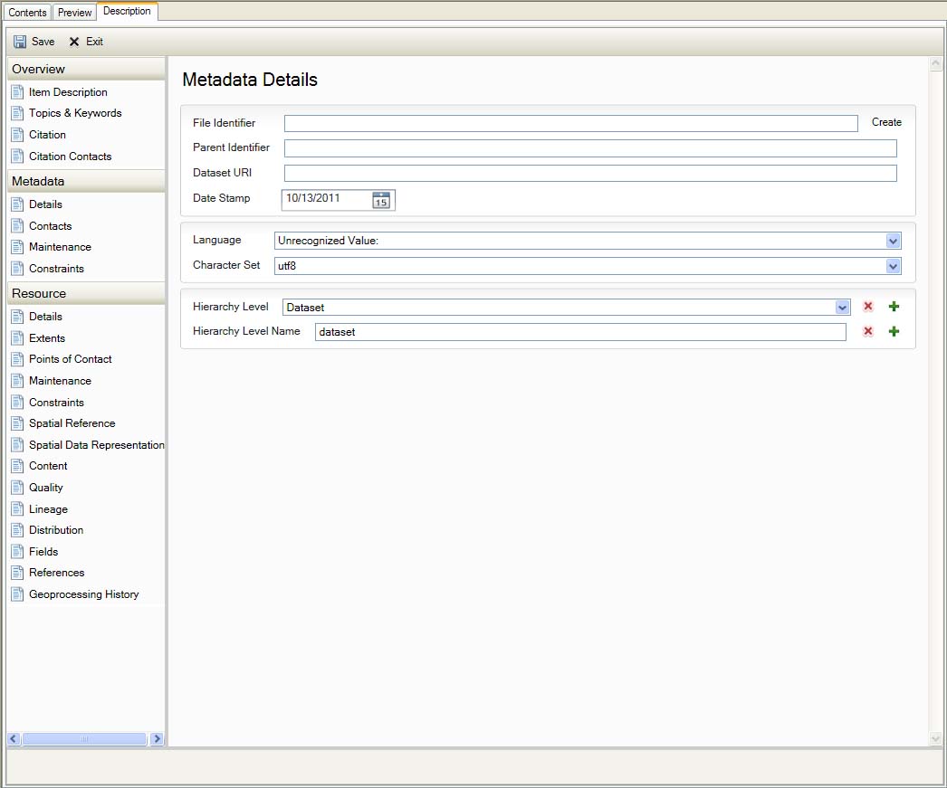
Metadata Details
Contacts
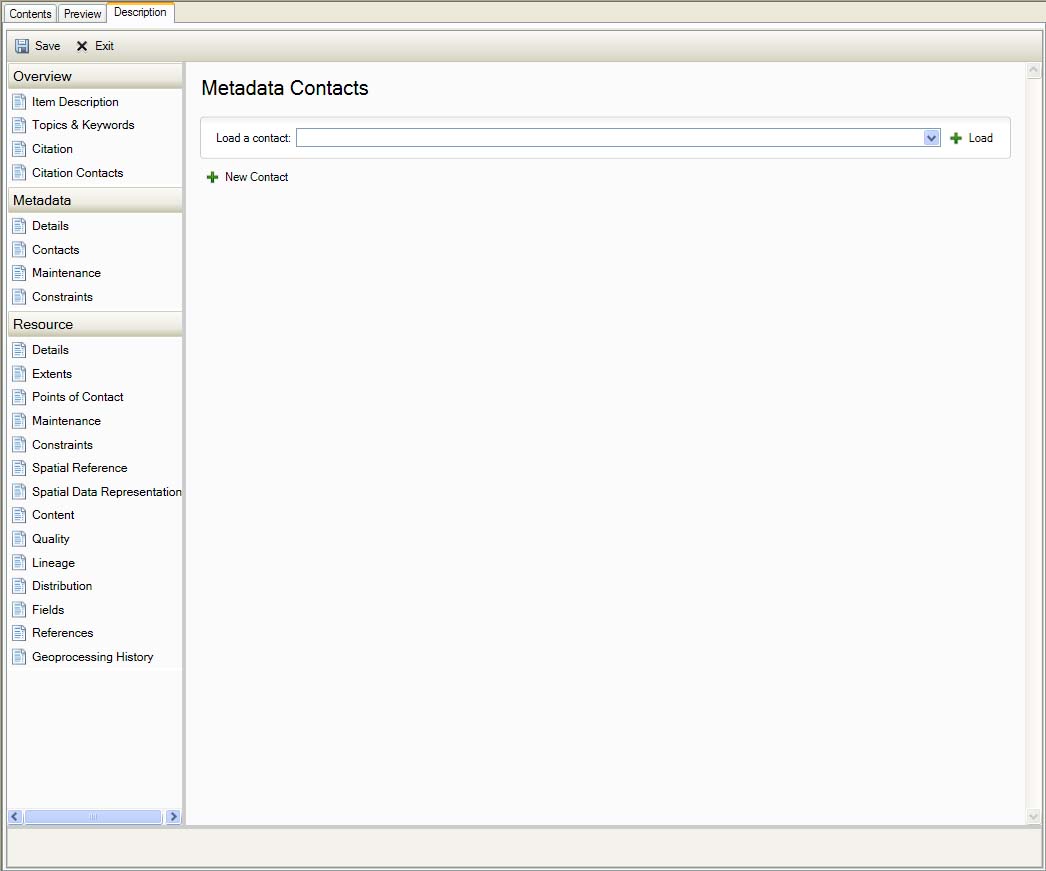
Metadata Contacts
Maintenance
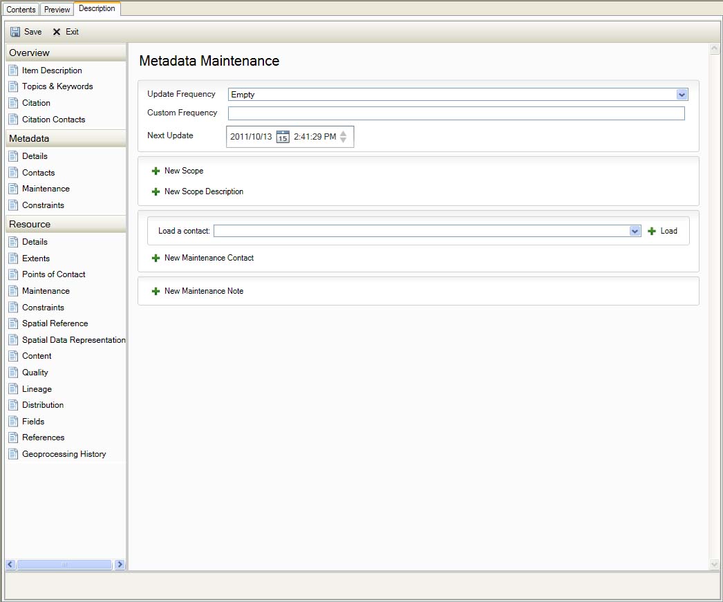
Metadata Maintence
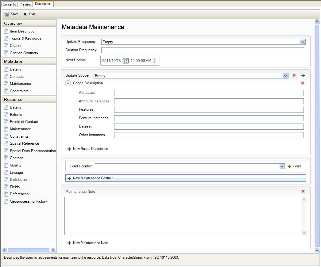
Metadata Maintence
Constraints
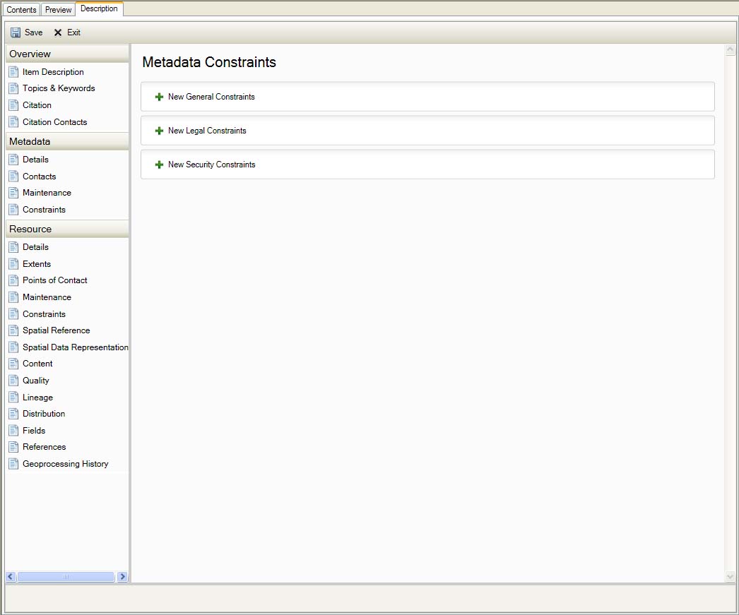
Metadata Constraints

Metadata Constraints
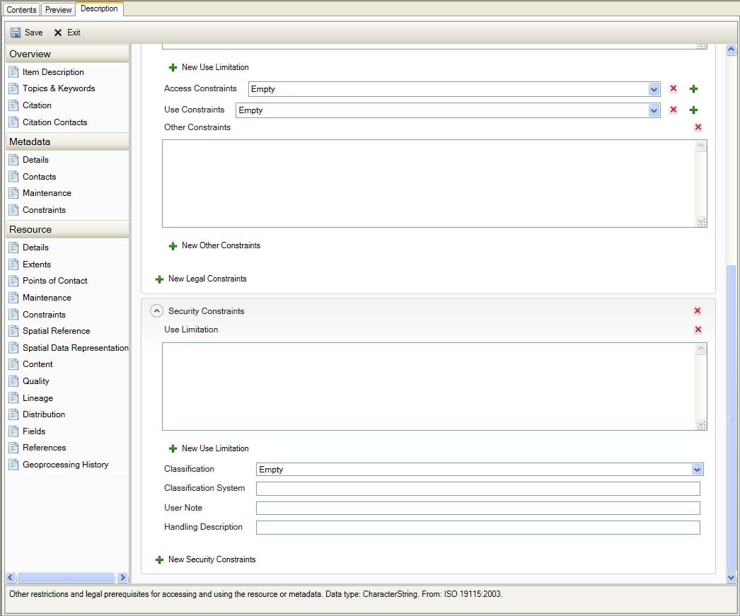
Metadata Constraints
Resources
Details
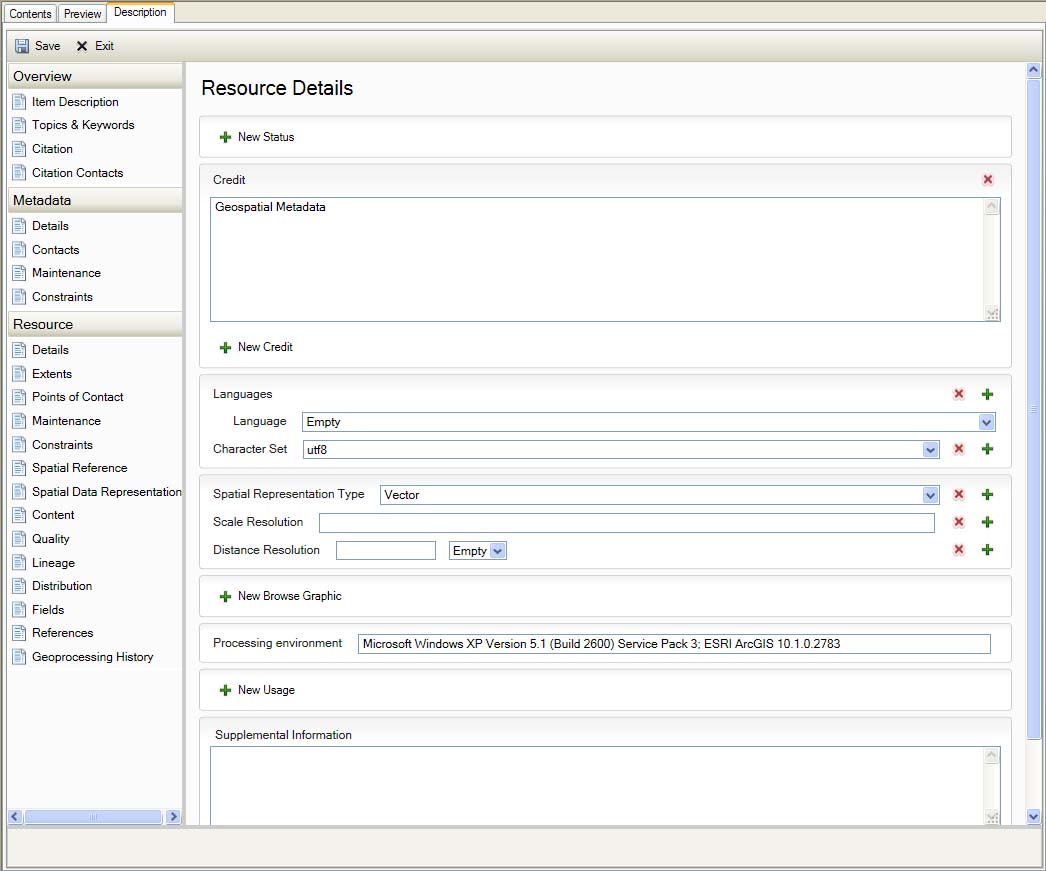
Resource Details
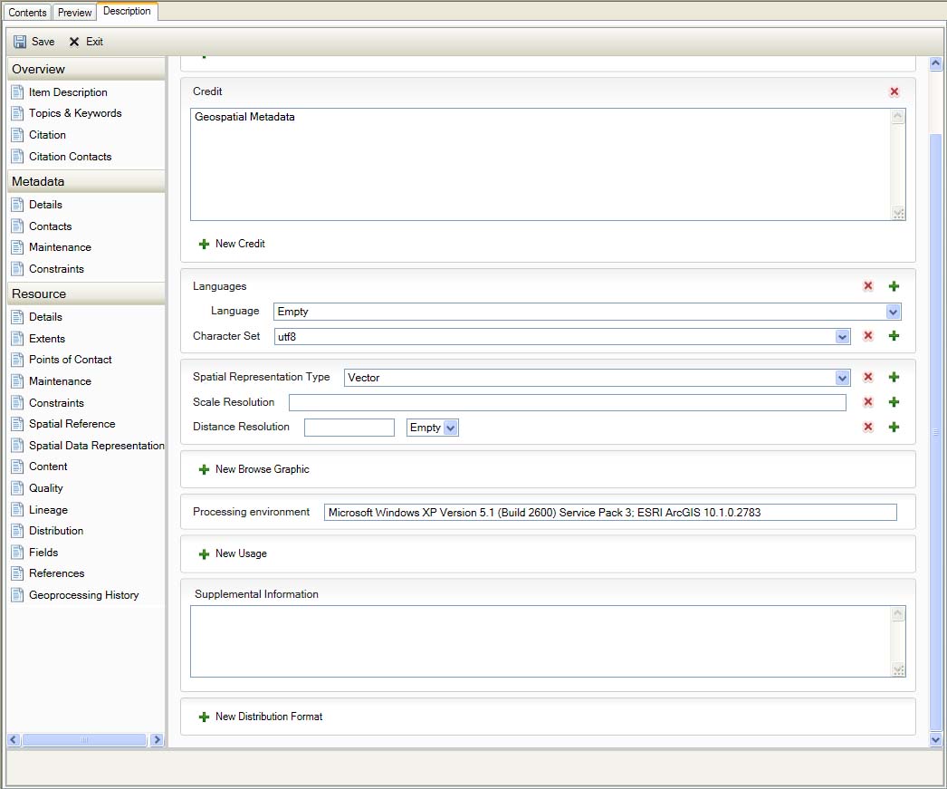
Resource Details
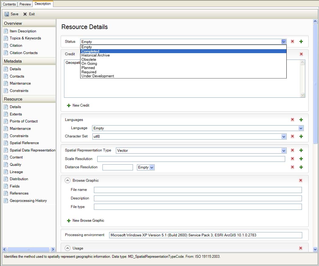
Resource Details
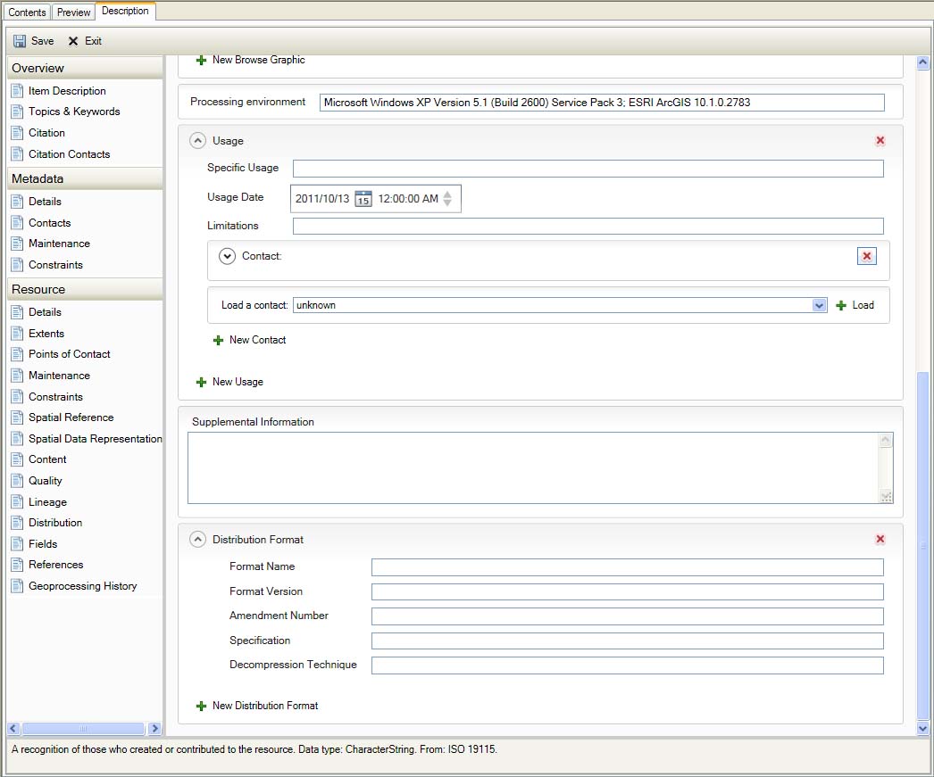
Resource Details
Extents
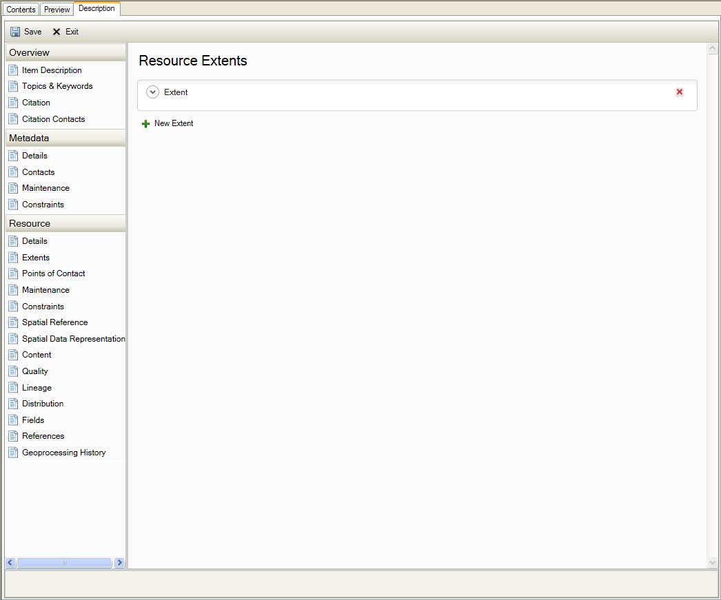
Resource Extents
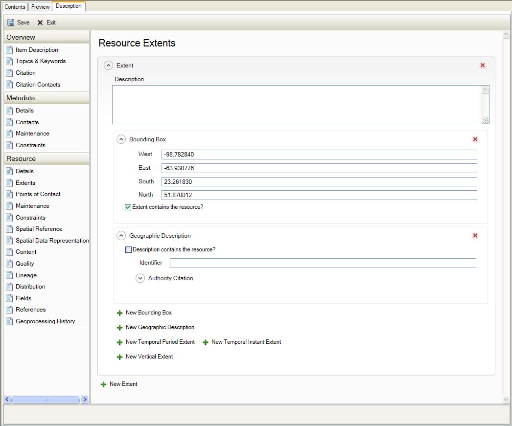
Resource Extents
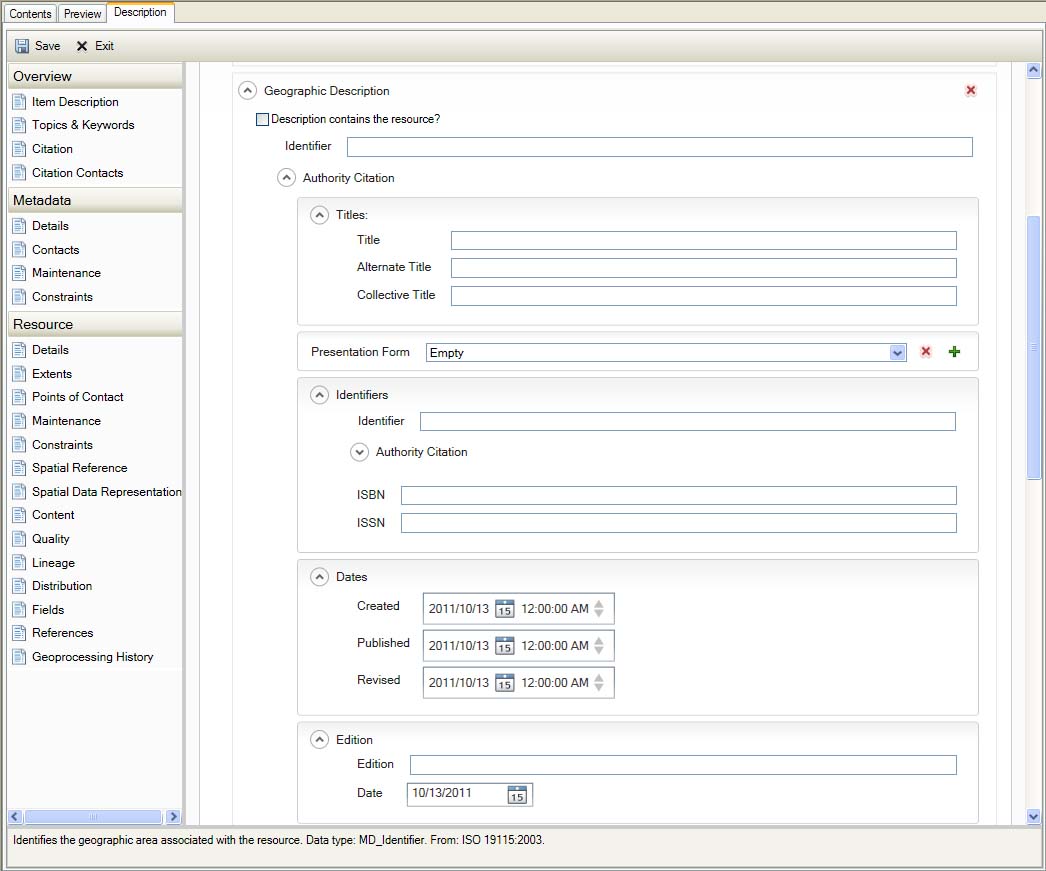
Resource Extents
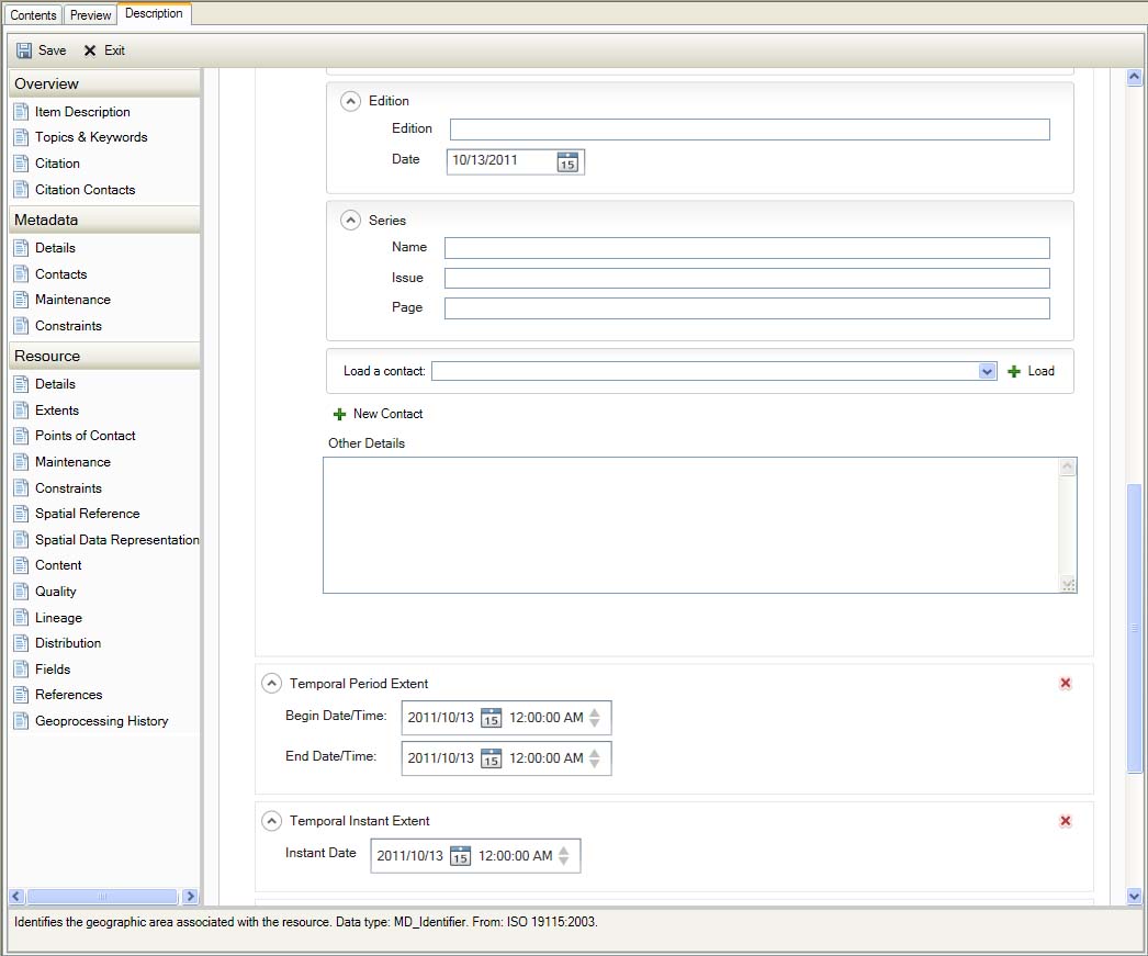
Resource Extents
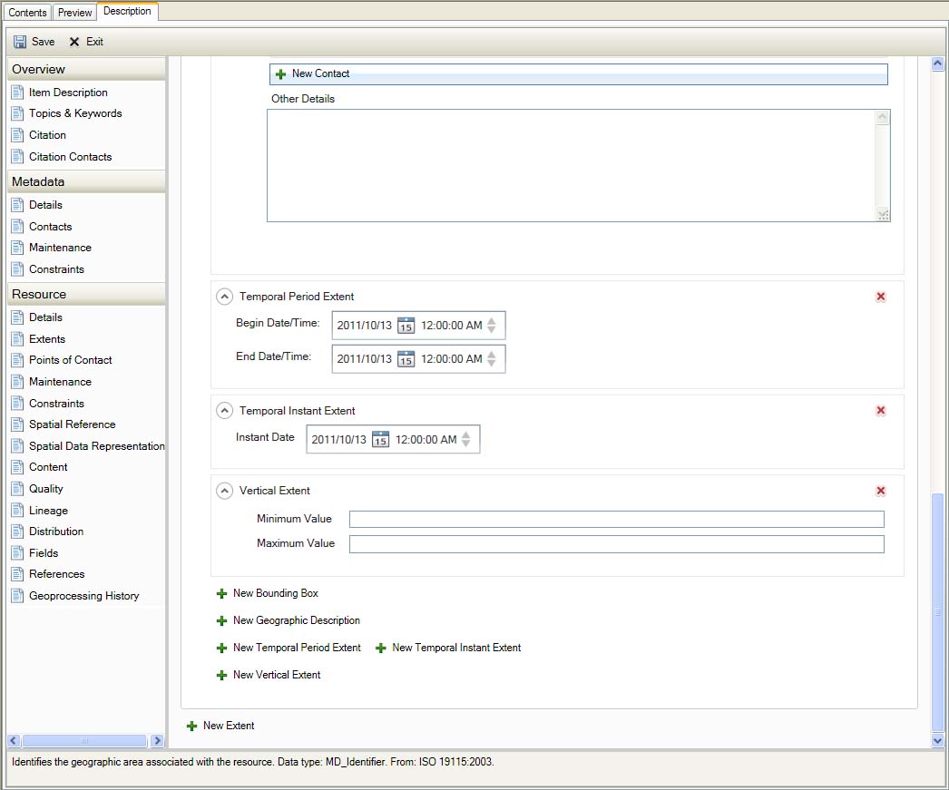
Resource Extents
Points of Contact
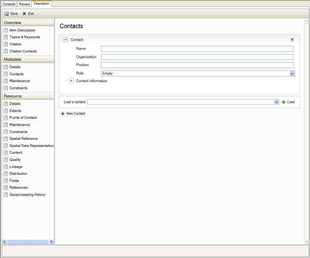
Resource Points of Contact
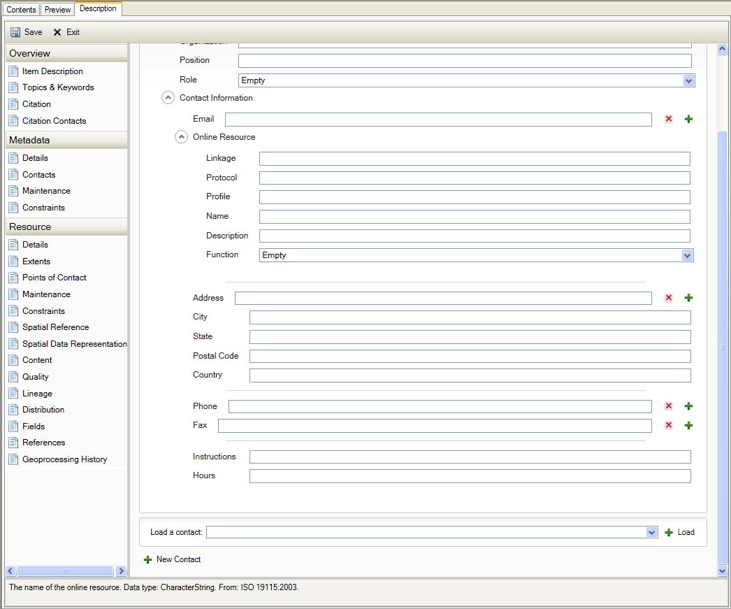
Resource Points of Contact
Maintenance
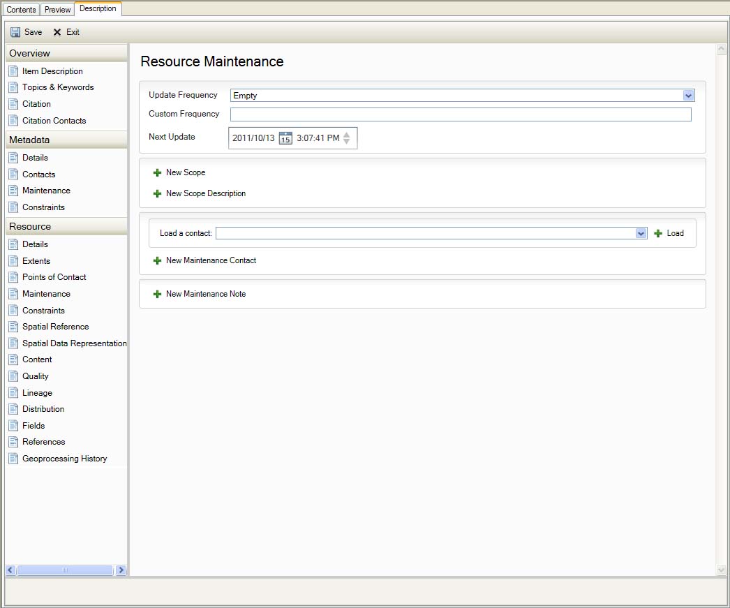
Resource Maintenance
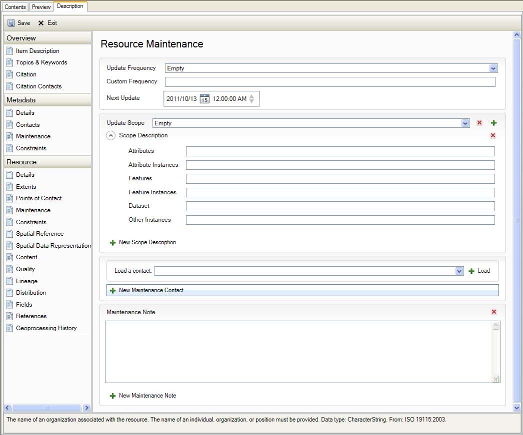
Resource Maintenance
Constraints
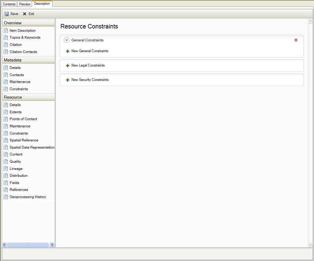
Resource Constraints
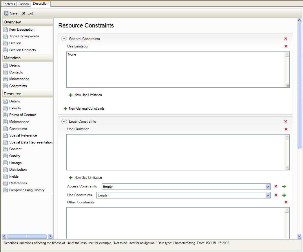
Resource Constraints
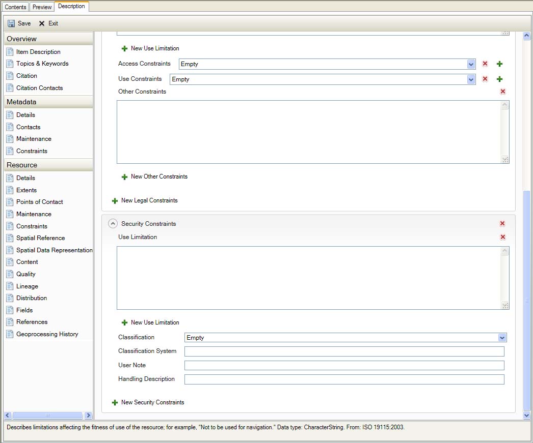
Resource Constraints
Spatial Reference
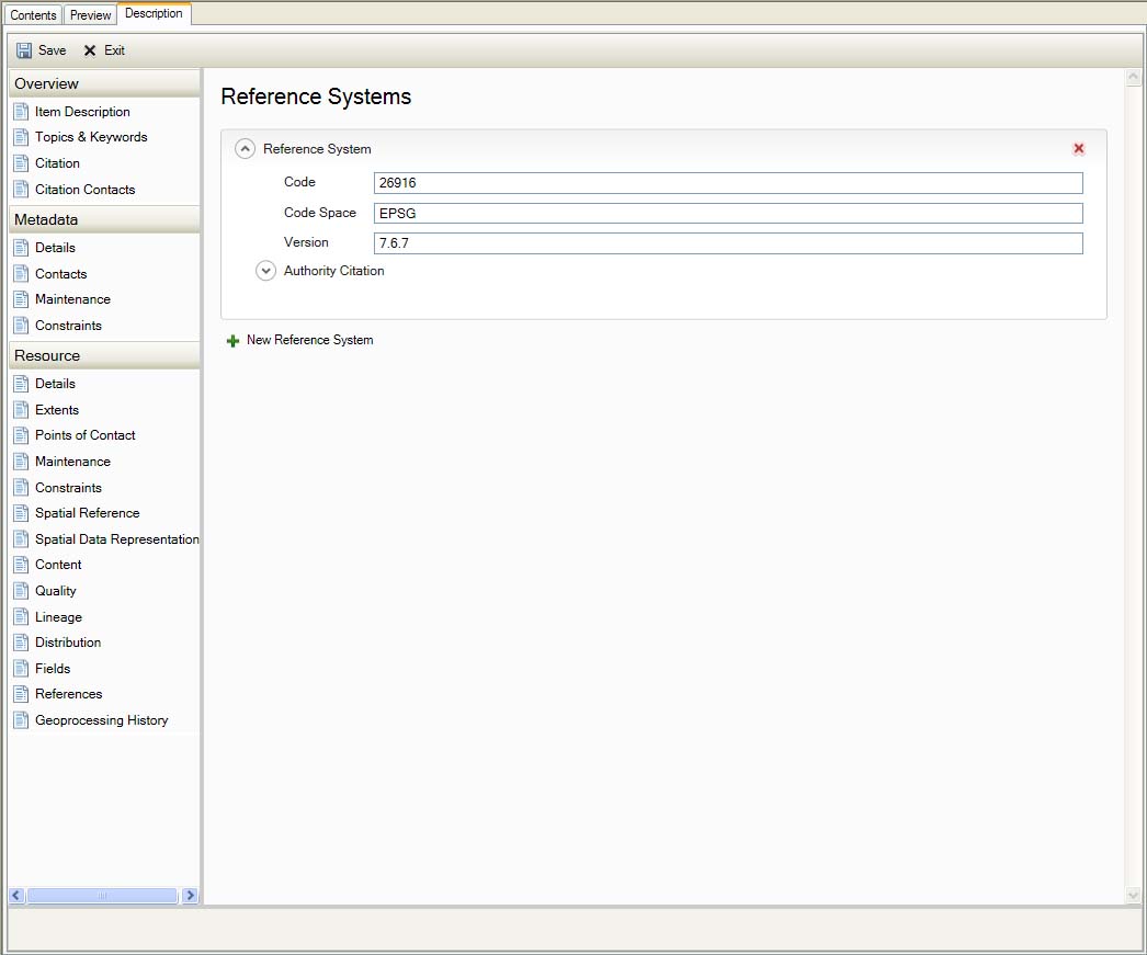
Spatial Reference
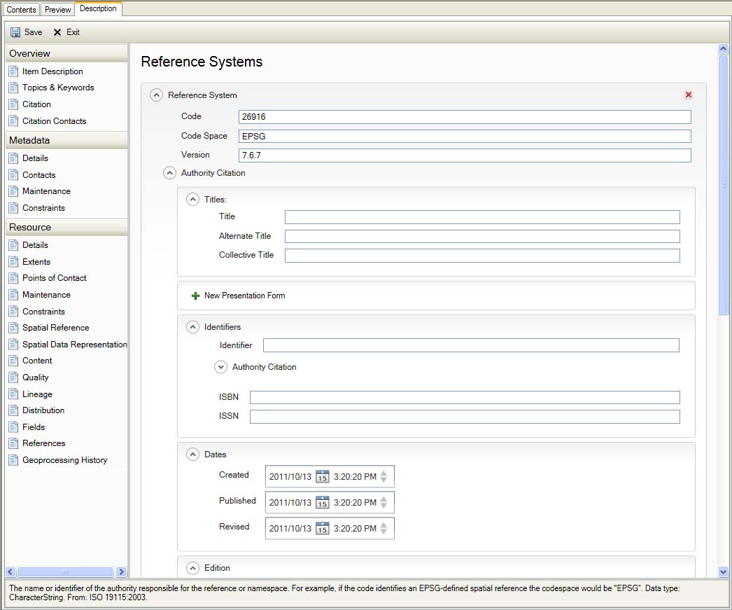
Spatial Reference
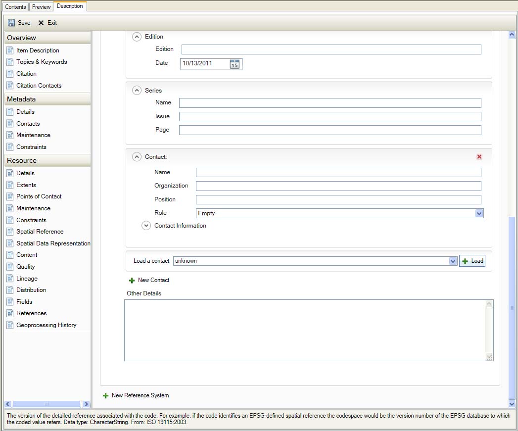
Spatial Reference
Spatial Data Representation
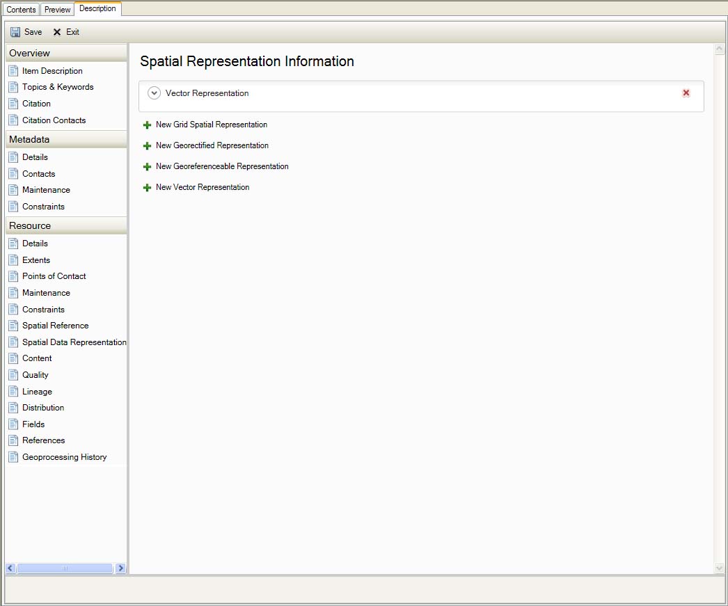
Spatial Data Representation
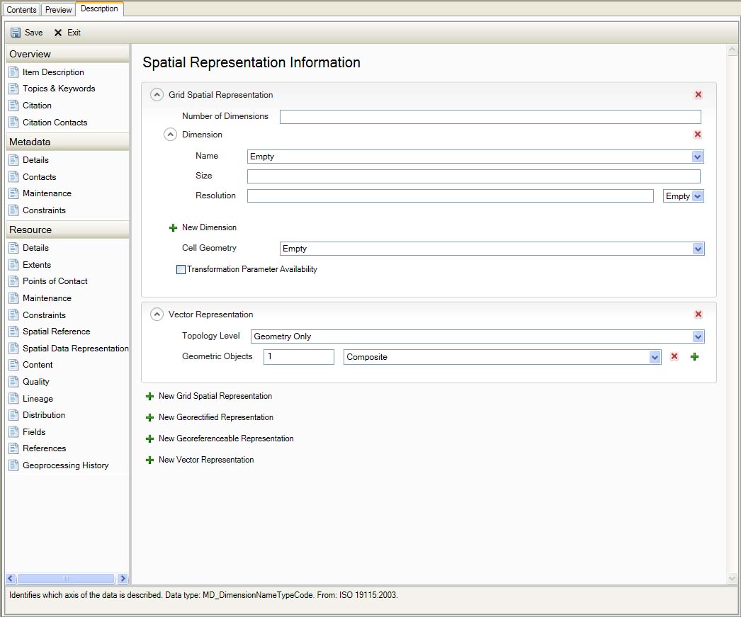
Spatial Data Representation
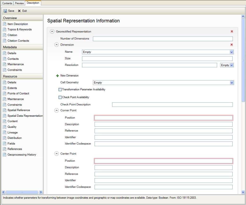
Spatial Data Representation
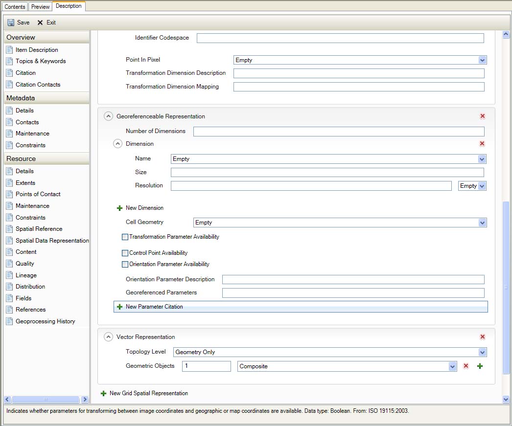
Spatial Data Representation
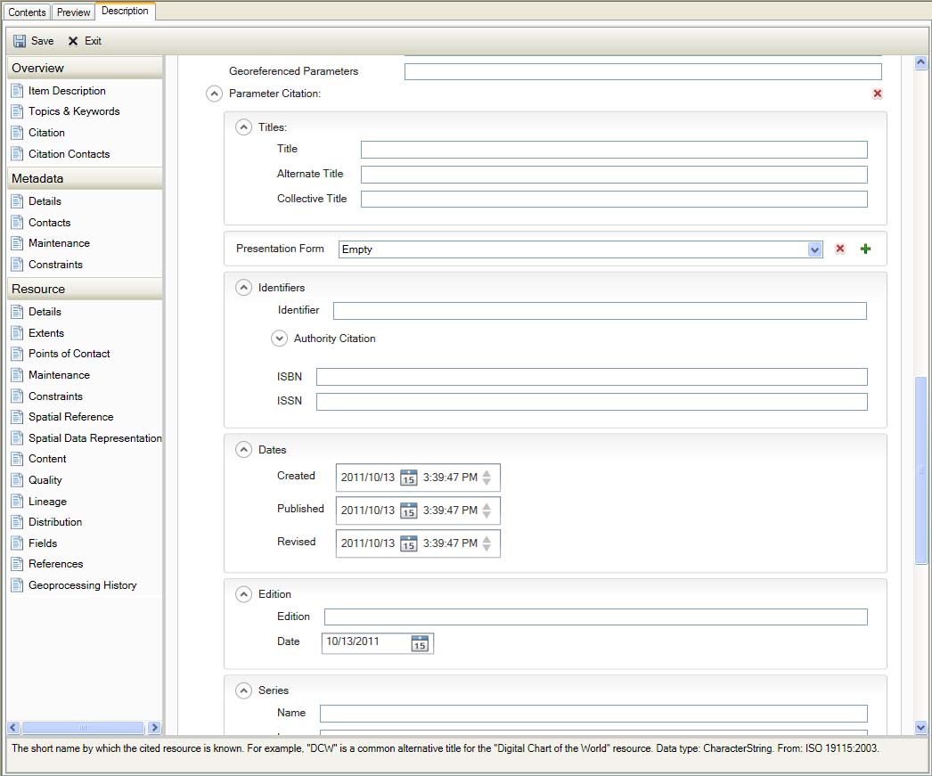
Spatial Data Representation
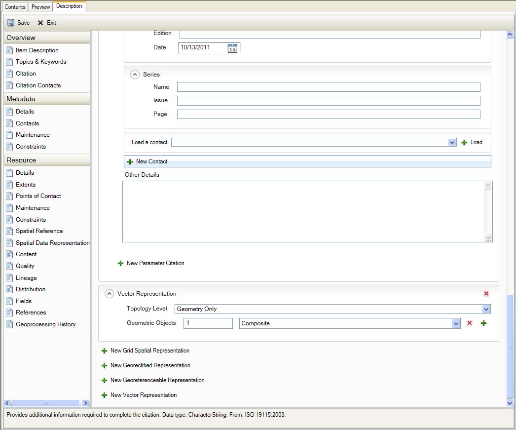
Spatial Data Representation
Content
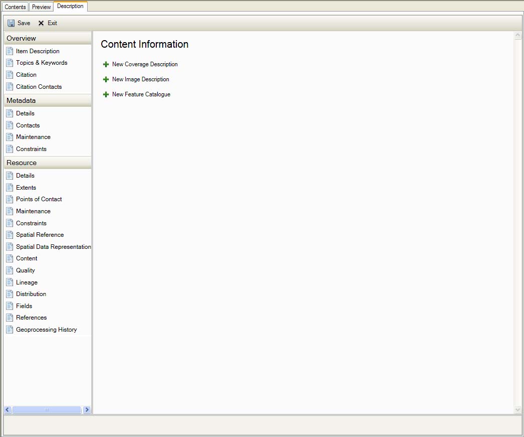
Resource Content
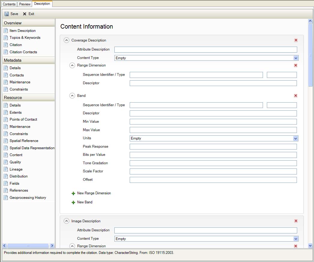
Resource Content
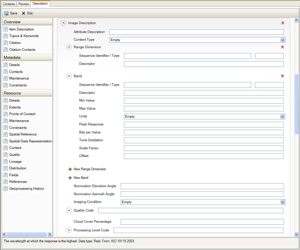
Resource Content
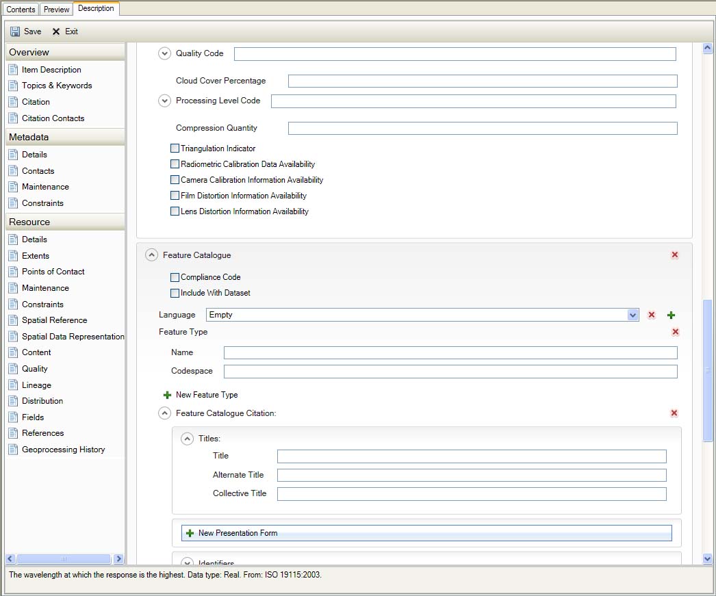
Resource Content
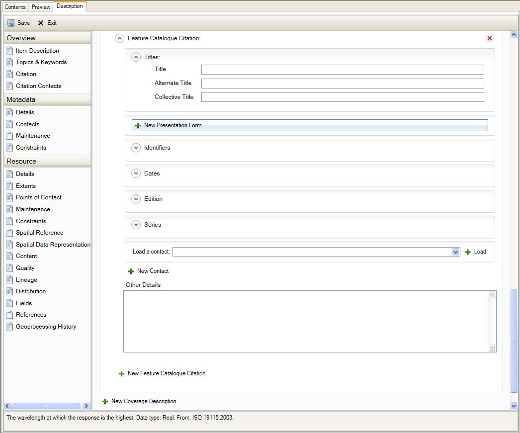
Resource Content
Quality
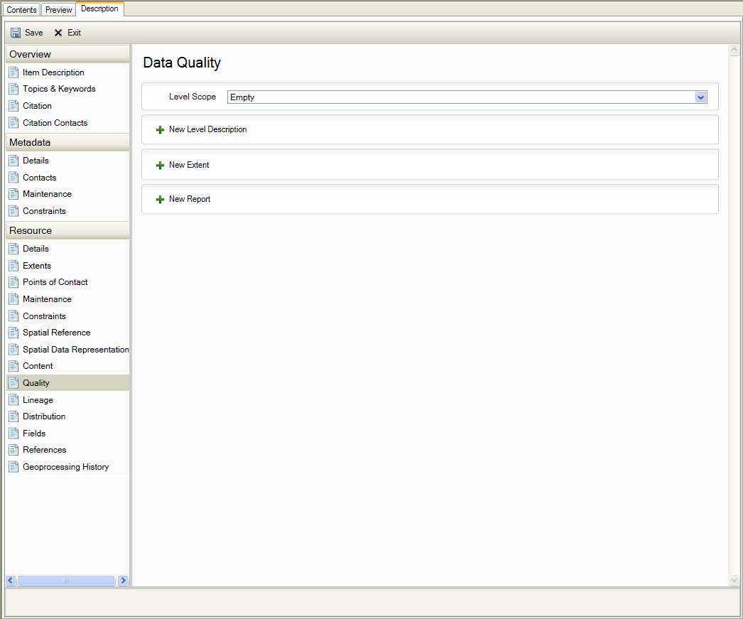
Resource Quality
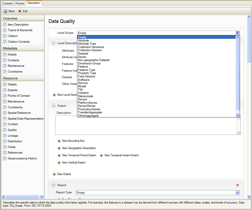
Resource Quality
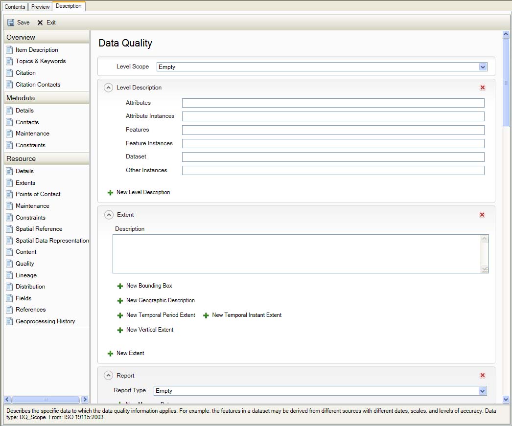
Resource Quality
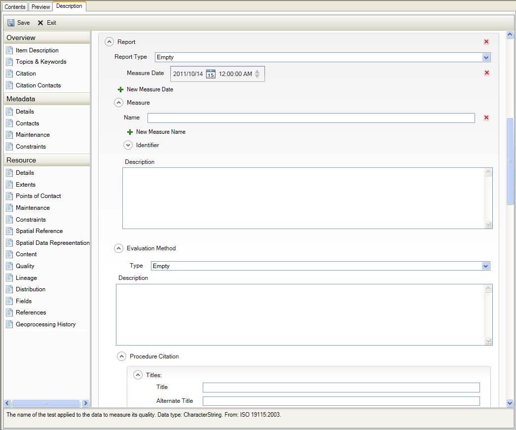
Resource Quality
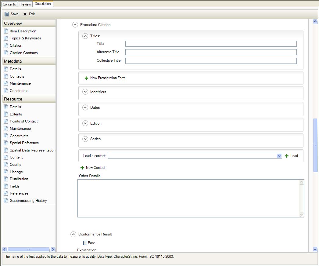
Resource Quality
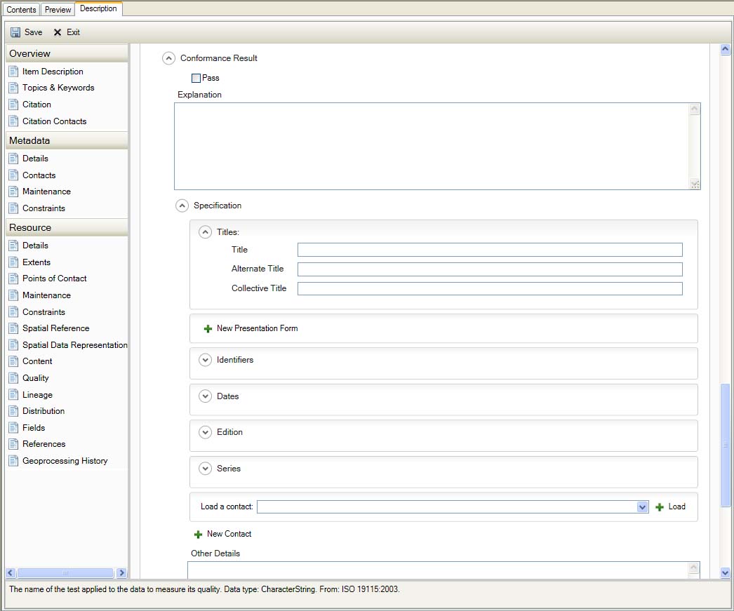
Resource Quality
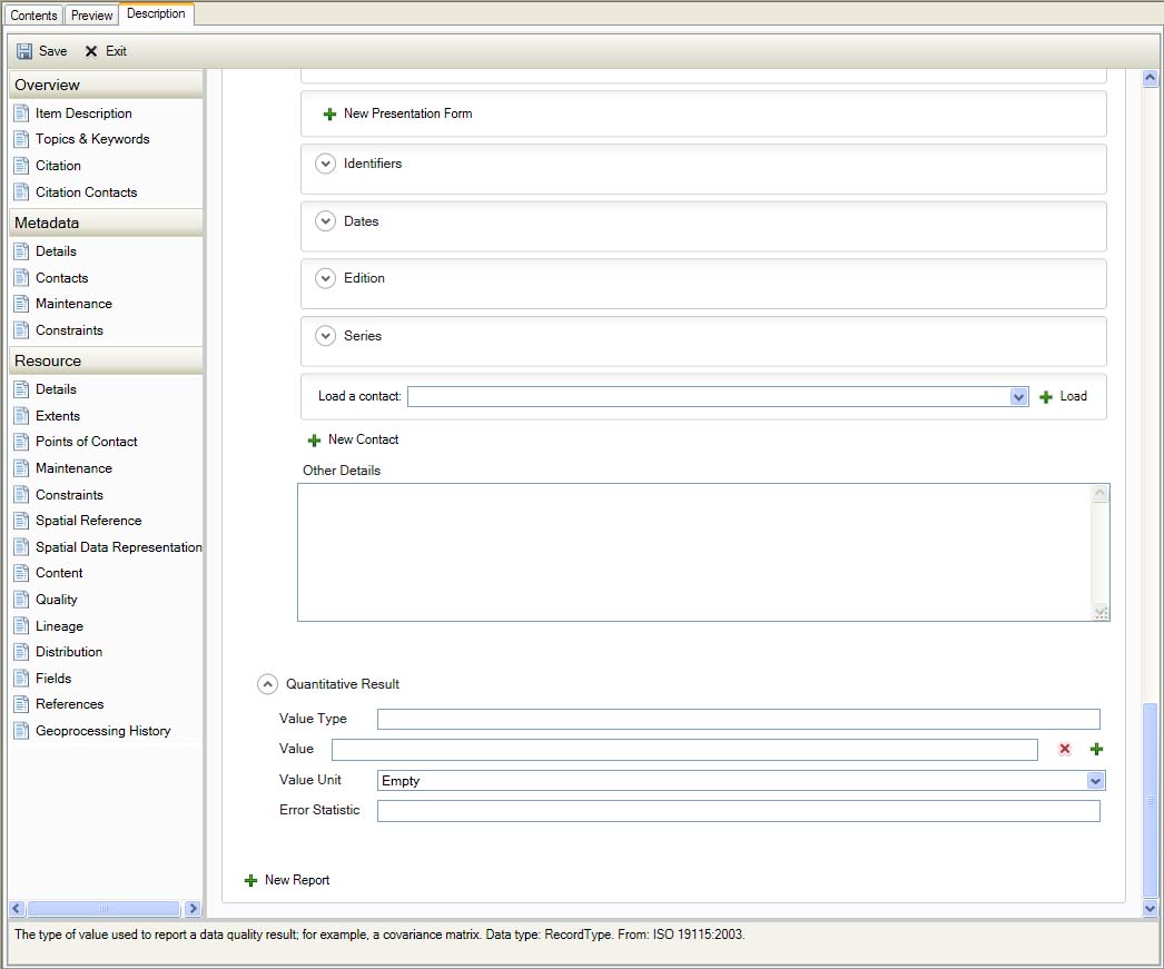
Resource Quality
Lineage
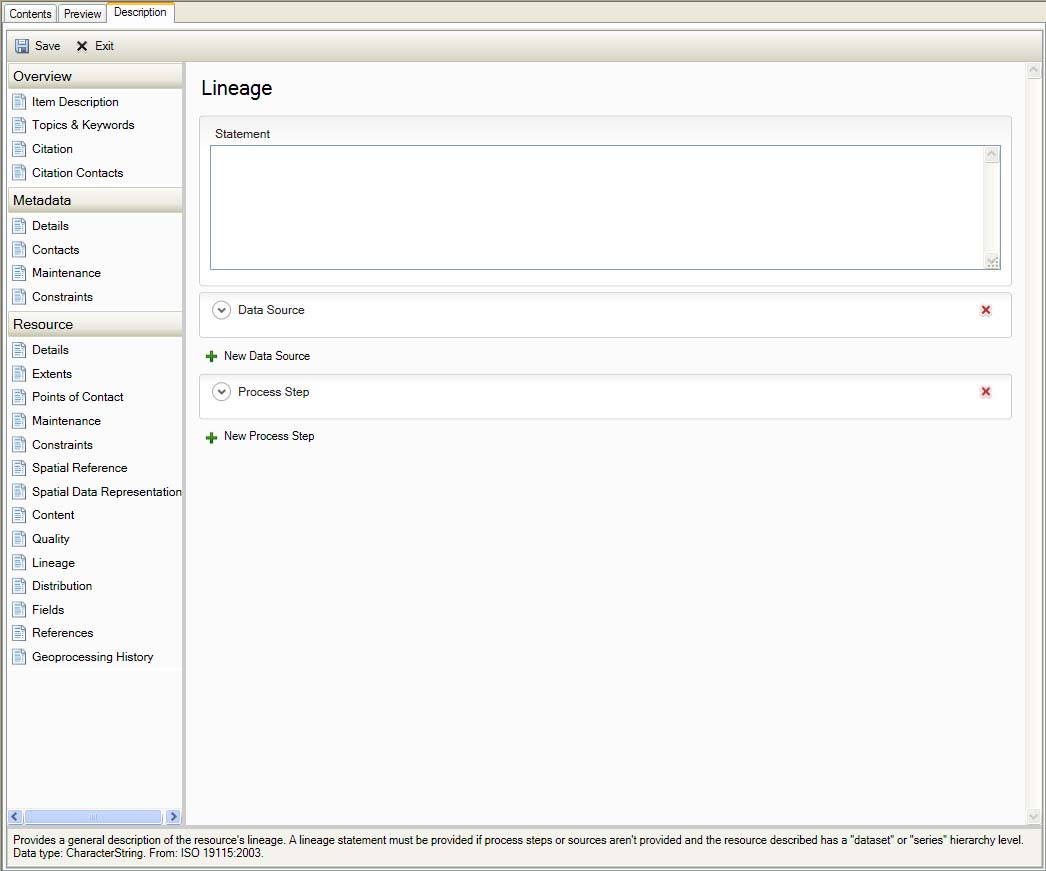
Resource Lineage
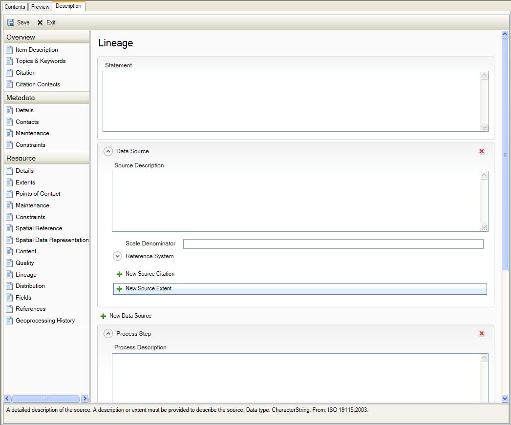
Resource Lineage
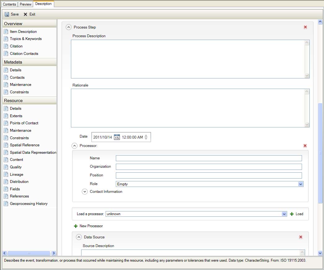
Resource Lineage
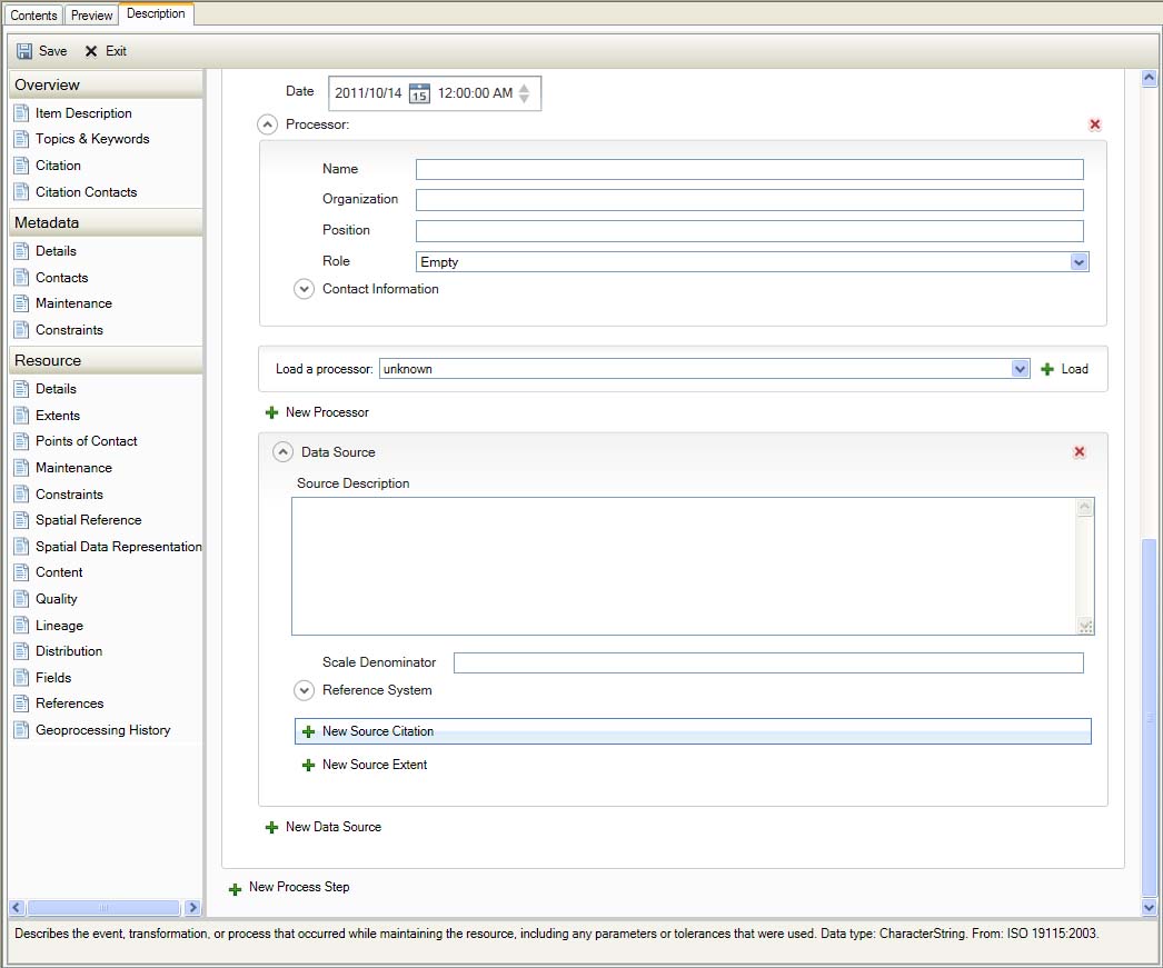
Resource Lineage
Distribution
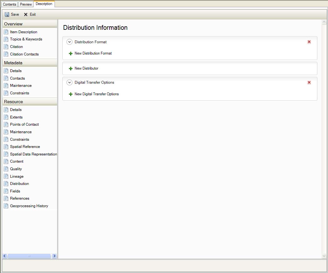
Resource Distribution
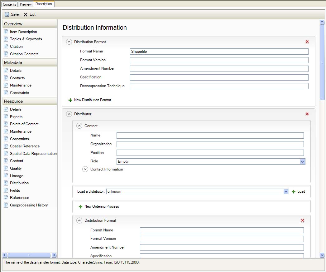
Resource Distribution
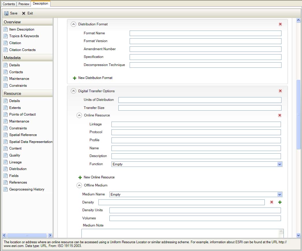
Resource Distribution
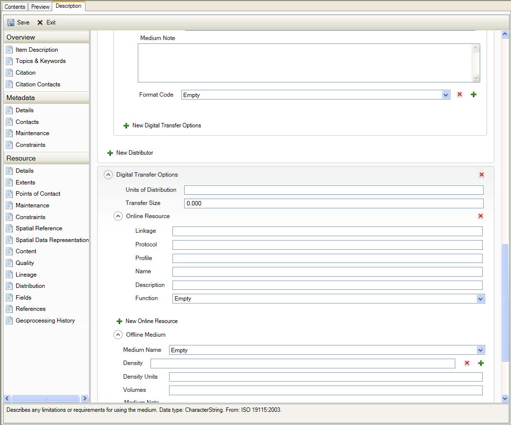
Resource Distribution
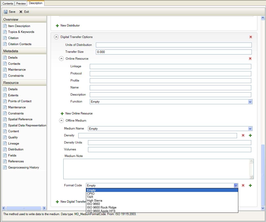
Resource Distribution
Fields
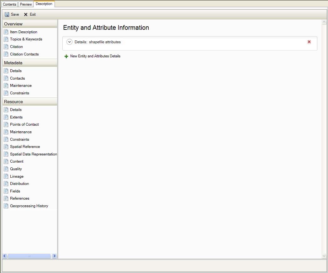
Resource Fields
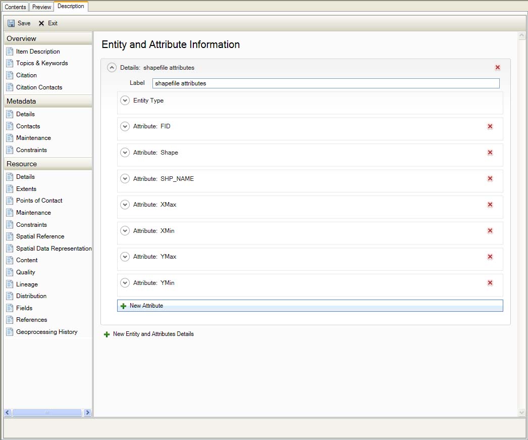
Resource Fields
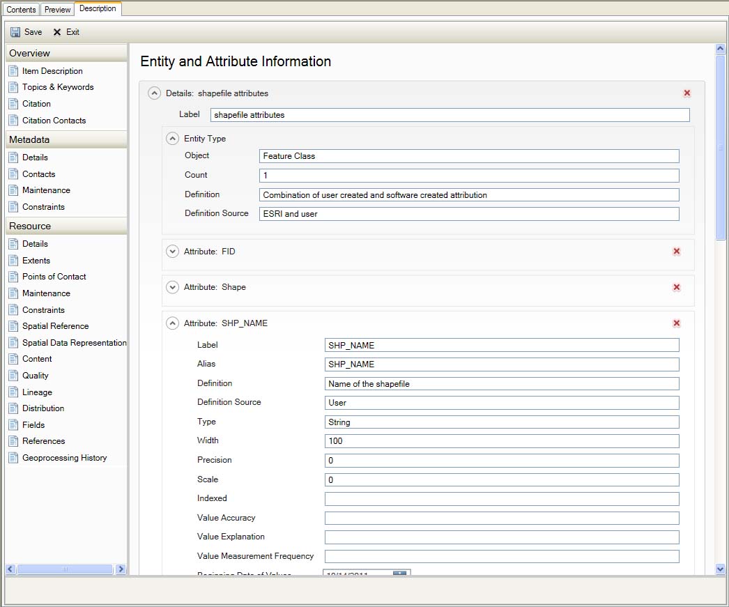
Resource Fields
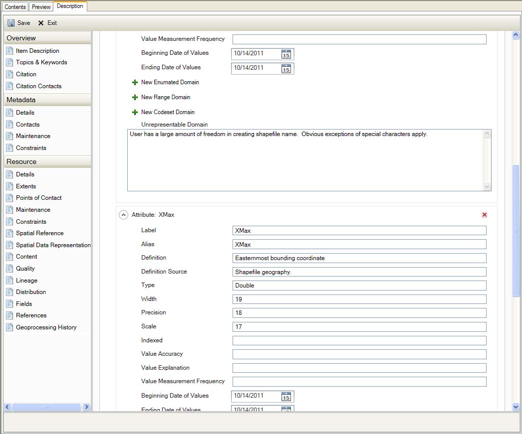
Resource Fields
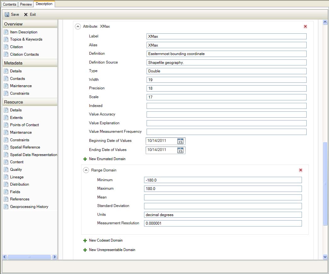
Resource Fields
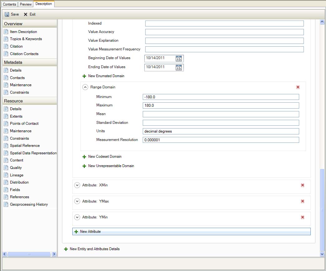
Resource Fields
References
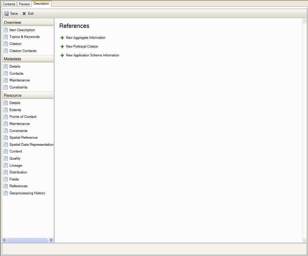
Resource References
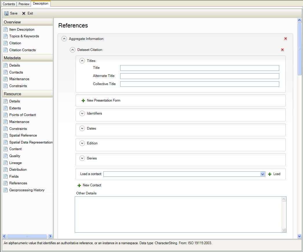
Resource References
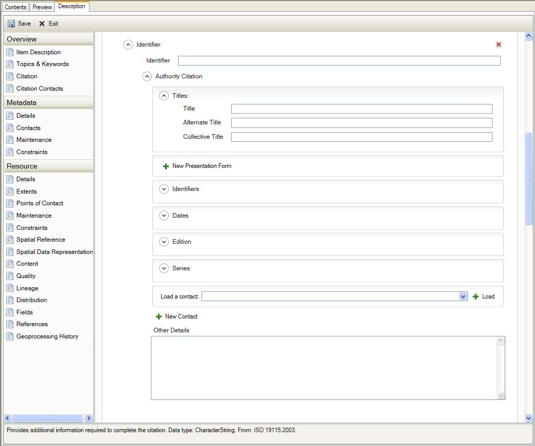
Resource References
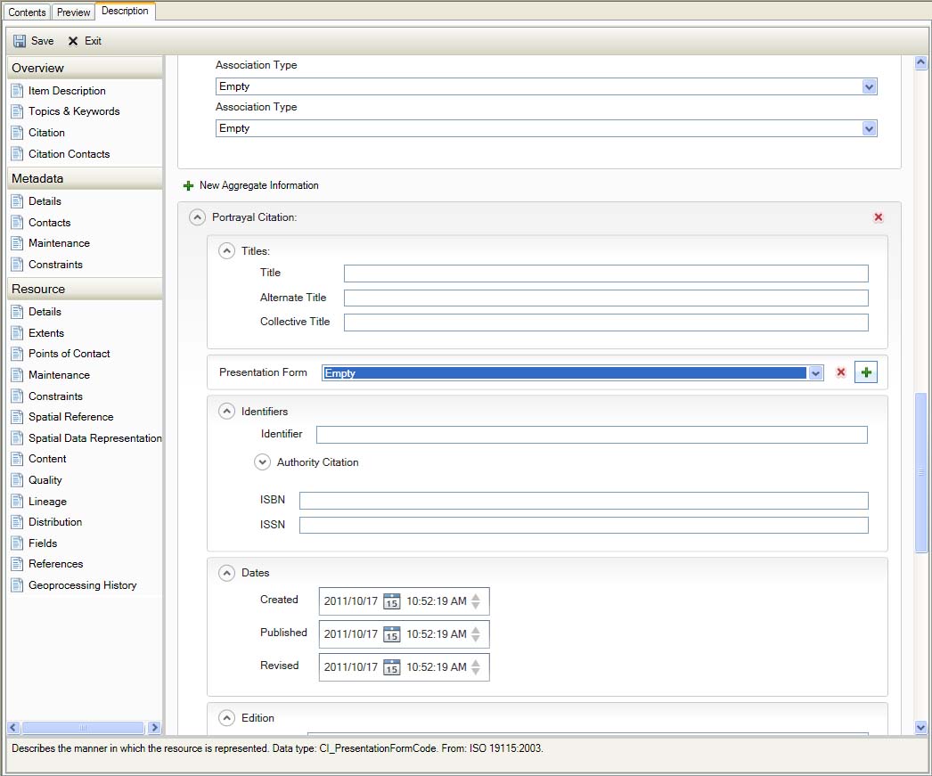
Resource References
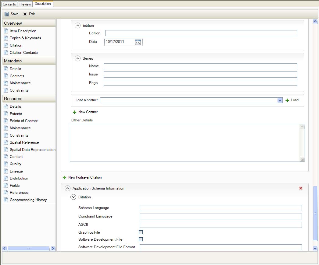
Resource References
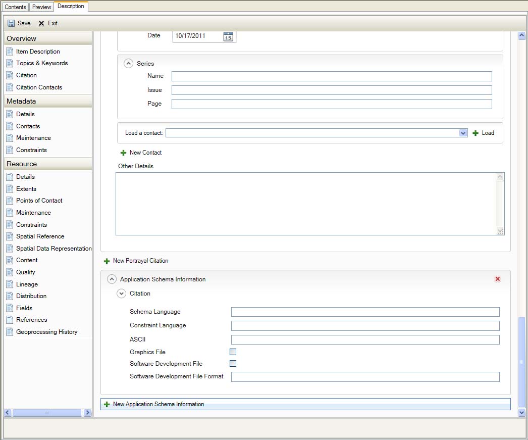
Resource References
Geoprocessing History
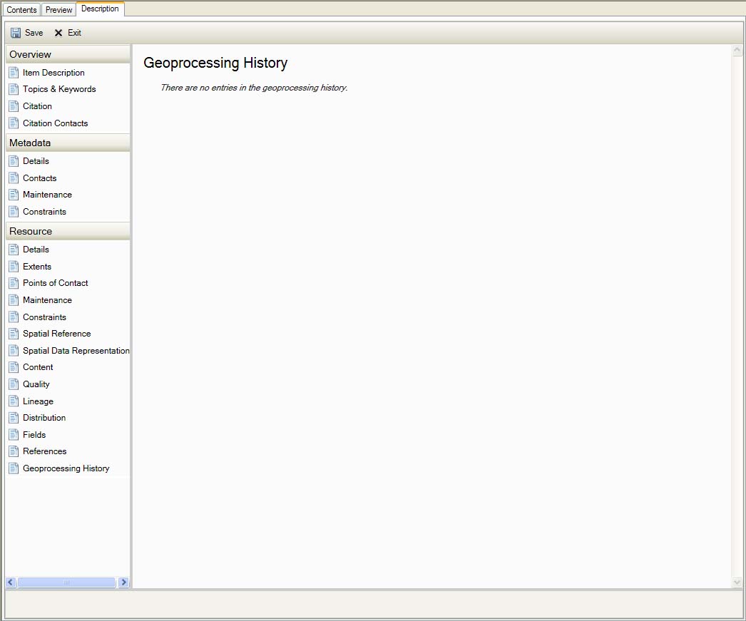
Resource Geoprocessing History
Dropdown menus and repetitive section notes
Language Dropdown screenshots
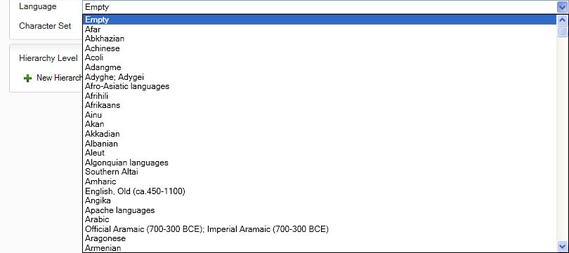
Language Dropdown 1
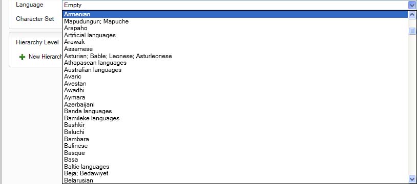
Language Dropdown 2
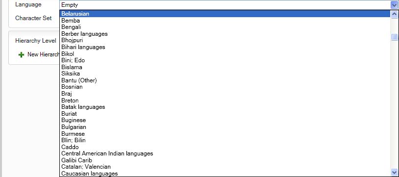
Language Dropdown 3
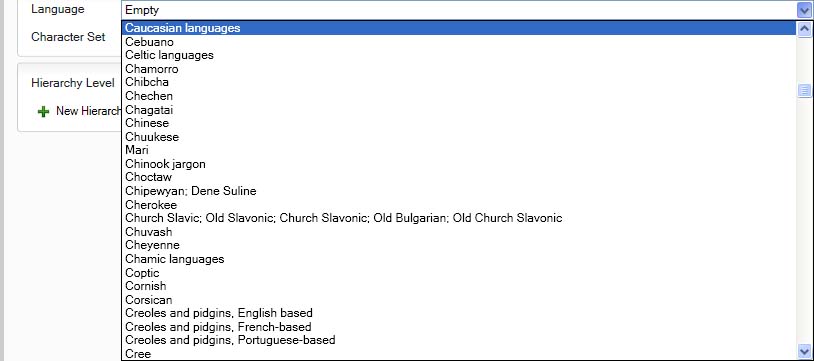
Language Dropdown 4
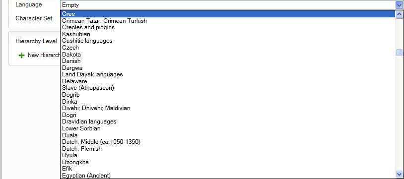
Language Dropdown 5
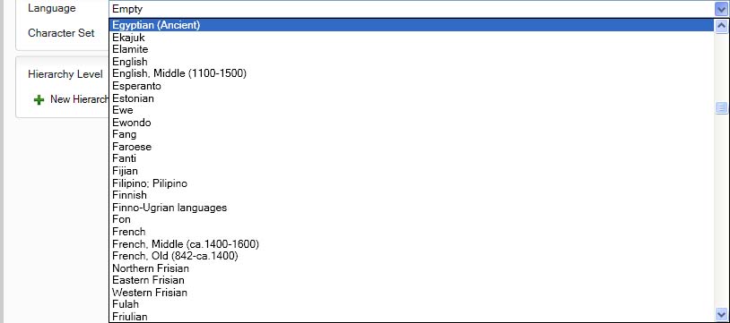
Language Dropdown 6
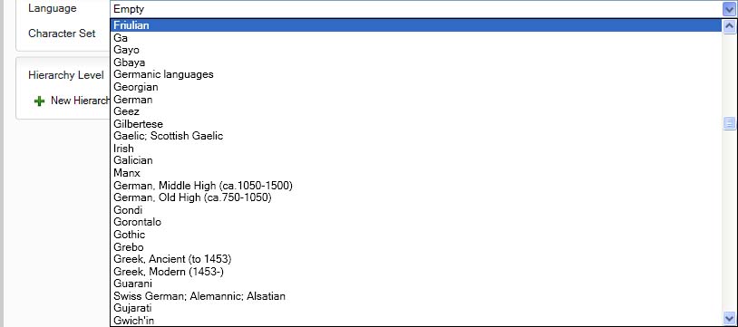
Language Dropdown 7
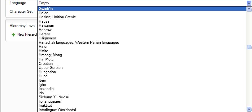
Language Dropdown 8
Language Dropdown 9
Language Dropdown 10
Language Dropdown 11
Language Dropdown 12
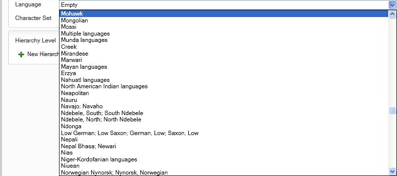
Language Dropdown 13
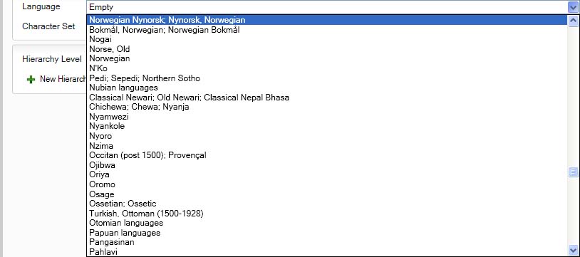
Language Dropdown 14
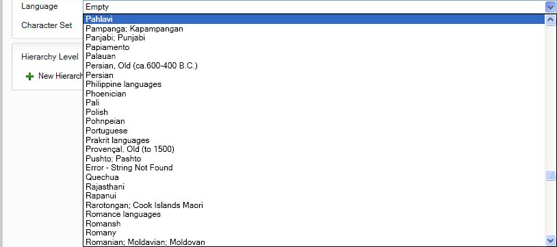
Language Dropdown 15
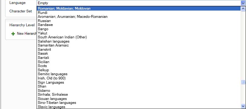
Language Dropdown 16
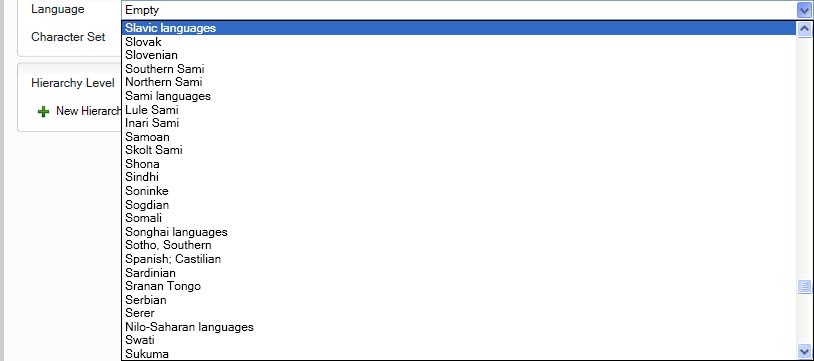
Language Dropdown 17
Language Dropdown 18
Language Dropdown 19
Language Dropdown 20
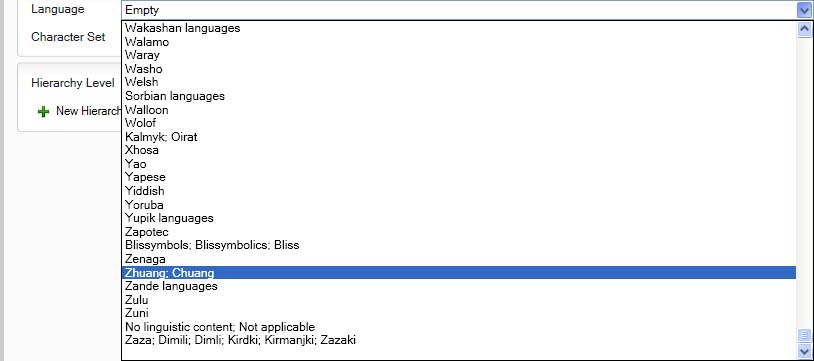
Language Dropdown 21
Character Set Dropdown screenshots
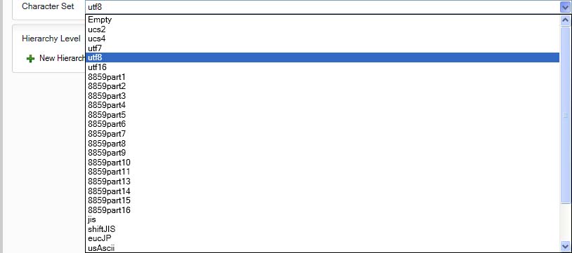
Character Set Dropdown 1
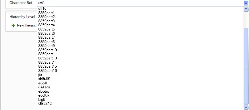
Character Set Dropdown 2
Unit Dropdowns
Distance Resolution Dropdown screenshots
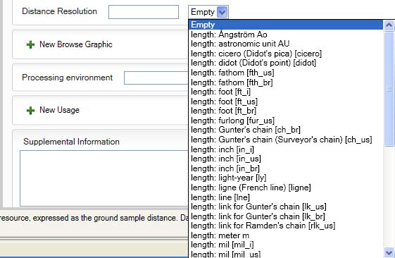
Distance Resolution Dropdown 1
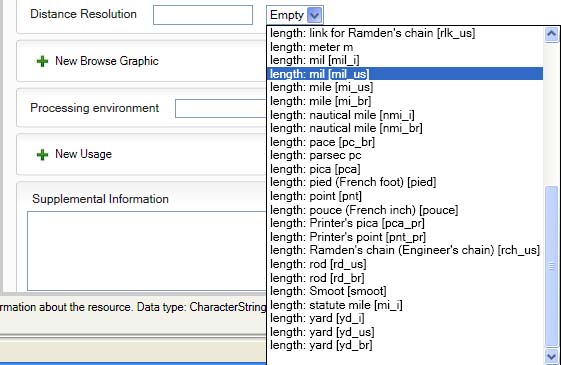
Distance Resolution Dropdown 2
Spatial Representation Resolution Dropdown screenshots
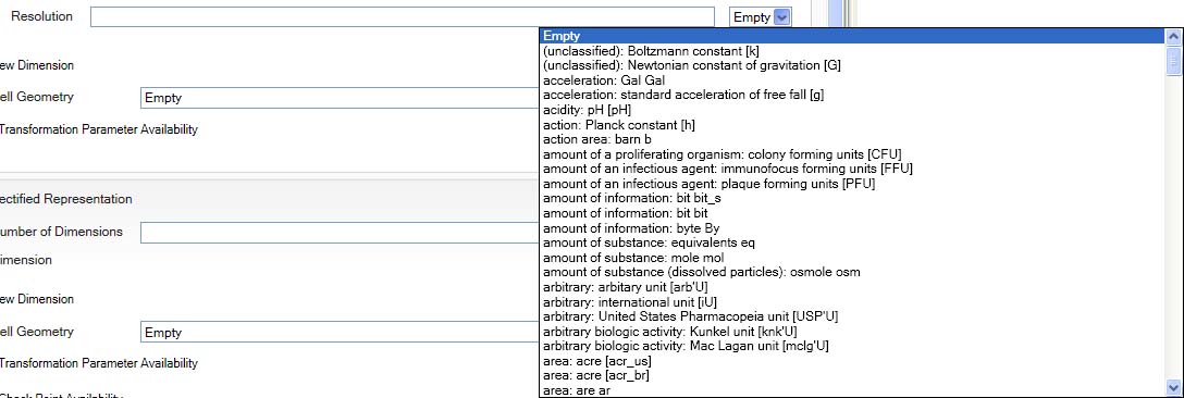
Spatial Representation Resolution Dropdown 1
Spatial Representation Resolution Dropdown 2
Spatial Representation Resolution Dropdown 3
Spatial Representation Resolution Dropdown 4
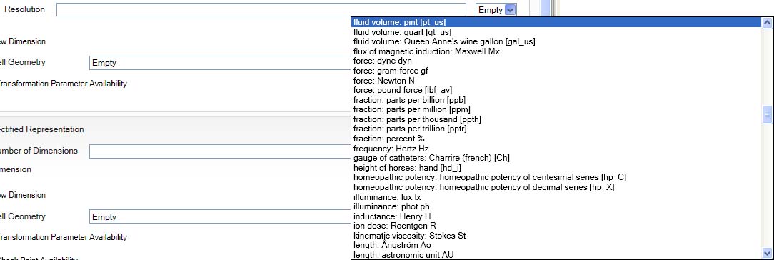
Spatial Representation Resolution Dropdown 5
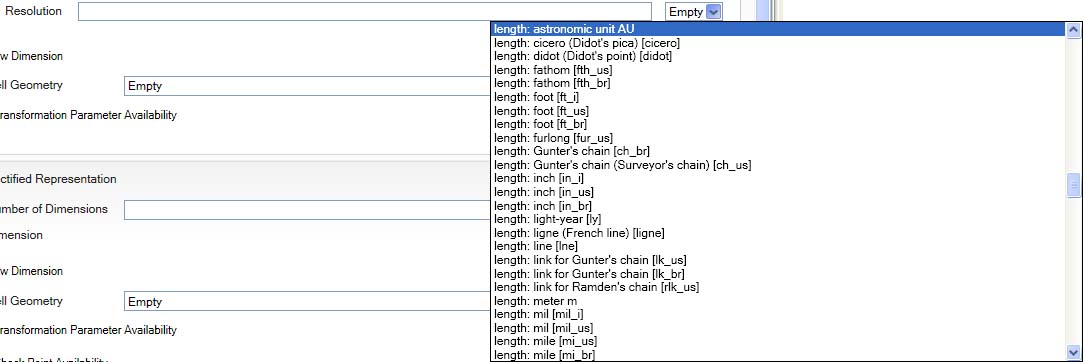
Spatial Representation Resolution Dropdown 6
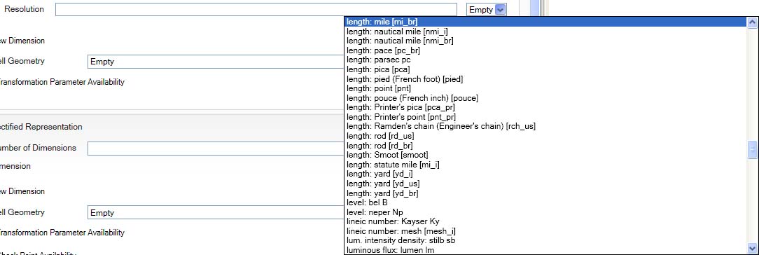
Spatial Representation Resolution Dropdown 7
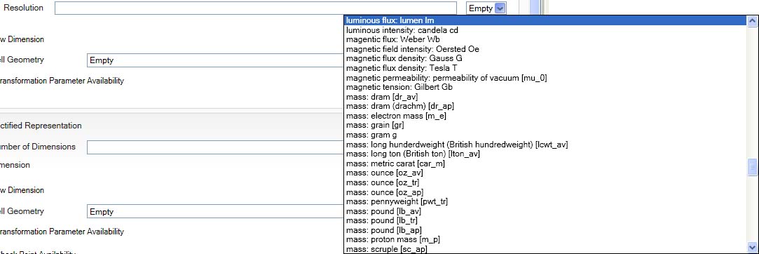
Spatial Representation Resolution Dropdown 8
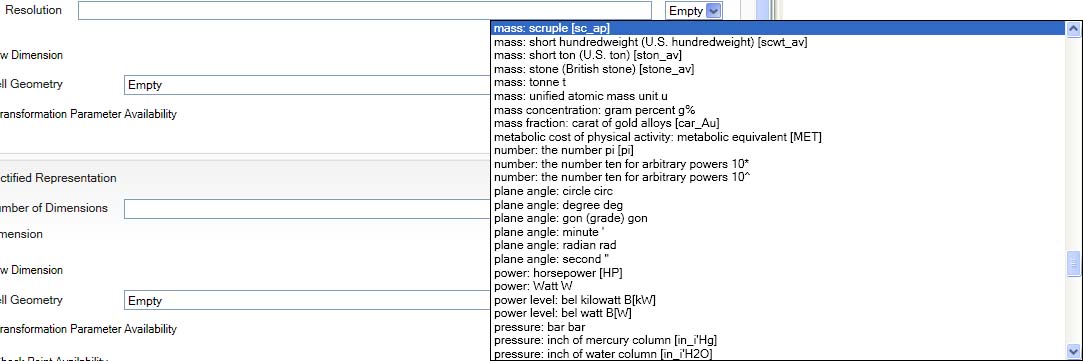
Spatial Representation Resolution Dropdown 9
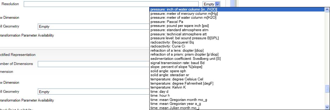
Spatial Representation Resolution Dropdown 10
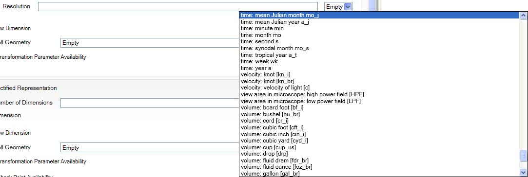
Spatial Representation Resolution Dropdown 11
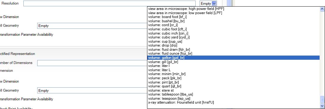
Spatial Representation Resolution Dropdown 12
Hierarchy Dropdown
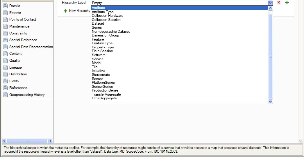
Hierarchy Dropdown
Currency Dropdown
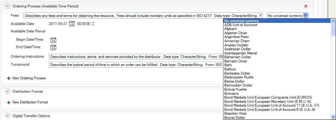
Currency Dropdown 1
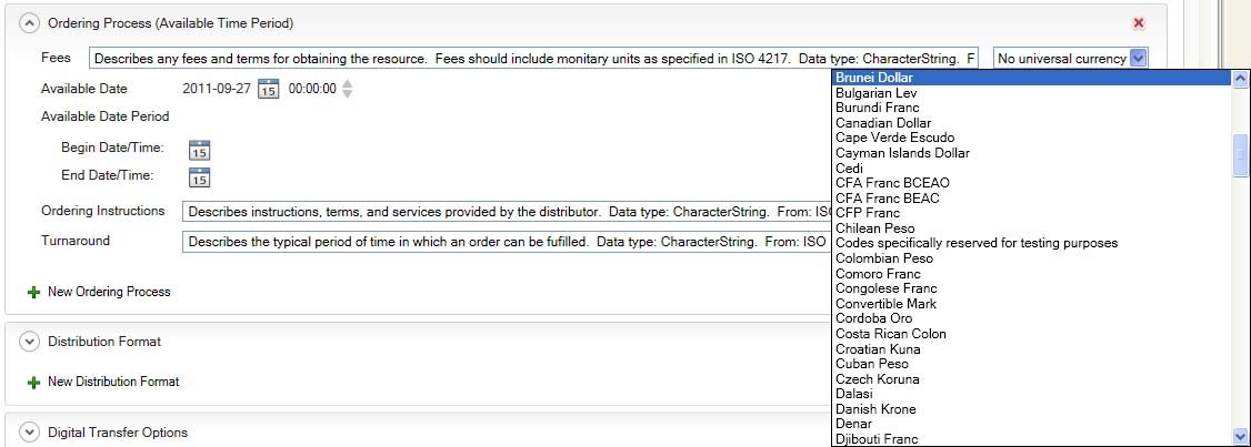
Currency Dropdown 2
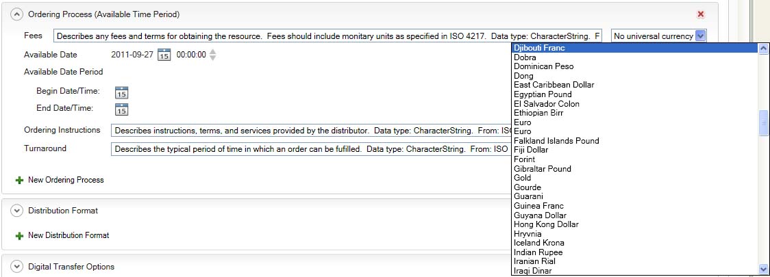
Currency Dropdown 3
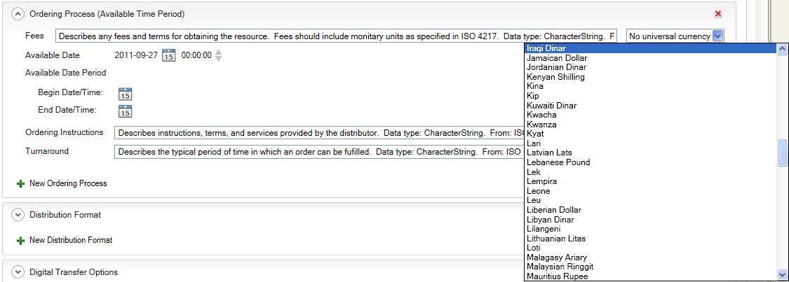
Currency Dropdown 4
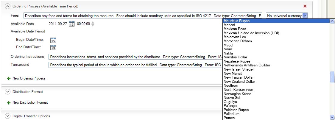
Currency Dropdown 5
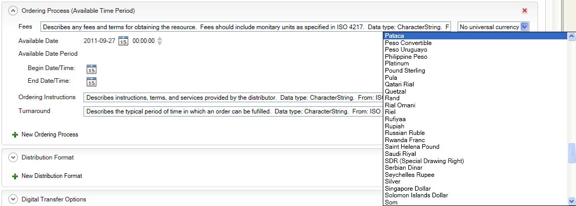
Currency Dropdown 6
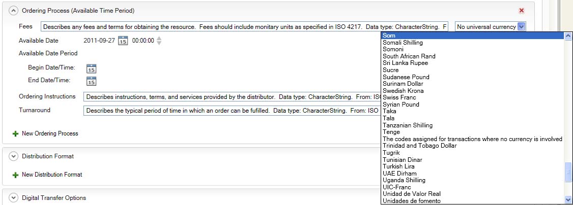
Currency Dropdown 7
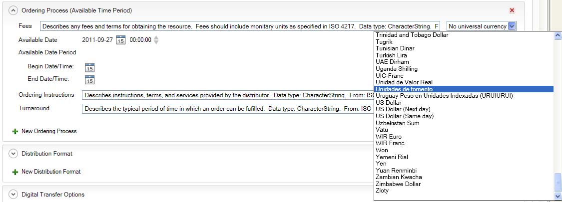
Currency Dropdown 8
Country Dropdown
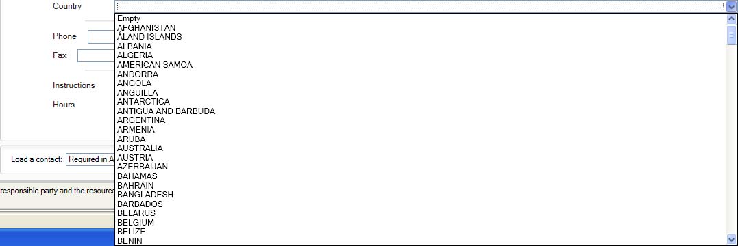
Country Dropdown 1
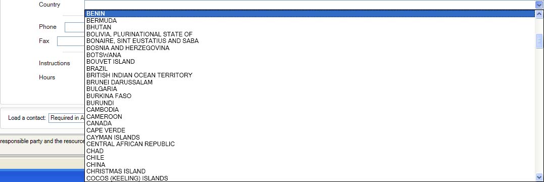
Country Dropdown 2
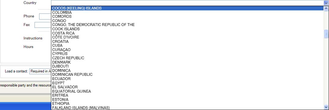
Country Dropdown 3
Country Dropdown 4
Country Dropdown 5
Country Dropdown 6
Country Dropdown 7

Country Dropdown 8
Country Dropdown 9
Country Dropdown 10
Country Dropdown 11